Rain chances & cooler temperatures moving in for our Wednesday
SUMMARY: Another cold front Wednesday will bring us the return of some showers to the area. Below average temperatures will also move in for the second half of the week into the weekend. The unsettled weather pattern of on & off again rain chances will continue through Saturday morning. The great news is that our severe weather threat will be low for the next 7-10 days.
WEDNESDAY: Rain showers will be possible anytime on Wednesday. A rumble of thunder or two is even possible as our cold front pushes through. Highs will be much cooler in the upper 60s. The heaviest rain and stormy activity looks like it will be confined to areas south of I-20. Winds will be switching from the SW/NE 5-10 mph.

WEDNESDAY NIGHT: Mostly cloudy with some rain chances possible. Overnight lows near 50 degrees.
THURSDAY: Mostly cloudy with morning showers possible across our southern counties. Turning mostly sunny during the day. Highs in the upper 60s to around 70.
THURSDAY NIGHT: Partly cloudy. Lows in the mid 40s.
FRIDAY: Mostly cloudy. A chance of showers late in the day and during the evening. Highs in the mid 60s. Overnight lows in the 40s.
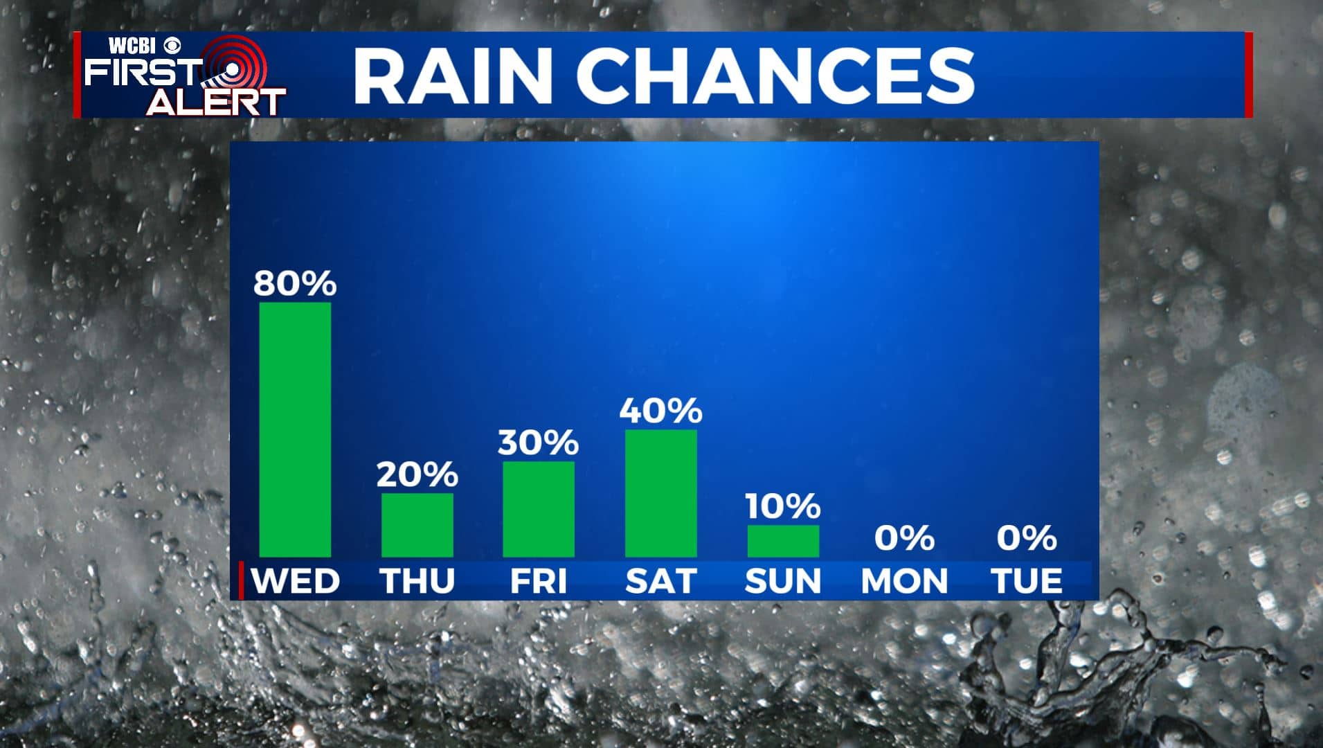
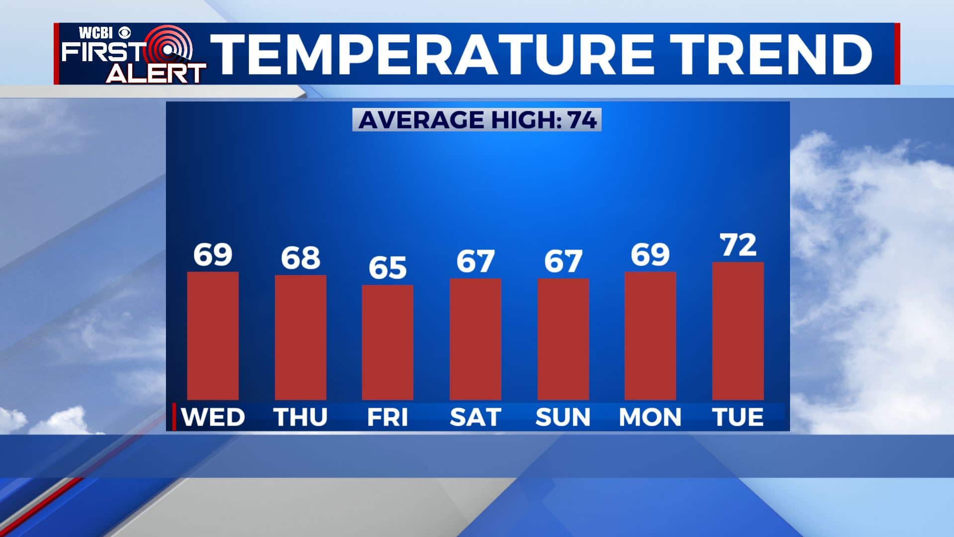
SATURDAY: Mostly cloudy with rain showers during the morning. Conditions should dry out a bit heading into the afternoon. Highs in the 60s.
SUNDAY-MONDAY: More sunshine will return to the forecast as we end the weekend and start a new workweek. Highs in the upper 60s to near 70 degrees. Overnight lows in the 40s.
TUESDAY: More clouds moving back in. Highs in the lower 70s.
Stay connected with @WCBIWEATHER on Facebook, Twitter, Instagram, and the WCBI News App.


Leave a Reply