Rain chances making a comeback this week
SUMMARY: While the workweek will start off on a dry and sunny note, rain chances will increase through the week. Showers are possible Tuesday into early Wednesday with even more rain likely Thursday into Friday.
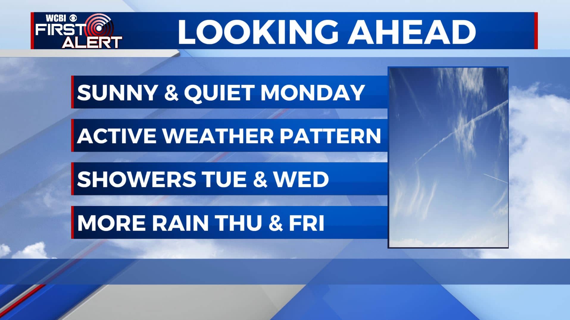
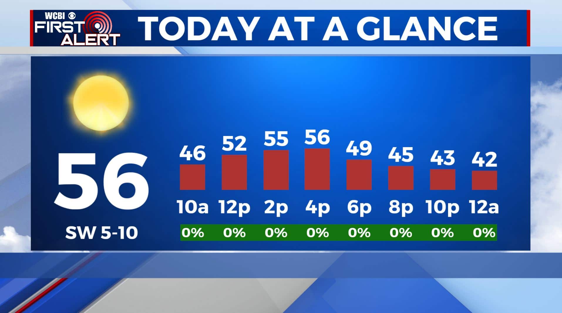
MONDAY: It’s a quiet and clear start to our Monday but it’s a cold one. Temperatures in the upper 20s to lower 30s. After enjoying a lot of sunshine this past weekend, you’ll be able to enjoy it for one more day. Highs seasonably cool in the mid 50s with a SW wind 5-10 mph.
MONDAY NIGHT: Expect an increase in cloud cover as our next cold front approaches the region. Overnight lows not as chilly in the 30s.
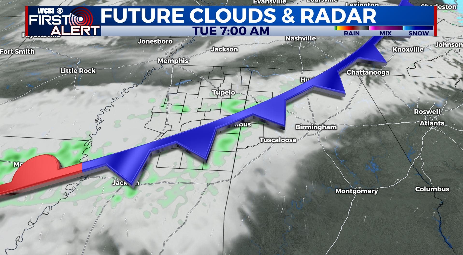
TUESDAY: Mostly cloudy. A few showers are possible as the cold front pushes through. Highs in the lower to mid 50s. 30s for overnight lows Tuesday night.
WEDNESDAY: The rain should be out early Wednesday morning. It looks like most of the day will be mostly sunny and dry. Highs will remain in the mid 50s with overnight lows in the 40s.
THURSDAY: Areas of widespread rain. Rain could be heavy at times. Highs in the upper 50s to near 60 degrees. Overnight lows in the 40s Thursday night.
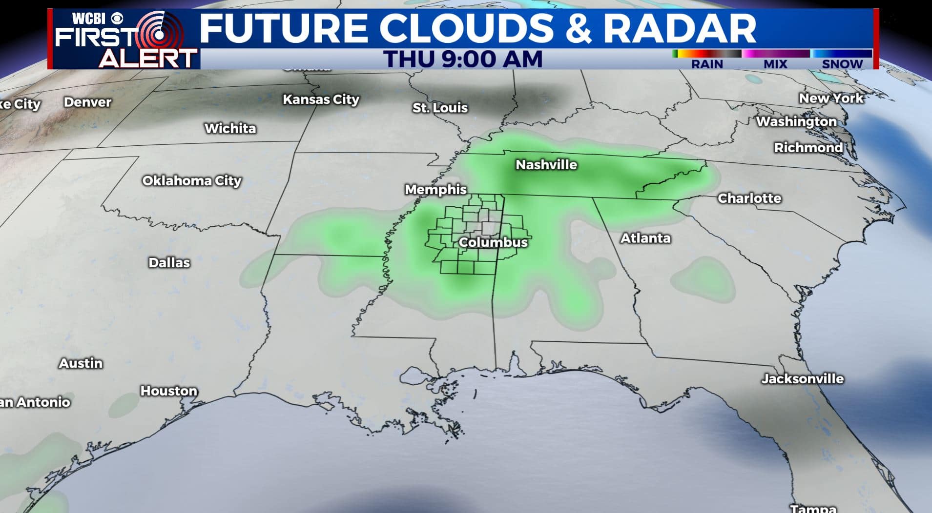
FRIDAY: Cloudy with a chance of rain. Highs in the mid 50s. Some spots could end up with a half an inch to an inch of rain by the weekend. Overnight lows in the 30s.
WEEKEND: We’ll get a quick break from the rain on Saturday before another round of showers move in on Sunday. Temperatures will remain just above normal with highs in the mid 50s into the lower 60s. Overnight lows in the 30s.
Stay connected with @WCBIWEATHER on Facebook, Twitter, Instagram, and the WCBI News App


Leave a Reply