Rain chances move back in for our Tuesday
SUMMARY: Keep the umbrella and rain gear handy as a few disturbances will pass through the region over the next week, leading to some rain chances in the forecast. Temperatures are going to be near average for this time of the year. No major storm systems in the forecast until maybe next week. We’ll be watching things.
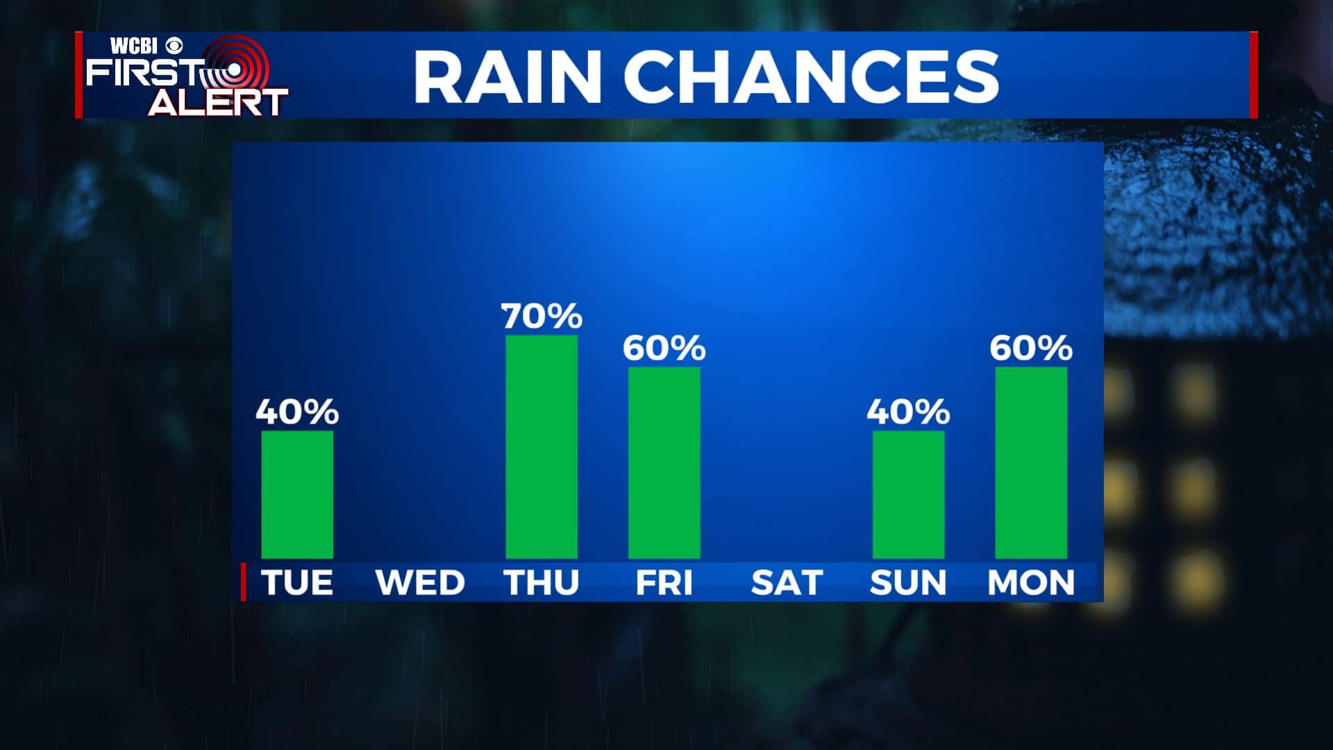
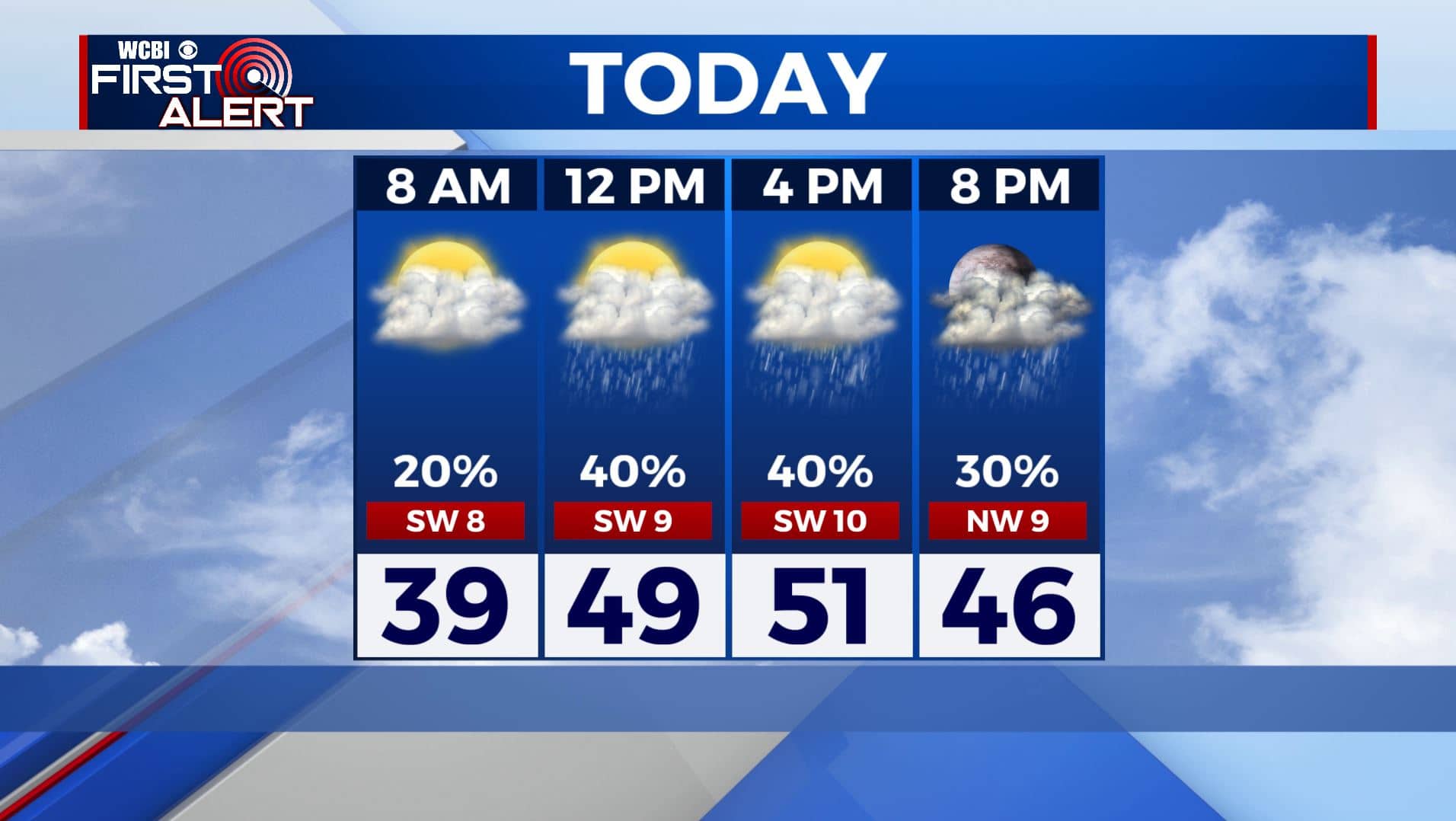
TUESDAY: Overcast skies moving into the region this Tuesday morning with a few light showers. Scattered chances of rain are possible as the cold front pushes through the region. Highs in the lower 50s with a SW/NW wind 5-10 mph.
TUESDAY NIGHT: The rain should be out of our area by early Wednesday morning. We’ll have cloudy skies for the most part. Lows in the mid 30s.
WEDNESDAY: It looks like most of the day will be mostly sunny and dry as high pressure moves in. Highs in the lower to mid 50s.
WEDNESDAY NIGHT: Cloudy skies. Lows in the 40s. Areas of rain develop overnight.
THURSDAY: Areas of widespread rain. Rain could be heavy at times. Highs in the upper 50s to near 60 degrees.
THURSDAY NIGHT: Cloudy. Areas of rain possible. Lows in the upper 40s.
FRIDAY: Mostly cloudy with areas of rain possible. Highs in the low to mid 50s. Lows in the low 30s Friday night.
SATURDAY: Sun & clouds. Highs in the lower to mid 50s. Lows in the 30s Saturday night.
SUNDAY: Mostly cloudy with a chance of rain. Highs in the mid to upper 50s.
MONDAY: Mostly cloudy with rain possible. Warmer highs in the mid 60s.
Stay connected with @WCBIWEATHER on Facebook, Twitter, Instagram, and the WCBI News App


Leave a Reply