Rain chances return for midweek
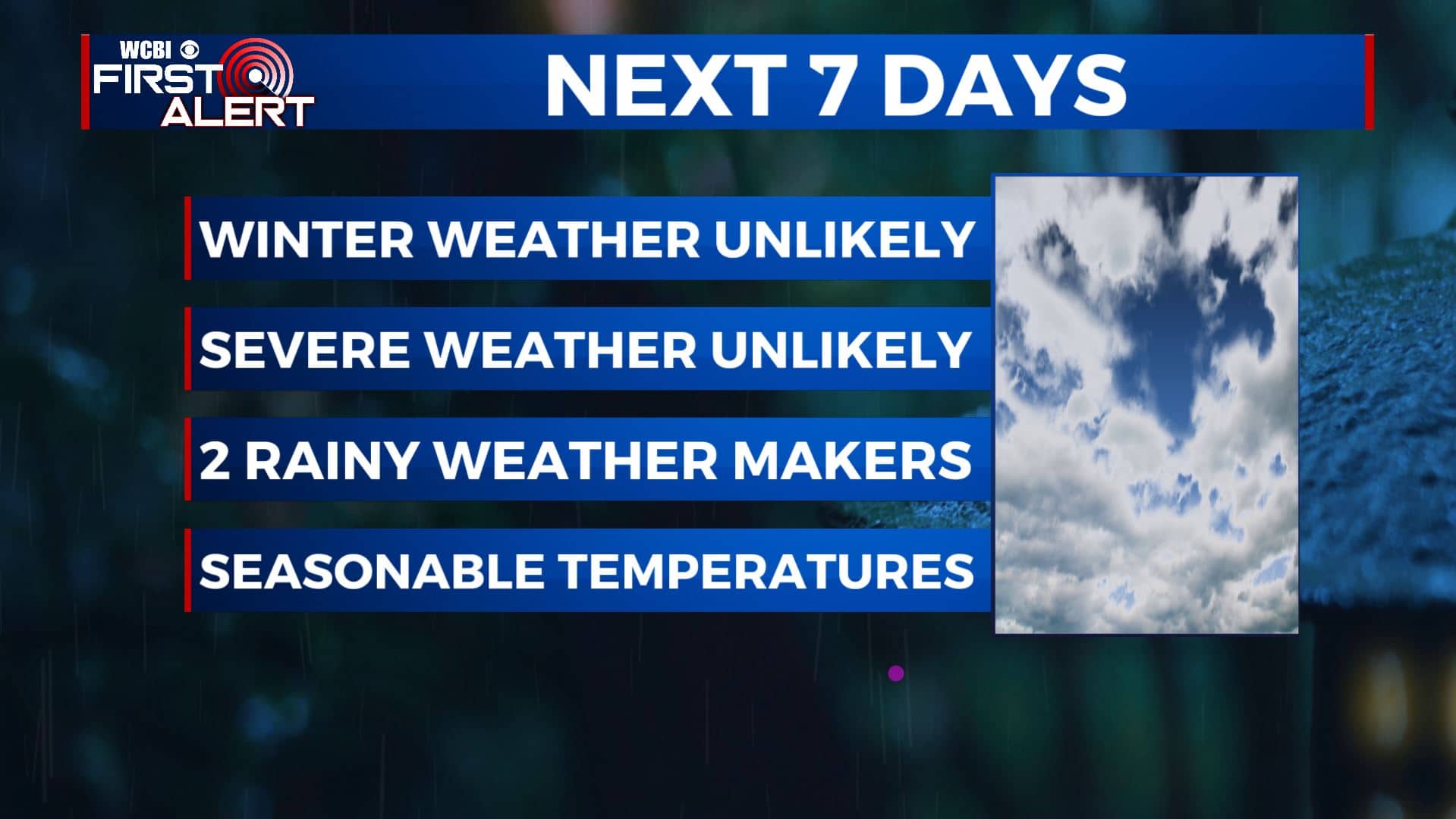
SUMMARY: We’re not expecting any major storm systems in the way of severe or winter weather the next week. There will be a few rain chances in the forecast, especially Tuesday night into Wednesday and the weekend. Not looking to be a washout. Seasonably cool air will continue into early next week.
TUESDAY: Clouds are beginning to break up a bit this morning, allowing for the sunshine to finally peak through for our Tuesday. It’s not going to last for long so enjoy it because rain chances move back in this evening. Highs in the upper 40s to lower 50s, depending on how much sunshine we see. Winds will switch up from NE to the SE at 5-10 mph.
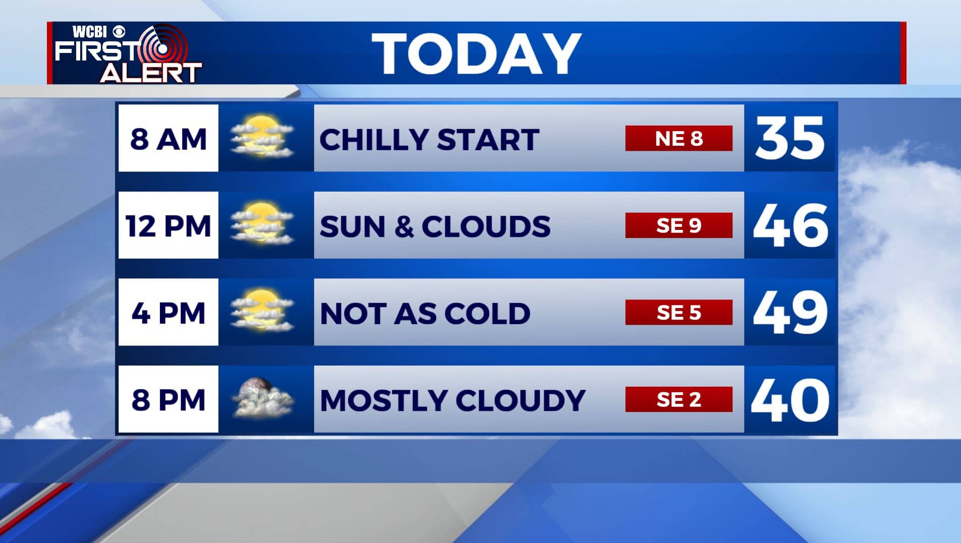
TUESDAY NIGHT: Rain chances will move in after sunset into the overnight hours. Lows near 40.
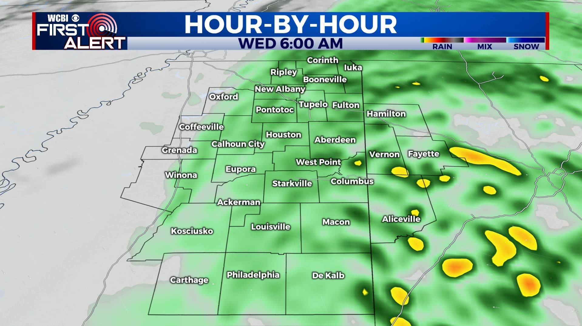
WEDNESDAY: Morning rain showers then mostly cloudy skies in the afternoon. Highs in the 40s. NW winds 5-10 mph. Total rainfall amounts between a quarter to half an inch.
WEDNESDAY NIGHT: Partly cloudy skies. A cold night with overnight lows in the upper 20s.
THURSDAY: The end of the workweek looks to be drier with more sunshine returning to the forecast. Staying a bit chilly with highs in the upper 40s.
THURSDAY NIGHT: Mostly clear skies and cold. Overnight lows in the mid to upper 20s.
FRIDAY: Mostly sunny skies. Highs in the lower to mid 50s.
WEEKEND: Mostly cloudy with rain chances moving in Saturday afternoon and evening. A mix of sun and clouds after some morning rain on Sunday. Highs in the mid 50s both days
Stay connected with @WCBIWEATHER on Facebook, Twitter, Instagram, and the WCBI News App


Leave a Reply