Rain coming on back
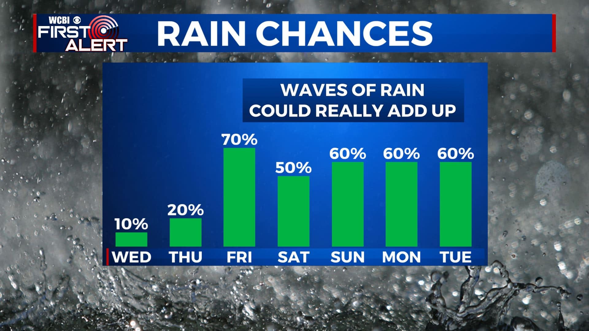
SUMMARY: Enjoy the sunny start to our Wednesday because clouds will roll in during the afternoon. They will usher in the first of many rain chances to come during the next week. Heavier rain is possible Thursday night into Friday. Several more rounds of rain and thunder can be expected during the weekend and early next week. Anywhere between 2″ and 6″ of rain (or more) could fall between now and next Tuesday.
TUESDAY NIGHT: Clear and quiet. Lows in the upper 30s to lower 40s. Light southerly winds.
WEDNESDAY: Bright sunshine to start off with increasing clouds during the afternoon. A few late day showers can’t be totally ruled out. Things should generally be OK for the MSU & Ole Miss baseball home openers at 4 p.m. Highs from the upper 60s to lower 70s. Winds SSW 5-10 mph.
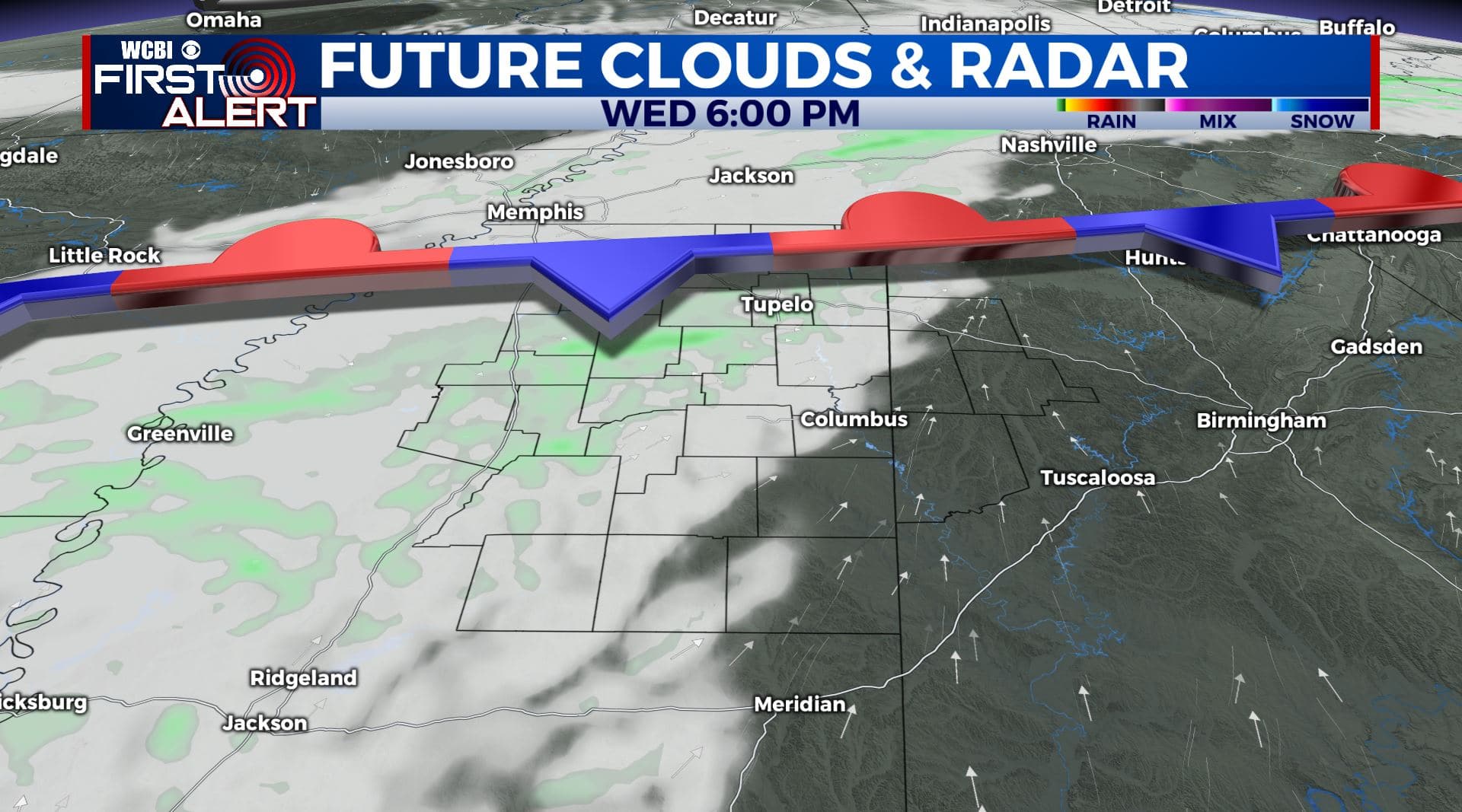
WEDNESDAY NIGHT: Mostly cloudy. Lows in the 40s. A few showers are possible.
THURSDAY: Mostly cloudy with a chance of showers. Highs in the lower 60s.
THURSDAY NIGHT: Areas of rain developing. Lows in the 40s.
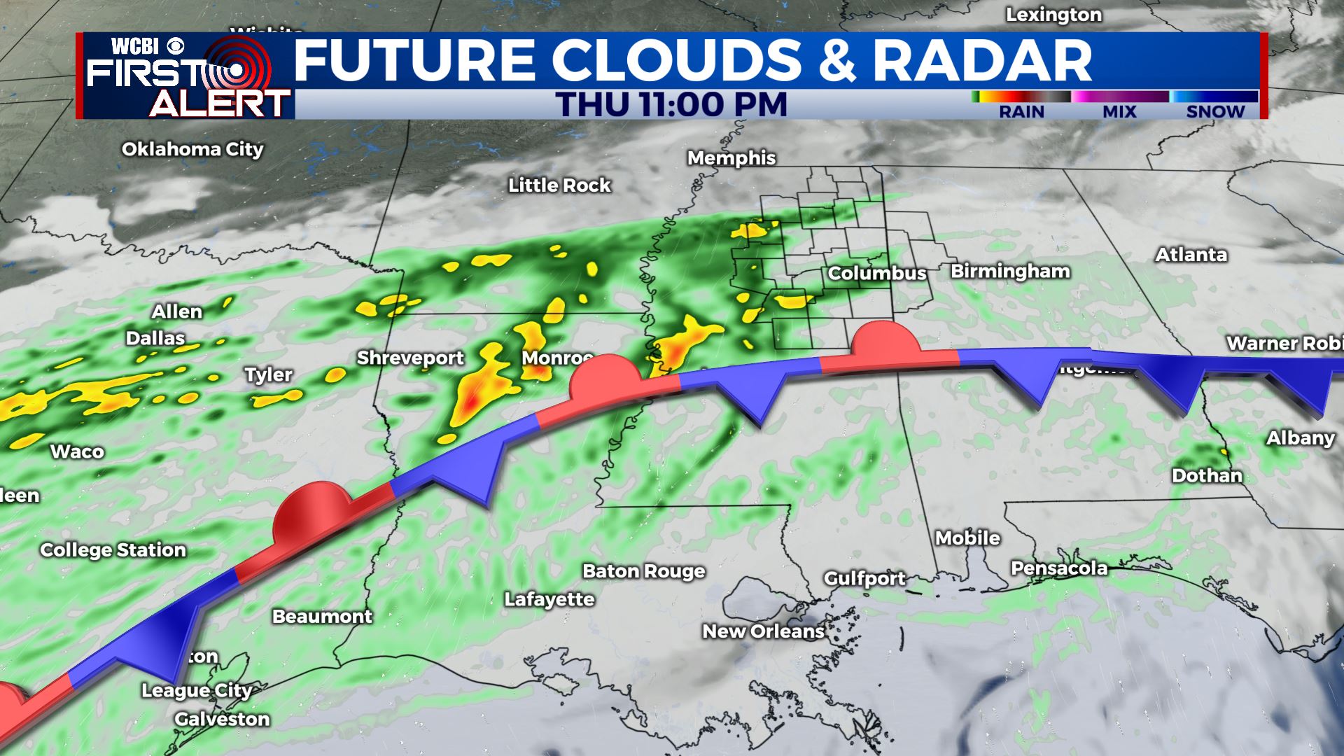
FRIDAY: Cloudy with areas of rain. Highs in the upper 50s.
SATURDAY: Mostly cloudy with a chance of rain. Highs in the upper 60s.
SUNDAY: Mostly cloudy. Showers and storms likely. Highs in the low to mid 70s.
MONDAY – TUESDAY: Mostly cloudy. Areas of rain will remain possible. Highs in the lower 60s.
Follow @WCBIWEATHER on Facebook, Twitter, Instagram, and the WCBI News App


Leave a Reply