Rain early leads way for cold temperatures
COLUMBUS – SUMMARY: A cold front Monday will drop highs down into the 50s in what will be the first of two cold fronts next week. Chances for rain persist on and off through Friday. Lows drop down into the 40s Monday and mostly stay there until Friday night, when the second cold front causes overnight temperatures to dip into the 20s.
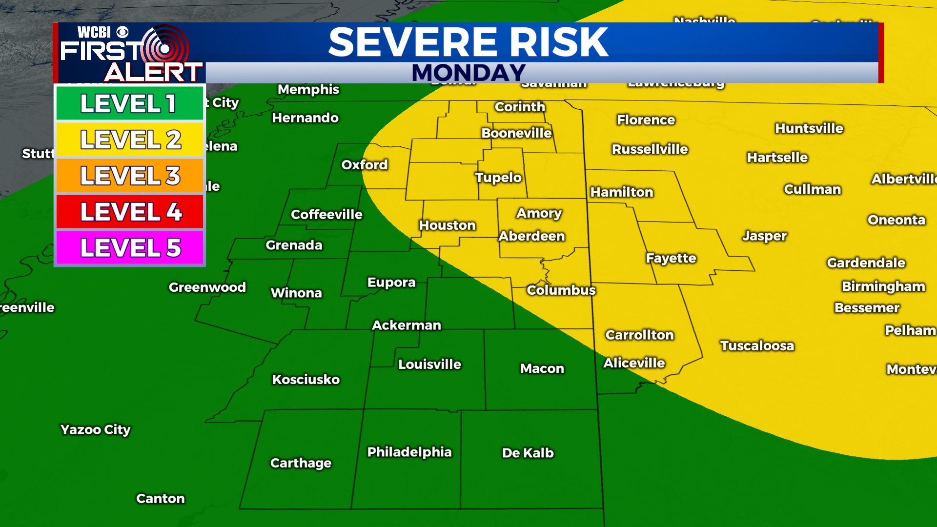
MONDAY: Showers and thunderstorms will move through the region as a squall line during the day Monday. At the moment, the chance for severe weather weather remains rather moderate with damaging winds and the brief tornado spin-up being the primary hazards. Highs will top out in the mid 70s and lows will bottom out in the mid 40s.
TUESDAY: The full effect of cold air moving into the region is seen Tuesday as afternoon temperatures only reach into the upper 50s. The chance for the odd shower also persists Tuesday. Overnight lows will improve slightly into the upper 40s.
REST OF THE WEEK: Rain chances continue on and off until our second cold front passes through the region on Friday. Friday’s cold front will be a bit more robust and lows will drop into the 20s, while highs will drop into the 40s. Highs will slowly rebound close to 70 by Friday before the front moves through.


Leave a Reply