Rain Exits, Temperatures Increase by Christmas
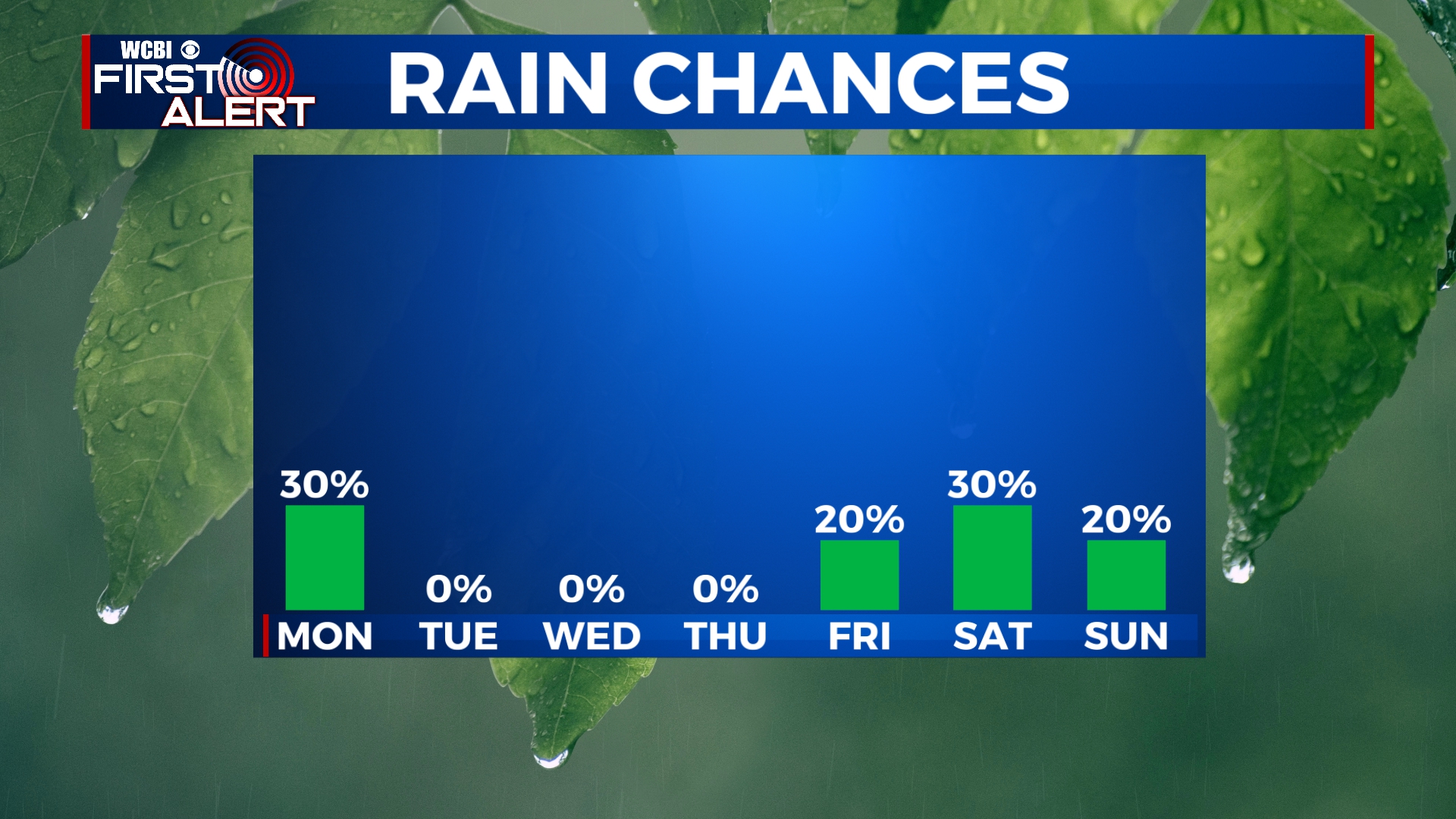
We’ll finally start to see the rain slack off by Monday afternoon, but clouds will linger through the day. Temperatures will be well above average by the middle of the week with highs near 70. Clouds will build through Christmas Day with some rain showers possible by the weekend.
SUNDAY NIGHT: Rain showers continuing off-and-on overnight. Temperatures holding steady in the mid to upper 40s with a breezy northerly wind.
MONDAY: Rain showers will linger into the morning hours of Monday, but we will finally start to see those exit the area by the afternoon. We’ll stay mostly cloudy for the rest of the day with temperatures climbing into the upper 50s.
TUESDAY-WEDNESDAY: We’re in for a very warm Christmas Eve and Christmas Day with highs in the mid to upper 60s. We may see a little bit of sunshine on Tuesday, but clouds will likely build into the area on Wednesday. No rain is expected. Morning lows will be in the 40s.
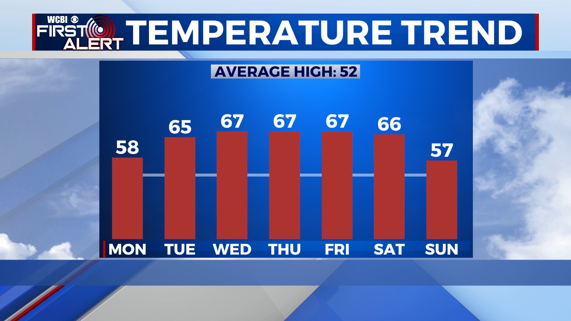
THURSDAY-SUNDAY: Clouds will linger through the end of the week with temperatures getting into the mid to upper 60s. A sprinkle or two is possible, but the best chance for any shower activity would be on Saturday. Even so, we’re only going to call it a 30% chance for some rain on Saturday. Temperatures will drop slightly on Sunday with highs in the upper 50s and lingering clouds.


Leave a Reply