Rain heading our way thanks to Zeta and cold front
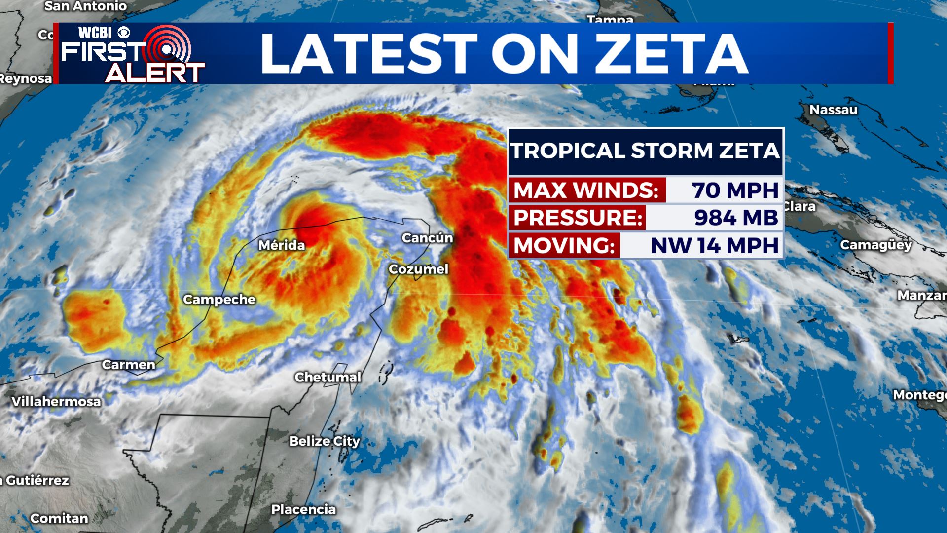
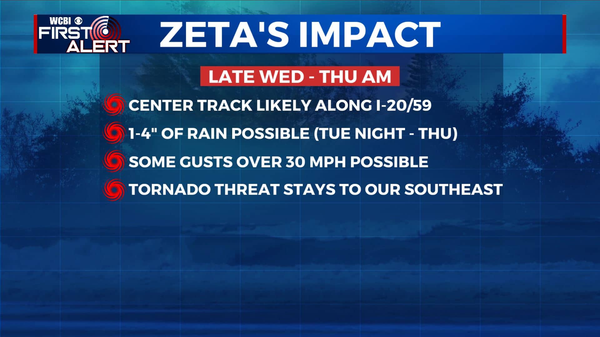
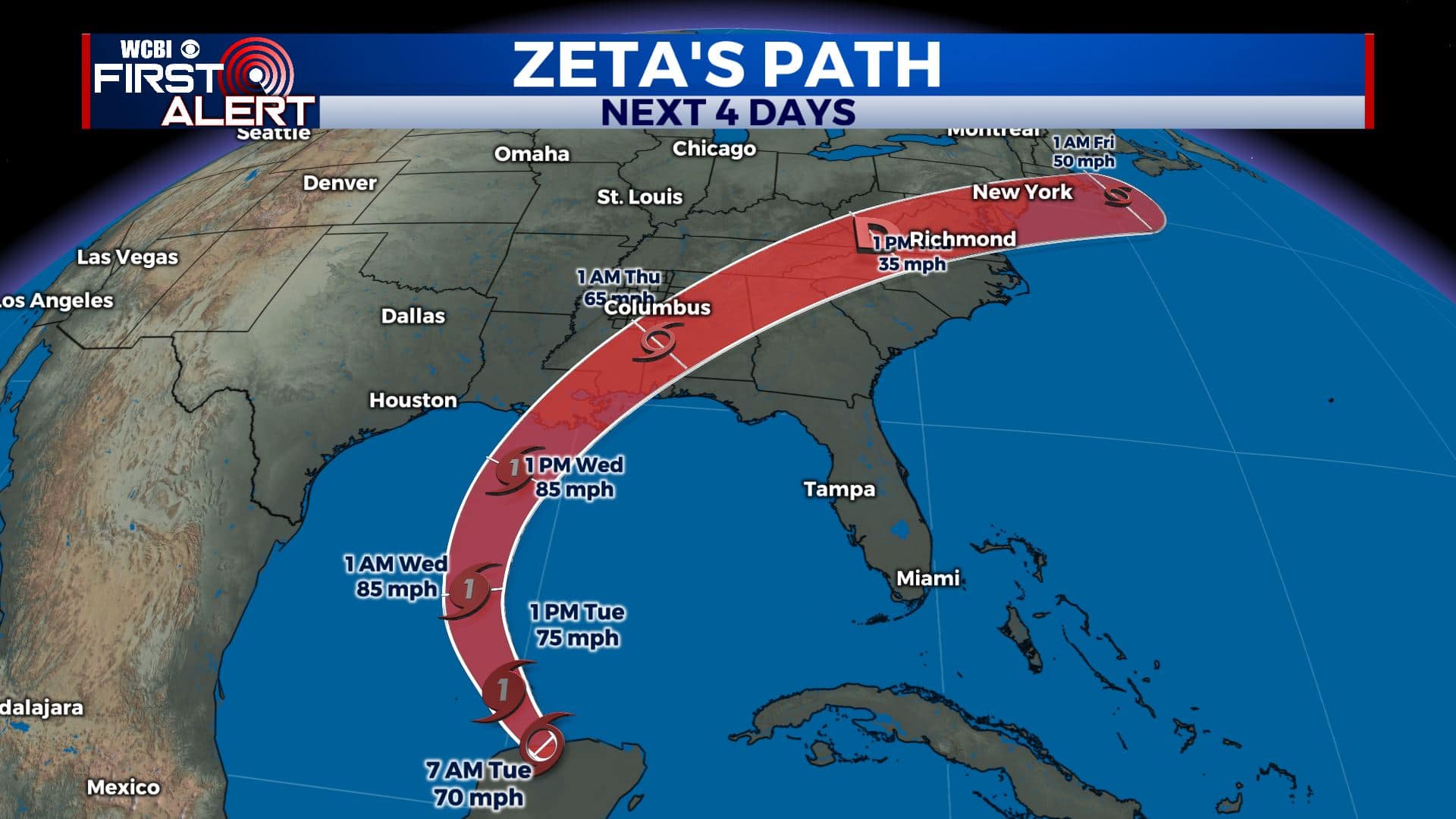
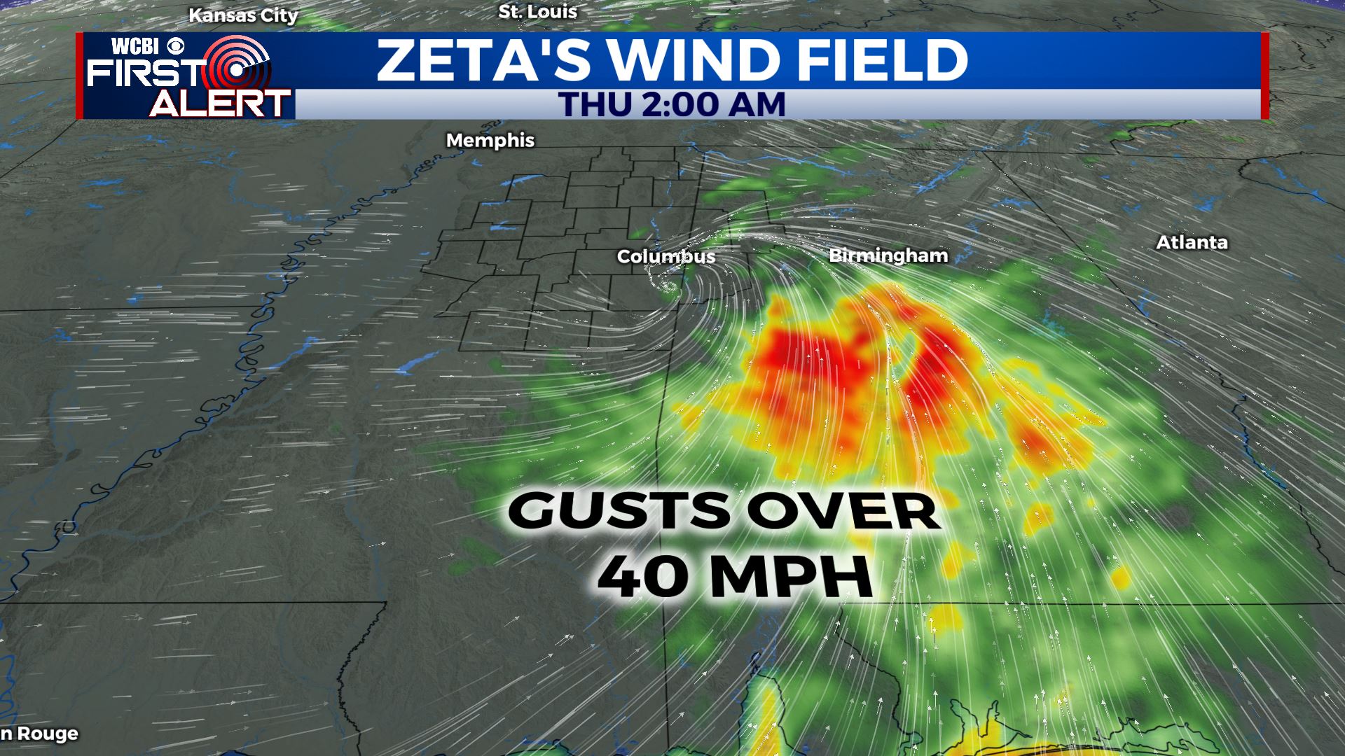
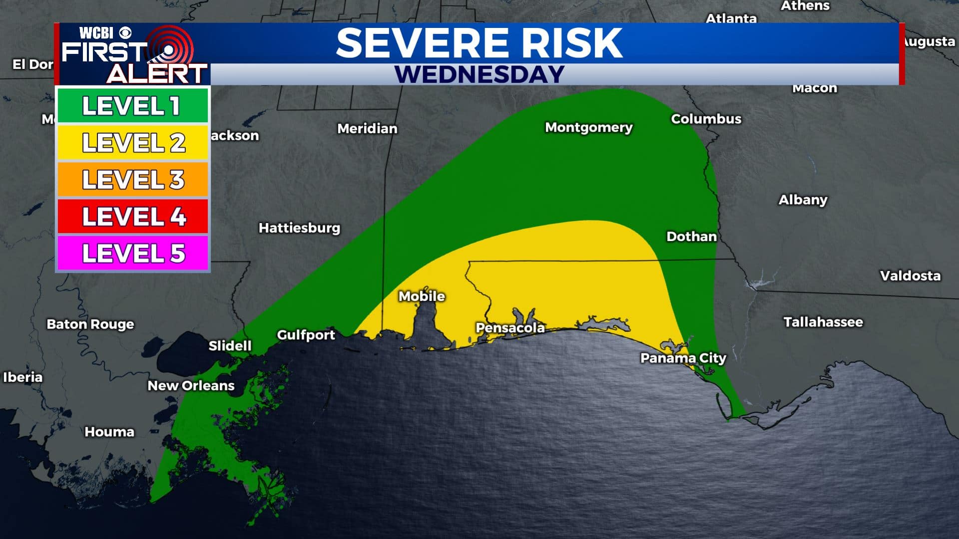
SUMMARY: As of 8 am Tuesday, Zeta made landfall over the Yucatan and has weaken to a tropical storm. It’s expected to strengthen back up to a Category 1 hurricane before making landfall along the norther Gulf Coast Wednesday. Tropical moisture from Zeta is going to merge with a cold front Tuesday night into Thursday. The end result will be a good chance of rain and a period of gusty winds. The highest wind from Zeta and and the isolated tornado threat currently looks to be along and south of the I-20/59 corridor Wednesday night and Thursday morning.
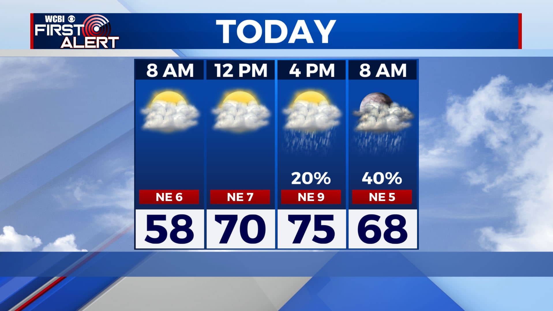
TUESDAY: We’re once again waking up to cloudy skies & misty conditions. Some of us could see some sunshine this afternoon. Rain chances start moving in during the evening hours. Highs mainly in the upper 60s to lowers 70s, due to a big gradient from NW to SE, depending on who sees the sunshine. Winds NE 5-10 mph.
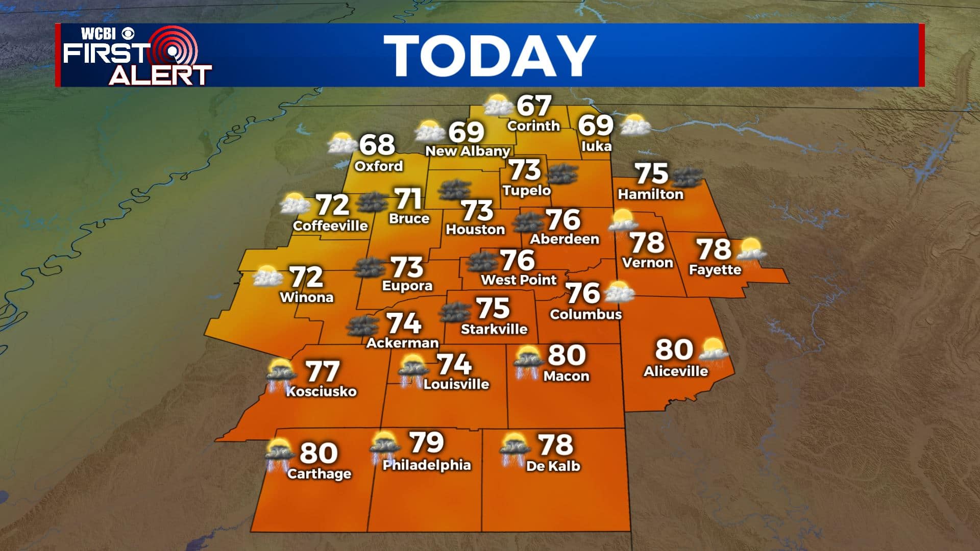
TUESDAY NIGHT: Cloudy with areas of rain likely. Some could be locally heavy or or at least steady. Milder lows in the 60s.
WEDNESDAY: Our best chance for heavy rain and some storms will be through the day Wednesday as a strong cold front approaches from the west and the remnants of Zeta swirl through the region. About 1-4 inches of rainfall is expected. We could also see some gusty winds Wednesday, but no severe weather/tropical tornado threat is expected for us as of now. Highs in the 70s. Winds SE 5-15 mph with higher gusts.
WEDNESDAY NIGHT: Rainy and breezy. Lows around 70. Winds SE 10-20 mph with higher gusts.
THURSDAY: Wet and breezy, especially during the first half of the day. Some gusts could be over 30 mph. The heaviest rain is likely during the morning hours with a drying trend taking over during the afternoon. Highs in the lower 70s.

FRIDAY-SUNDAY: The end of the workweek and the weekend will be drier, mostly sunny and boo-tiful which is good news for any Halloween plans you may have. Temperatures will be feeling much cooler with highs only in the mid 60s and overnight lows in the 40s.
Stay connected with @WCBIWEATHER on Facebook, Twitter, Instagram, and the WCBI News App


Leave a Reply