RAIN MOVES OUT, BUT THE COLD WILL REMAIN
SATURDAY NIGHT: Heavy rain will continue to fall across the area. As we progress throughout the overnight hours, rain will start to decrease from west to east. Temperatures will bottom out in the lower 40’s to upper 30’s across the region.
SUNDAY: Showers will continue to push out of our area. We will dry out from west to east, most of us seeing an end to the rain by 2 PM. Winds will shift to the northwest, ushering in colder air on the backside of this system. Highs on Sunday will top out in the lower 40’s. Areas along and north of Interstate 22 have the potential to see some snowflakes fall before this system moves out. No impacts or accumulations are expected.
SUNDAY NIGHT: Clouds hang around, and temperatures drop into the middle and lower 30’s. We cannot rule out for the possibility of a few flurries across the northern portions of our area. No accumulations or impacts are expected.
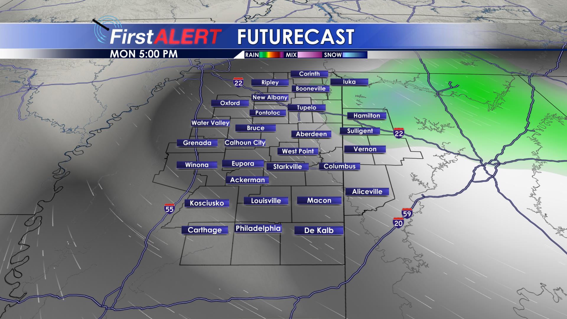
MONDAY: Clouds will hang around on Monday. We could see a few sprinkles or flurries across our northeastern most counties throughout the day on Monday. No accumulations or impacts are expected. Monday will remain cold, with highs in the lower to middle 40’s. We will drop down below freezing Monday night, with overnight lows bottoming out in the upper 20’s and lower 30’s.
TUESDAY/WEDNESDAY: High pressure will build back in behind our exiting weather system, bringing us an abundance of sunshine for both Tuesday and Wednesday. Highs will warm from the upper 40’s on Tuesday, to the lower 50’s on Wednesday. Rain chances remain at 0% both days, with overnight lows on Tuesday in the upper 20’s, and overnight lows on Wednesday in the upper 30’s and lower 40’s.
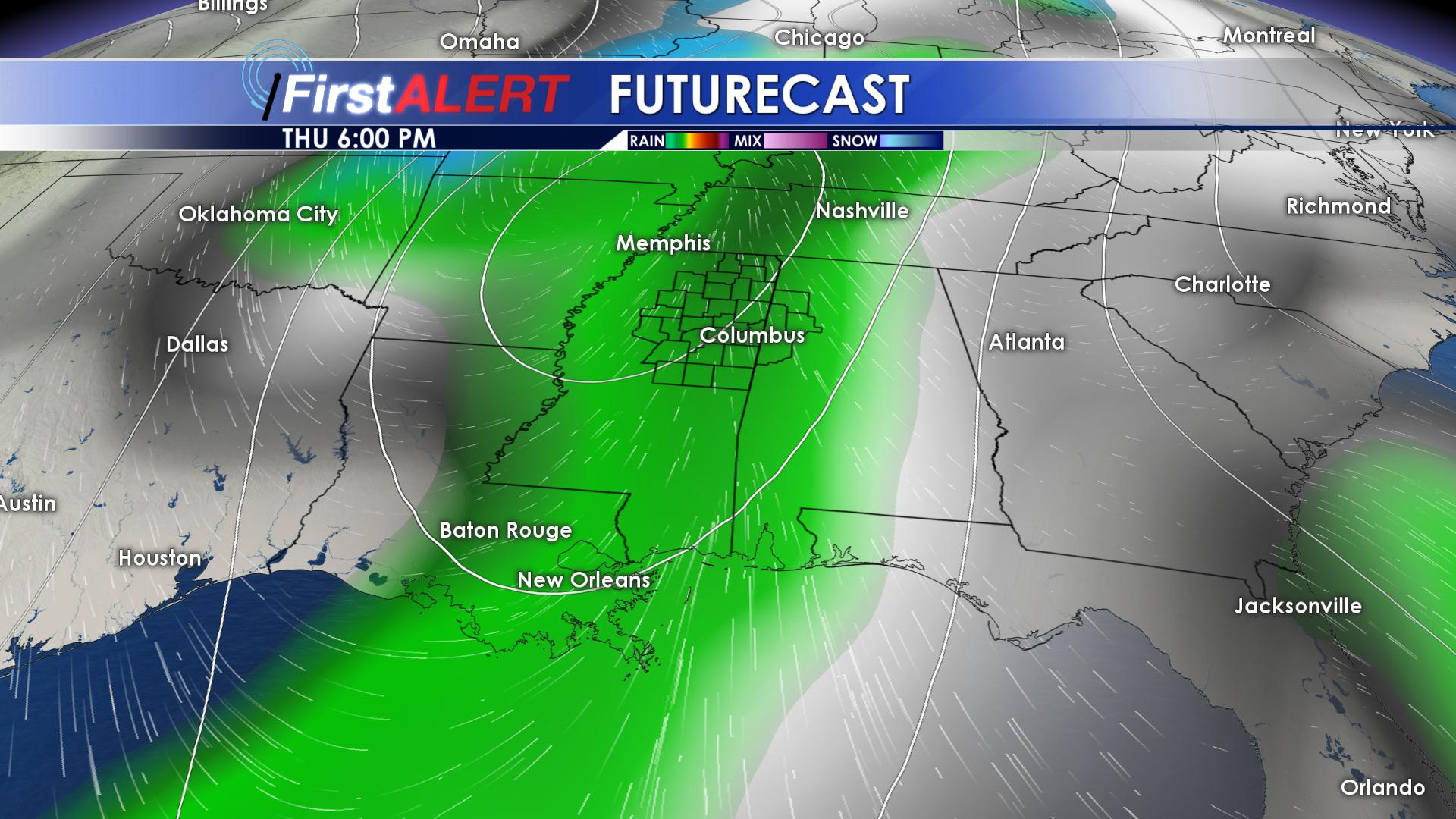
THURSDAY/FRIDAY: Our next rain maker will begin to move into the twin states on Thursday. We could even have a few rumbles of thunder. As of now, no severe weather is expected. We could see more heavy rainfall out of this system, but details remain unclear. Highs on Thursday will top out in the upper 50’s, before dropping to the lower 50’s on Friday. We will remain above freezing both nights, with lows only getting down into the upper 30’s and lower 40’s.
SATURDAY: Highs on Saturday will remain in the middle 50’s, with sunshine returning to the area.
FOLLOW @WCBIWEATHER ON FACEBOOK, TWITTER, INSTAGRAM AND SNAPCHAT


Leave a Reply