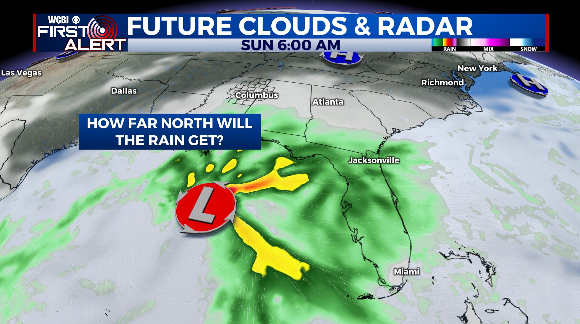
Rain possible this weekend
SUMMARY: A storm system will organize in the Gulf of Mexico this weekend and our region will experience more cloud cover and even some rain. The American GFS model suggests very little rain this far north but the European ECMWF model suggests 1-3” of rain may fall. It’s all about the track of the storm so stay tuned for updates. If you are heading south and southeast it does appear to be a soaker of a weekend. Pleasant weather builds back in for Christmas but more stormy weather is possible by the end of next week and next weekend.
WEDNESDAY NIGHT: Clear and cold. Lows in the 20s. Calm wind.
THURSDAY: Sunny. Highs in the low 50s. Light and variable wind.
THURSDAY NIGHT: Mainly clear. Lows in the upper 20s. Light wind.
FRIDAY: A mix of sun and clouds. Highs in the low 50s. Lows in the 30s Friday night.
WEEKEND: Mostly cloudy. Areas of rain and showers are possible. It may be very light or quite heavy depending on the track of the system moving through the Gulf of Mexico. Either way no thunder or severe weather will occur here. We’re expecting highs in the 50s but some spots could stay in the upper 40s if the wet solution pans out. Stay tuned.
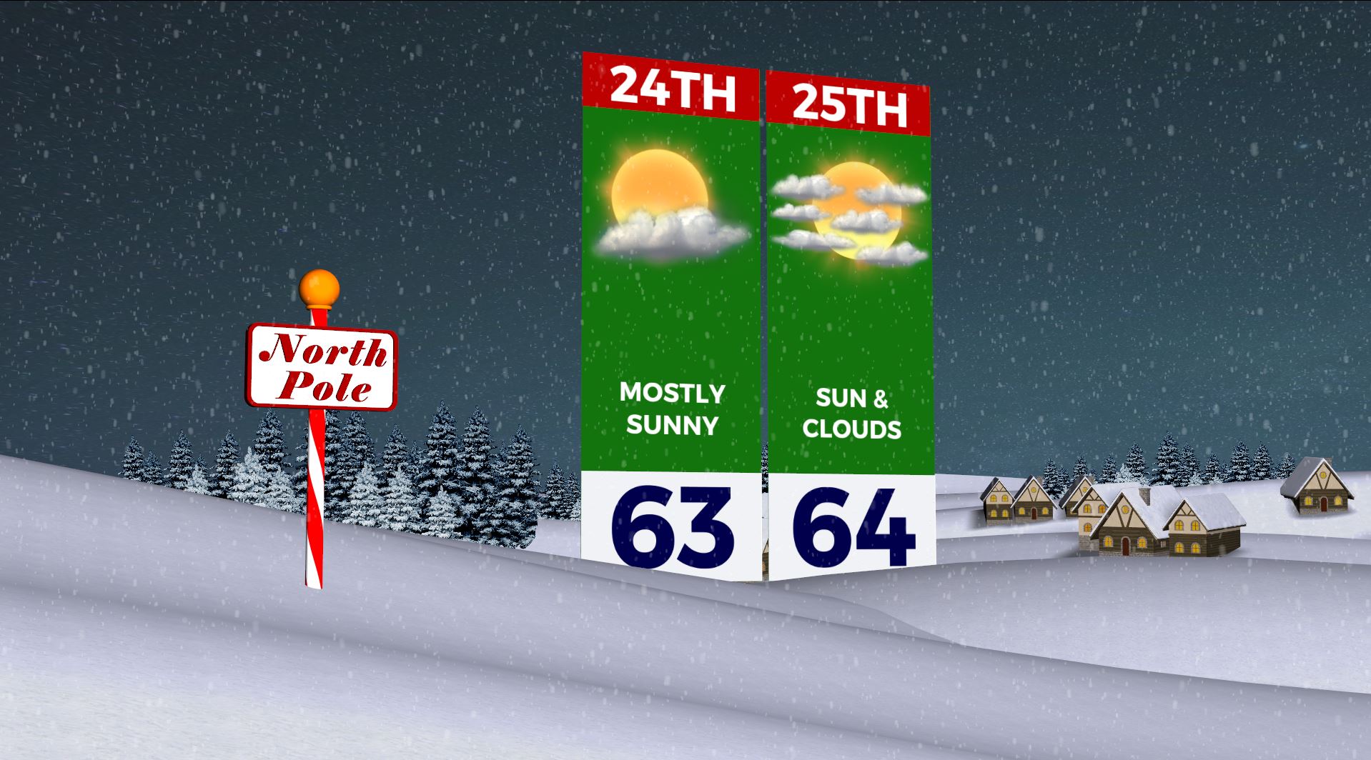
EARLY NEXT WEEK: Pleasant conditions return just in time for Christmas. Look for highs in the 60s with lows in the 30s and 40s. No White Christmas for us this year.
LATE NEXT WEEK: Some data suggest it could become stormy again going into next weekend. It’s something to watch since we can have very active weather this time of year.
Follow @WCBIWEATHER on Facebook, Twitter, Instagram, and the WCBI News app


Leave a Reply