RAIN, RAIN AND MORE RAIN
The weather story for 2019 so far has definitely been rain! We have seen so much rain this year, and it looks like we could see a few more inches over the next few days. Once Monday arrives, sunshine will return, and we may actually get to dry out just a bit!
FRIDAY: More showers and storms will be possible across the area on Friday, a few of which could be strong to severe. We are looking at another round of showers and storms moving in late Thursday night into Friday morning. These showers and storms will hang around through Friday afternoon. Southern portions of the area, along and south of Highway 82, have the potential to see a few severe storms with damaging winds being the main threat. Highs on Friday will remain below average, topping out in the middle 70s.
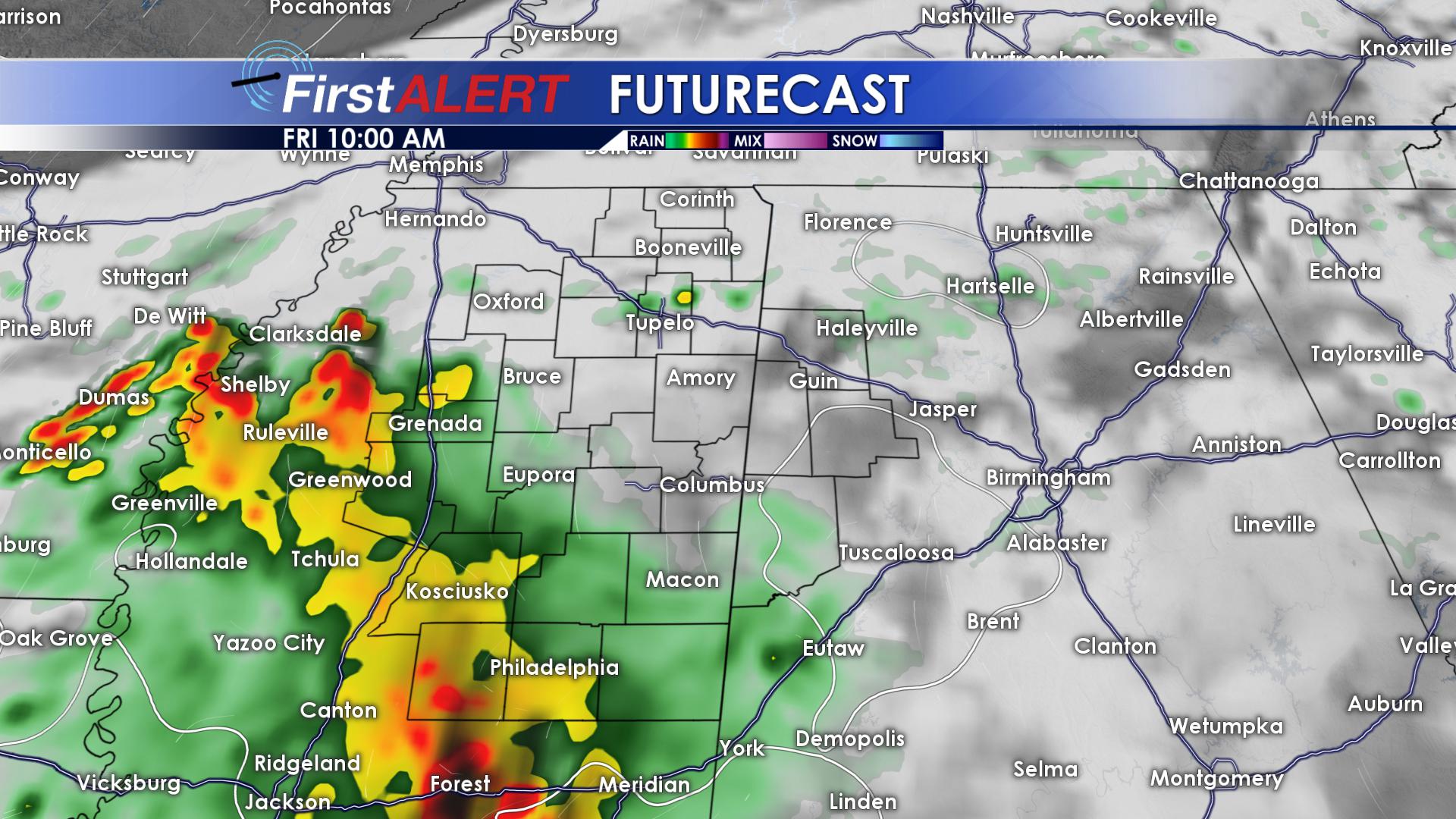
Rain Continues Friday
SATURDAY & SUNDAY: The soggy pattern will continue into the weekend! More widespread showers and storms will be likely on Saturday, a few of which could be on the strong side. Highs on Saturday will top out in the middle 70s. Overnight lows will remain mild, dropping down into the middle 60s. Rain showers will hang around through Sunday morning! As we head into the late afternoon, things will FINALLY begin to dry out as our stalled front begins to lift out of the area. Highs on Sunday will remain in the middle 70s. Once things start to clear out Sunday night, temperatures will cool off, dropping down into the middle 50s overnight.
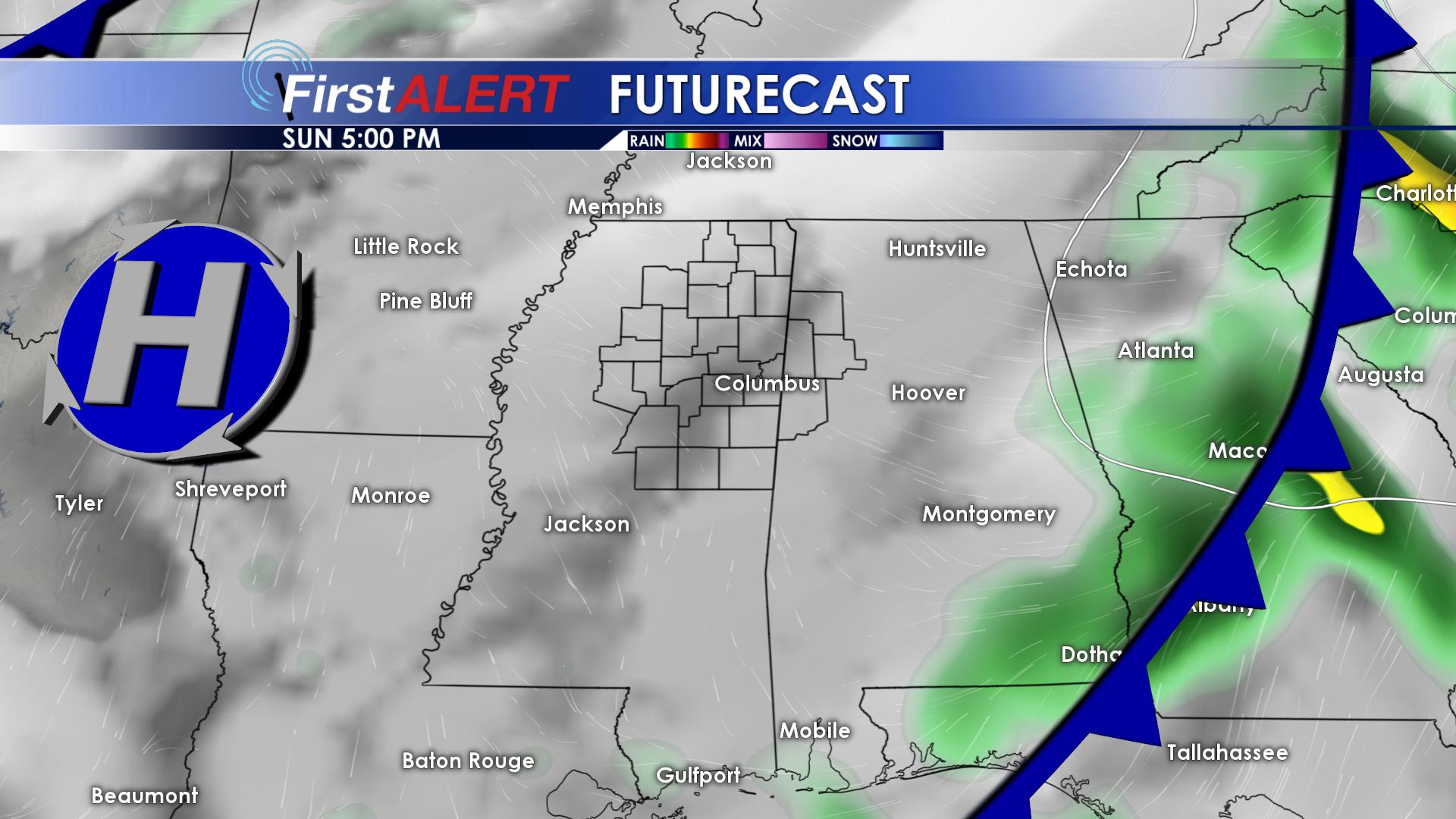
Rain Leaving Sunday Afternoon
MONDAY & TUESDAY: GET OUTSIDE ALERT! Monday and Tuesday are going to be absolutely beautiful! We will remain mostly dry, with just a few clouds. Highs will return to the upper 70s for both Monday and Tuesday, with overnight lows hanging out in the middle to lower 50s.
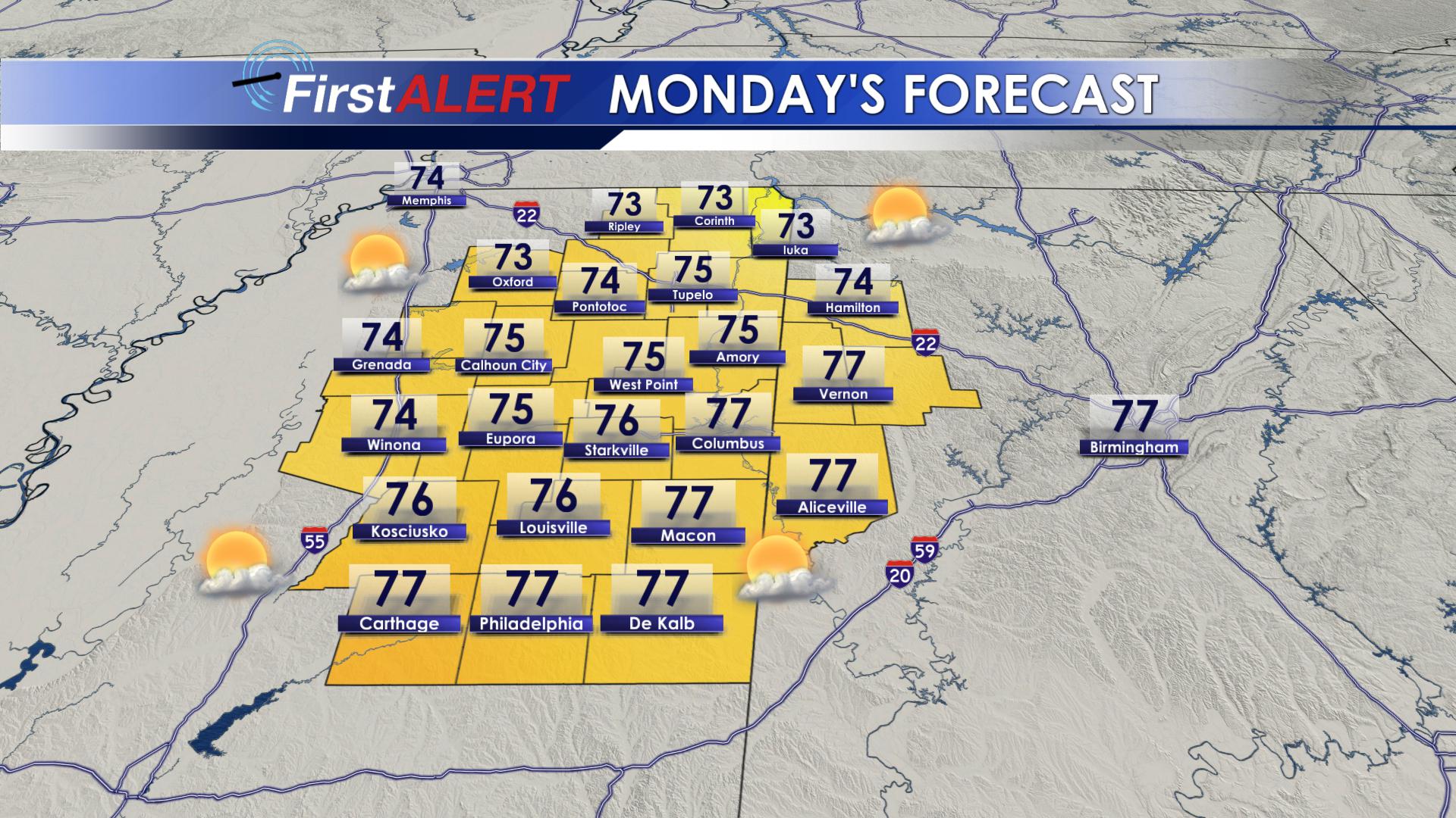
Beautiful Monday and Tuesday
WEDNESDAY & THURSDAY: A weak disturbance will move through our area Wednesday afternoon, bringing the chance of an isolated shower or two to portions of northern Mississippi and northern Alabama. Temperatures will warm into the lower 80s for both Wednesday and Thursday of next week, with overnight lows in the middle 50s. Isolated rain showers will remain possible for Thursday, too.
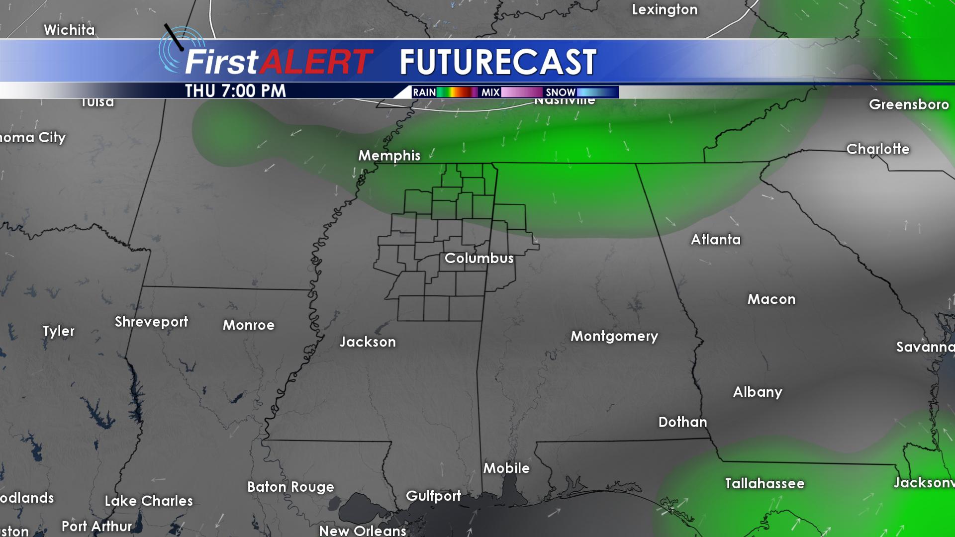
Isolated Showers Return
FOLLOW US ON FACEBOOK, TWITTER AND INSTAGRAM @WCBIWEATHER


Leave a Reply