Rain & storm chances coming back
SUMMARY: Mainly clear and cool conditions will continue tonight but there won’t be a frost or freeze threat. Some showers are possible late Friday evening into Saturday morning. Another round of rain and storms is on tap for Sunday. Some look to be strong/severe but it’s still uncertain how far north the prime zone of activity can get. Stay tuned…
THURSDAY NIGHT: Mainly clear. Lows in the mid 40s. Light SE winds.
FRIDAY: Sun & clouds. Warmer. Highs in the mid 70s. Winds SSW 10-20 mph.
FRIDAY NIGHT: Mostly cloudy with areas of showers. A few storms are also possible. Lows in the low 50s.
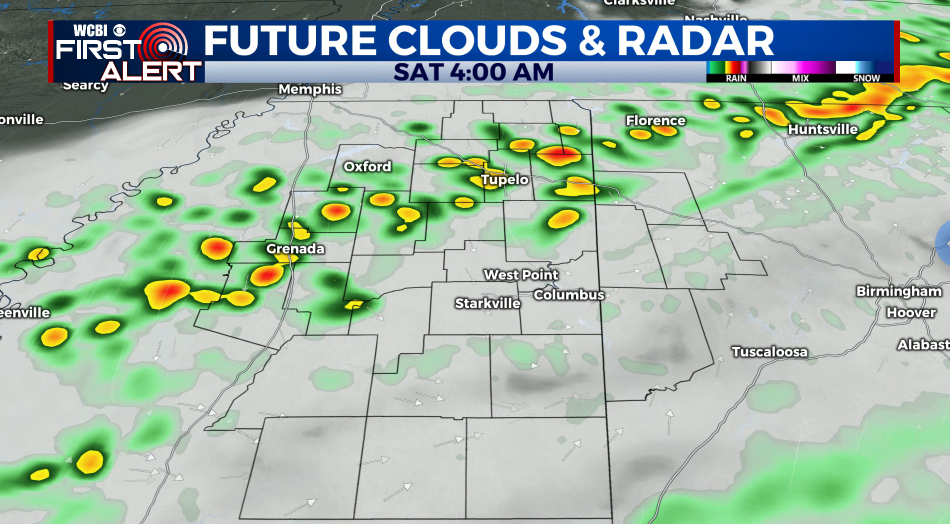
SATURDAY: Mostly cloudy with some showers in the morning. Sunshine develops during the day. Highs should top out in the upper 60s to around 70.
SATURDAY NIGHT: Areas of rain and thunder. Lows in the low 50s.
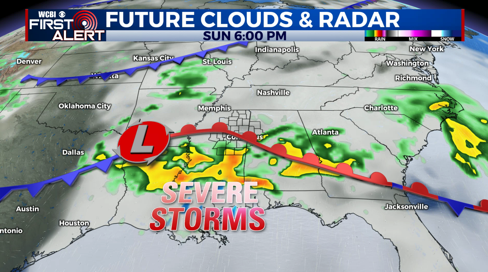
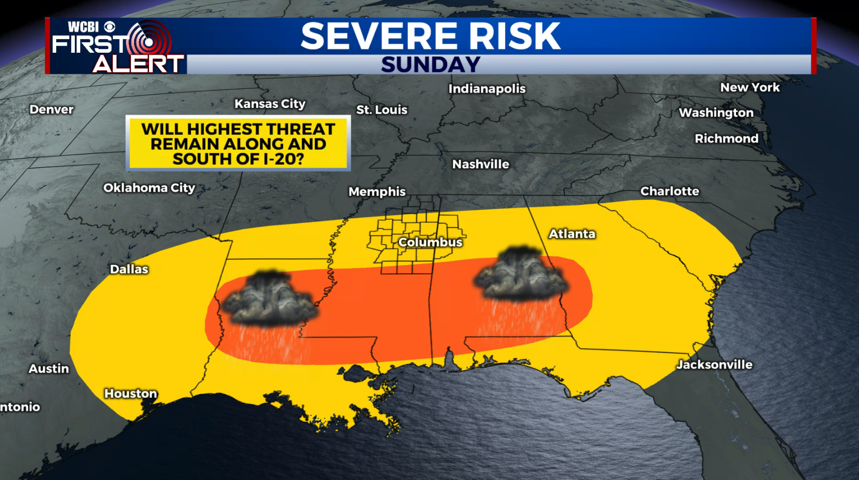
SUNDAY: A 90% chance of rain and storms. Highs in the low 70s. Severe weather is possible in the region, especially along and south of the I-20 corridor. Locations as far north as US 82 may be affected if the system trends northward so be sure to stay tuned for additional updates over the next 2 days.
EARLY NEXT WEEK: Mostly sunny to partly cloudy weather builds back in for Monday and Tuesday. Additional storms are may return by Wednesday or Thursday.
Follow @WCBIWEATHER on Facebook, Twitter, Instagram, and on the WCBI News App


Leave a Reply