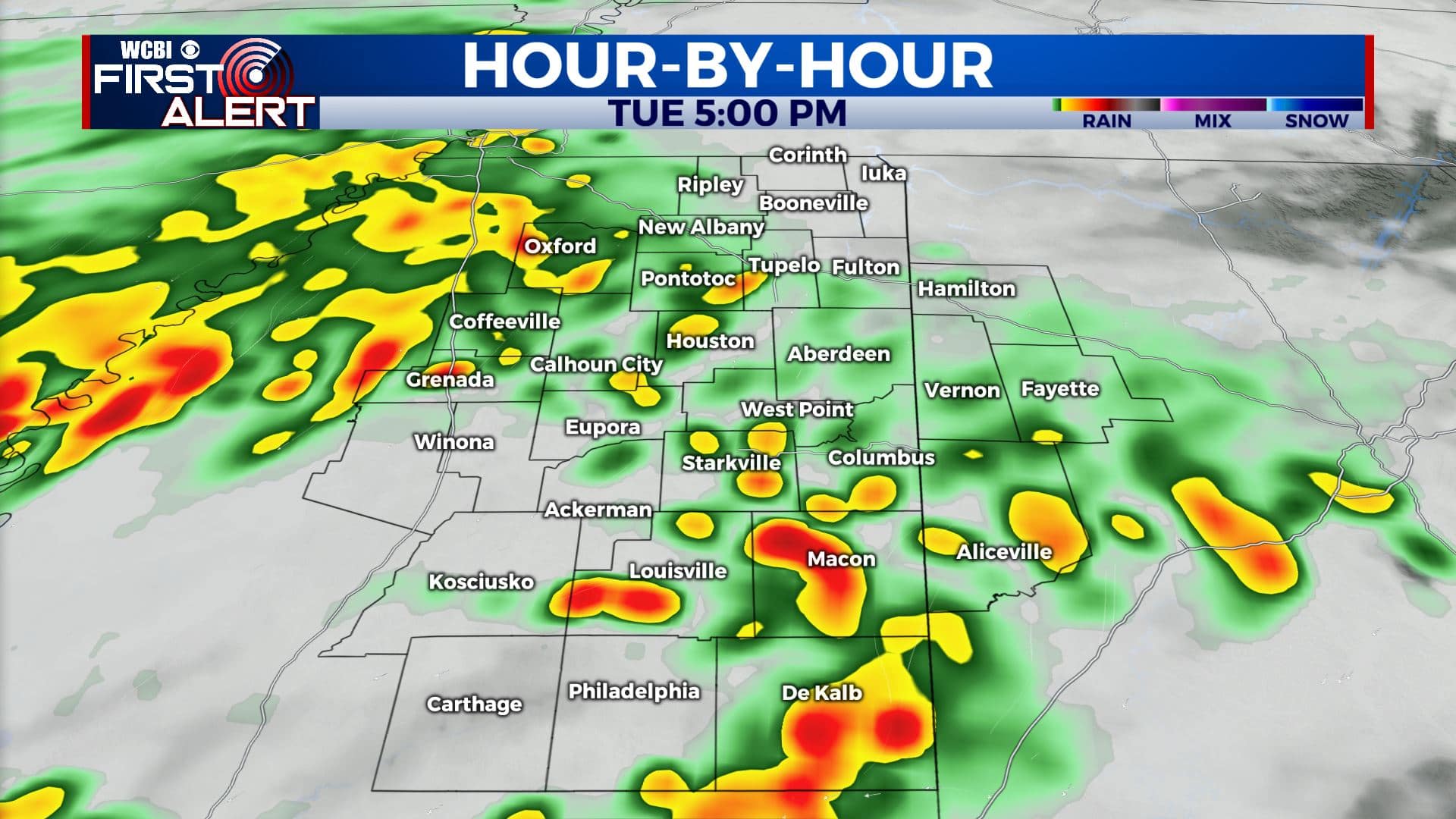
Rain & storm chances for your Tuesday
SUMMARY: The cool below average temperatures and the unsettled weather pattern will remain in place through midweek. Clouds will likely break up by Thursday afternoon with mostly sunny skies into the weekend. Temperatures are going to warm back up to the 70s and 80s by the weekend too as we finally get a much needed break in the storm activity.
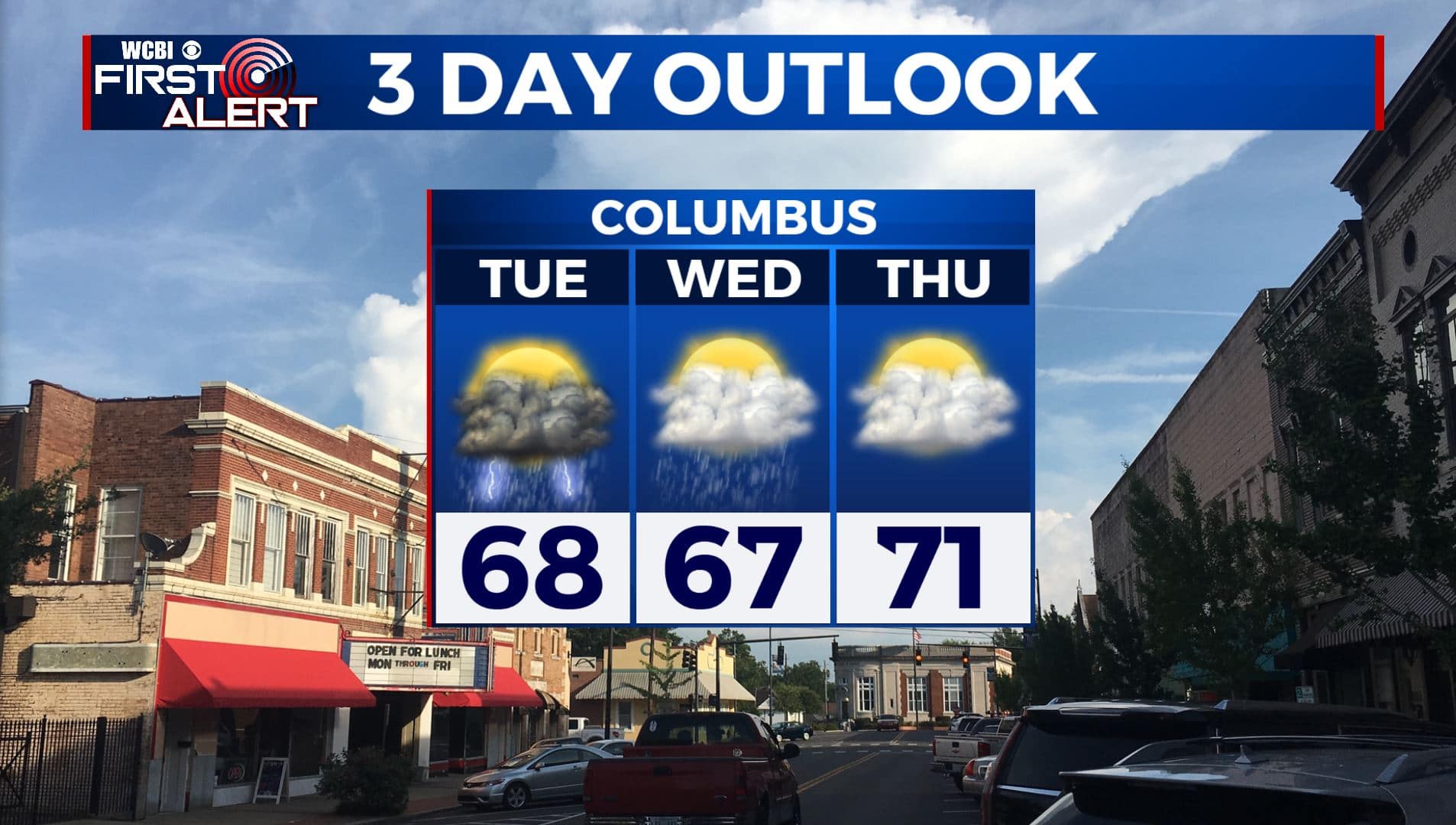
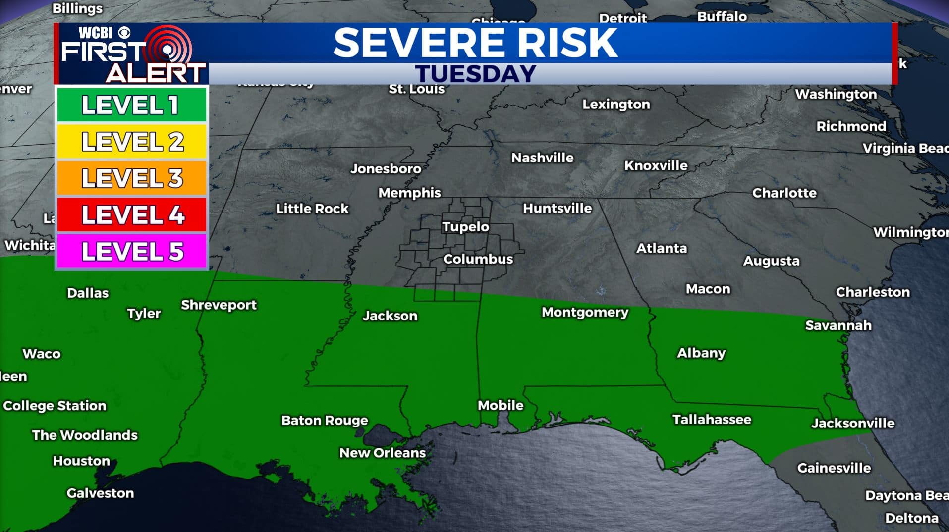
TUESDAY: Another cloudy day is ahead for us with areas of rain and storms possible. The best chance for any strong to severe storms will be along and south of I-20. Highs will remain below average in the upper 60s. Highs will remain below average from the upper 60s to lower 70s. Winds NE 5-10 mph.
TUESDAY NIGHT: Cloudy with a chance of showers and a few storms. Lows in the mid 50s.
WEDNESDAY: Mostly cloudy skies with a chance of a few lingering showers. Highs in the mid to upper 60s.
WEDNESDAY NIGHT: Cloudy. A continuing chance of a few showers. Lows in the mid 50s.
THURSDAY: A mix of sun & clouds. A few lingering showers. Highs in the lower 70s.
THURSDAY NIGHT: Partly cloudy skies with cooler overnight lows around 50 degrees.
FRIDAY: Mostly sunny skies. Highs in the mid 70s. Lows in the low 50s Friday night.
SATURDAY-SUNDAY: Much needed sunshine for the weekend. Temperatures continue to warm up to the lower to mid 80s. Overnight lows in the 50s and low 60s.
MONDAY: Clouds will begin to increase again along with a few showers moving in as we begin a new workweek. Highs in the mid 80s.
Stay connected with @WCBIWEATHER on Facebook, Twitter, Instagram, and the WCBI News App.


Leave a Reply