Rain & storms are back
SUMMARY: An active, wet, and potentially stormy weather pattern is setting up and it looks to continue through early next week. Between 2” and 6” of rain could fall during the coming days and that may lead to flooding issues. Keep an eye on the creeks, streams, and rivers over the coming days. Some isolated strong to severe storms with hail and gusty winds are also possible from time to time.
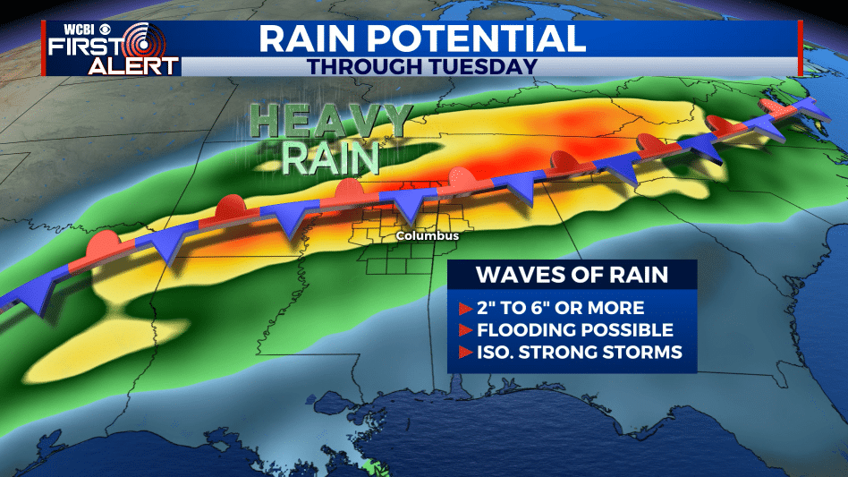
THURSDAY NIGHT: Cloudy skies with areas of rain and storms. Heavy rain is possible in addition to a few strong/severe storms with hail and gusty winds. Lows in the 40s to around 50. Winds ENE 5-15 mph.
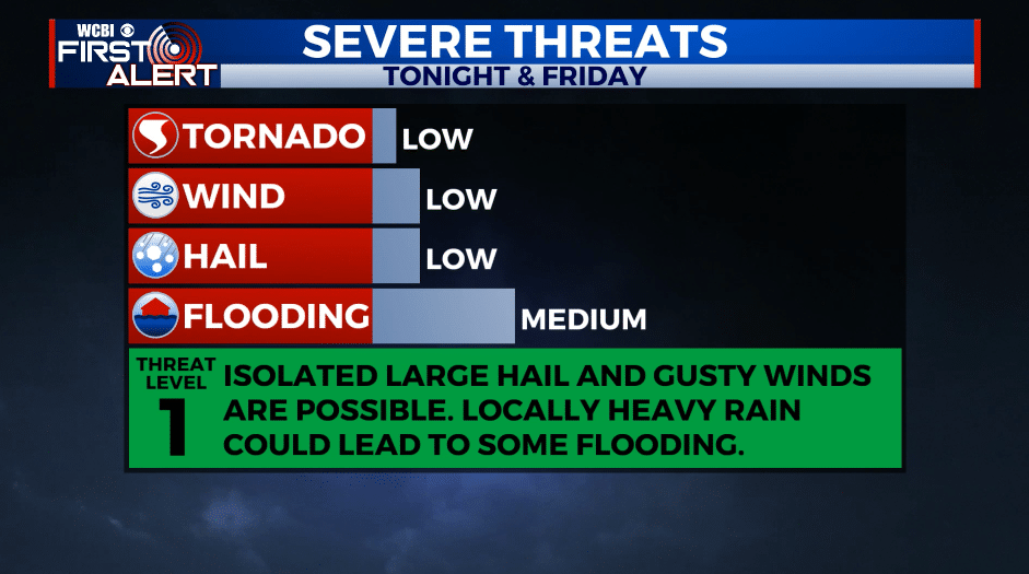
FRIDAY: Areas of rain and thunder. An isolated strong/severe storm with hail and gusty wind will remain possible. We’re forecasting highs in the low 60s but it could end up being warmer if a warm front pushes in from the south faster than expected. Winds ESE 5-15 mph.
FRIDAY NIGHT: Mostly cloudy and mild. Lows around 60. The chance of showers will continue during the night.
SATURDAY: Mostly cloudy. A continuing chance of rain and thunder. It probably won’t rain the entire day but keep an umbrella close at hand if you have outdoor plans. Spring-like highs in the mid 70s can be expected along with noticeably higher humidity.
SATURDAY NIGHT: Warm and humid. Lows in the low to mid 60s. A chance of showers and storms.
SUNDAY: Mostly cloudy. Warm highs in the mid to upper 70s. A good chance of rain and storms, especially during the 2nd half of the day.
MONDAY-TUESDAY: Mostly cloudy. A continued chance of rain and storms each day. Highs in the 60s, lows in the 40s.
Follow @WCBIWEATHER on Facebook, Twitter, Instagram, and the WCBI News App


Leave a Reply