Rain & Storms Friday, Cool Saturday
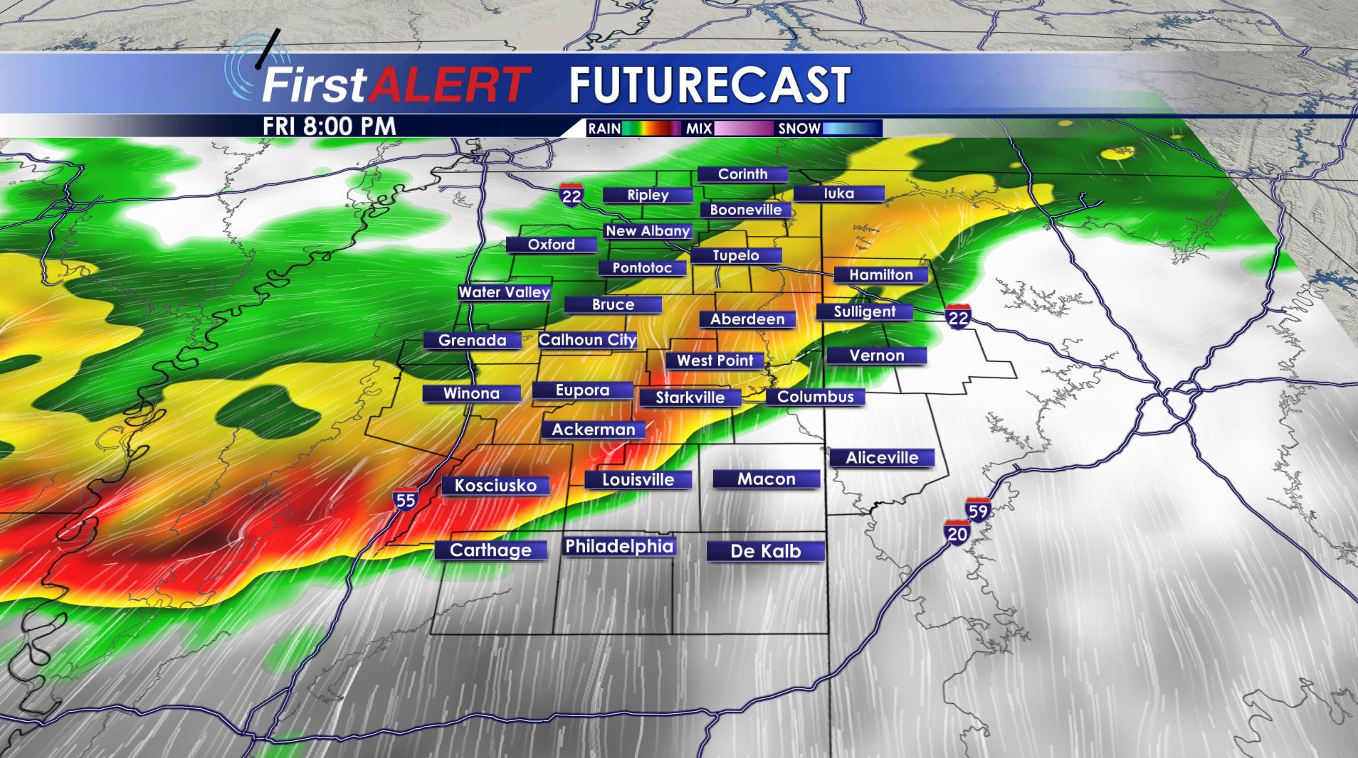
Friday Evening Futurecast
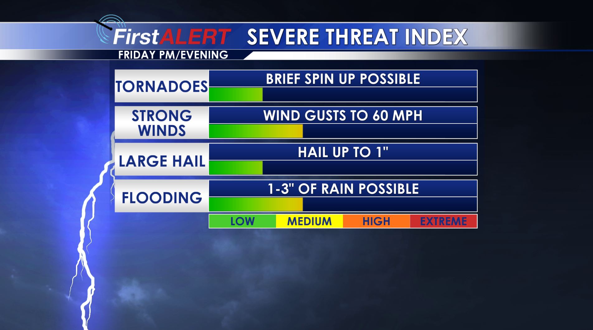
Severe Threat Index
THURSDAY NIGHT: Variably cloudy with lows in the mid 40s. A few showers are possible.
FRIDAY: Areas of rain and storms are possible during the morning mainly north of the Golden Triangle. More widespread showers and storms are expected to develop during the afternoon. A line of strong to severe storms is possible during the late afternoon and evening. Strong straight-line wind gusts would be the main threat if storms develop but we can’t rule out a spin up tornado and a some hail. The highest odds of strong storms is along and southwest of a line from Water Valley to Columbus. Highs will be mainly in the 60s but a few spots in our southern counties may briefly get into the 70s.
FRIDAY NIGHT: The strongest storms should push south of our area by midnight but lingering showers and clouds will stick around during the night. Gusty NW winds are going to develop and they’ll usher in colder mid to low 40s by sunrise Saturday:
SATURDAY: Breezy and cool conditions are likely all day long. A fair amount of cloud cover is expected too. We’re going to keep a 30% chance of showers going but it doesn’t look like an all day washout at this time. Highs top out only in the low 50s.
SATURDAY NIGHT: Clear, calm, and cold weather sets up shop again. Another widespread freeze is looking like with lows in the low 30s.
SUNDAY: Mostly sunny skies and seasonable 60s return. It should be a great day to get some chores done outdoors.
NEXT WEEK: We’re going to keep a chance of showers and storms in the forecast for Monday but new information suggests the system moving through will not be that strong. A fair amount of sunshine is likely from Tuesday through Friday and that will help to support a warming trend by the end of the week.
Follow @WCBIWEATHER on Facebook, Twitter, Instagram, and Snapchat


Leave a Reply