Rain & Storms Friday, Severe Threat Saturday
Saturday Severe Threat
THURSDAY NIGHT: Areas of rain and embedded storms will continue. Temperatures will rise from the upper 40s to the lower 50s by daybreak Friday.
FRIDAY: Look for more rain and storms around the region. Additional heavy rainfall may lead to more flooding. Temperatures will gradually rise into the 60s as winds become more southerly during the day. Mid to upper 60s are possible from the Golden Triangle and to the south. Cooler upper 50s to lower 60s are more likely closer to the Tennessee border.
FRIDAY NIGHT: Temperatures hover in the 60s as the chance of rain and storms continue. A a few stray strong storms can’t be ruled out across western Mississippi.
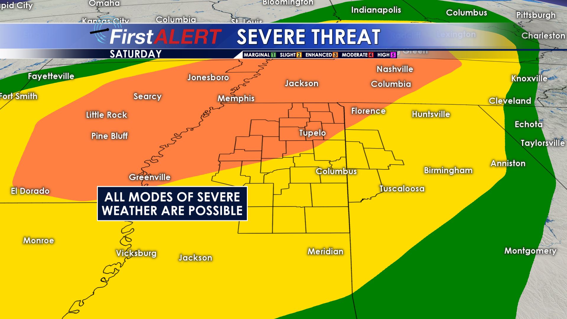
SATURDAY: We still expect a warm and breezy day with highs well into the 70s. While some rain and storms may be around during the morning the best chance of severe weather in our area looks to be from about 1 p.m. through about 10 p.m. All modes of severe weather are possible, including hail, damaging wind gusts, and tornadoes. Be sure to stay weather aware going into the weekend.
SATURDAY NIGHT: Rain and storms exit once a cold front passes. Lows tumble back into the 40s.
SUNDAY-MONDAY: Mostly sunny weather returns! Highs top out around 60 while overnight lows fall back into the 30s. A two day stretch is what the region needs after all of the recent rainfall.
Follow @WCBIWEATHER on Facebook, Twitter, and Instagram


Leave a Reply