Rain & storms return this week
SUMMARY: The weather pattern will be much more active over the next week but that’s typical for late November. A cold front on Wednesday will spark some gusty showers and storms. Thanksgiving looks seasonable and dry but more wet and potentially stormy weather lurks for the rest of the long holiday week.
MONDAY NIGHT: Clear and chilly. Lows in the mid to low 30s. Areas of frost are possible.
TUESDAY: Mostly sunny to partly cloudy. Highs in the mid 60s. Winds SE 10 mph.
TUESDAY NIGHT: Becoming cloudy with rain possible late. Breezy southerly winds 10-15 mph. Lows in the mid 50s.
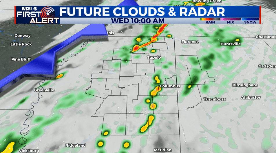
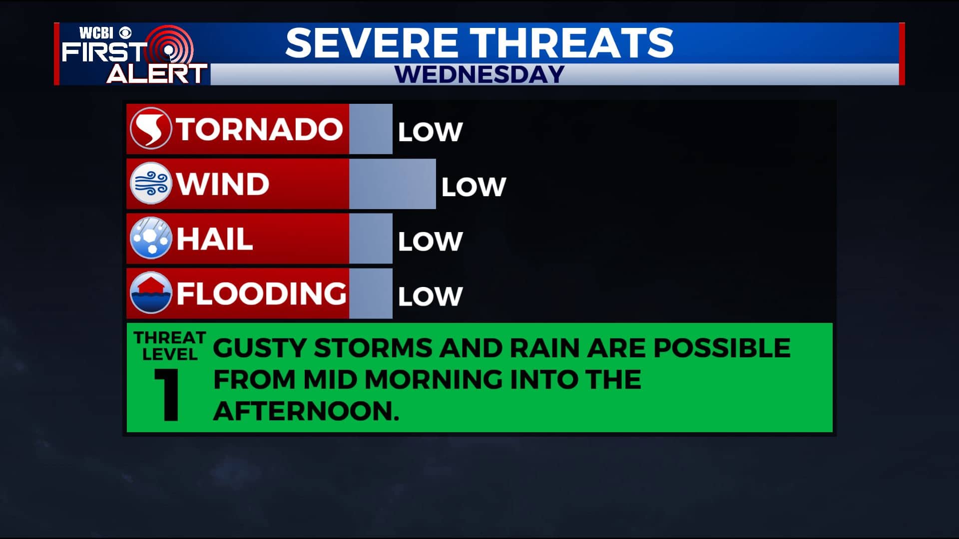
WEDNESDAY: Areas of rain and storms from about mid morning into the afternoon. Some storms could be severe with damaging wind gusts the main concern. The overall tornado risk should remain relatively low with this setup but it bears watching. Highs in the low 70s. Winds SSW 10-20 mph.
WEDNESDAY NIGHT: Partly cloudy. Lows in the 40s.
THANKSGIVING DAY: Partly cloudy. Highs in the mid to upper 60s.
FRIDAY-SUNDAY: Mostly cloudy with areas of rain likely. Some storms could also develop depending on how things set up. Highs in the 60s Friday & Saturday with cooler upper 50s to low 60s Sunday. Several inches of rain could fall across the region during the weekend, depending on how things develop.
Follow @WCBIWEATHER on Facebook, Twitter, Instagram, and the WCBI News App


Leave a Reply