Rain & Storms Thursday
WEDNESDAY NIGHT: Variably cloudy. A few stray showers can’t be ruled out during the evening with a better chance for some rain drifting in late. Lows should be in the low 60s in most spots. A few cooler locations may briefly dip into the upper 50s.
THURSDAY: An area of low pressure is going to push through the region. There is a 50-60% chance of rain and storms here but the strongest storms and heaviest rain still appear to be focused south of our area. We’ll continue to watch it as things come together. Highs are going to top out in the 70s. Lingering showers are possible Thursday night with temperatures dipping into the upper 50s to around 60.
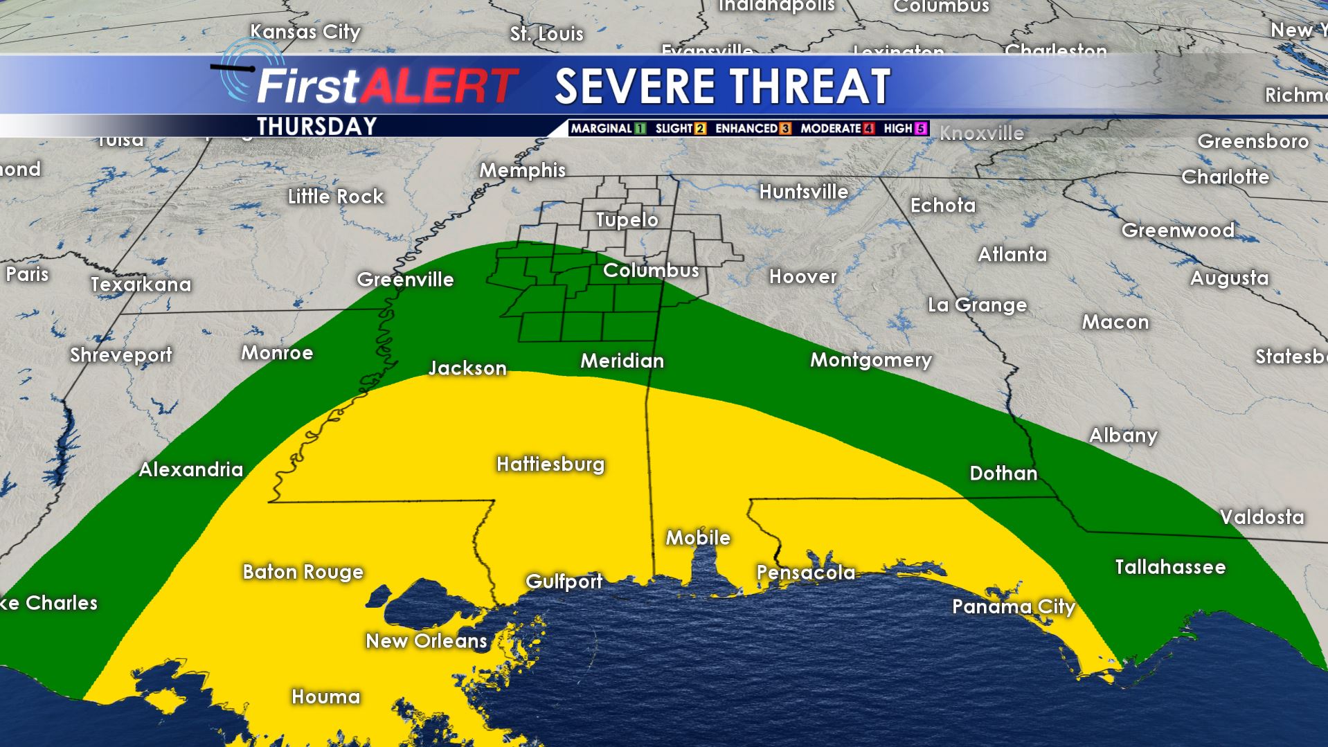
Severe Threat Thursday
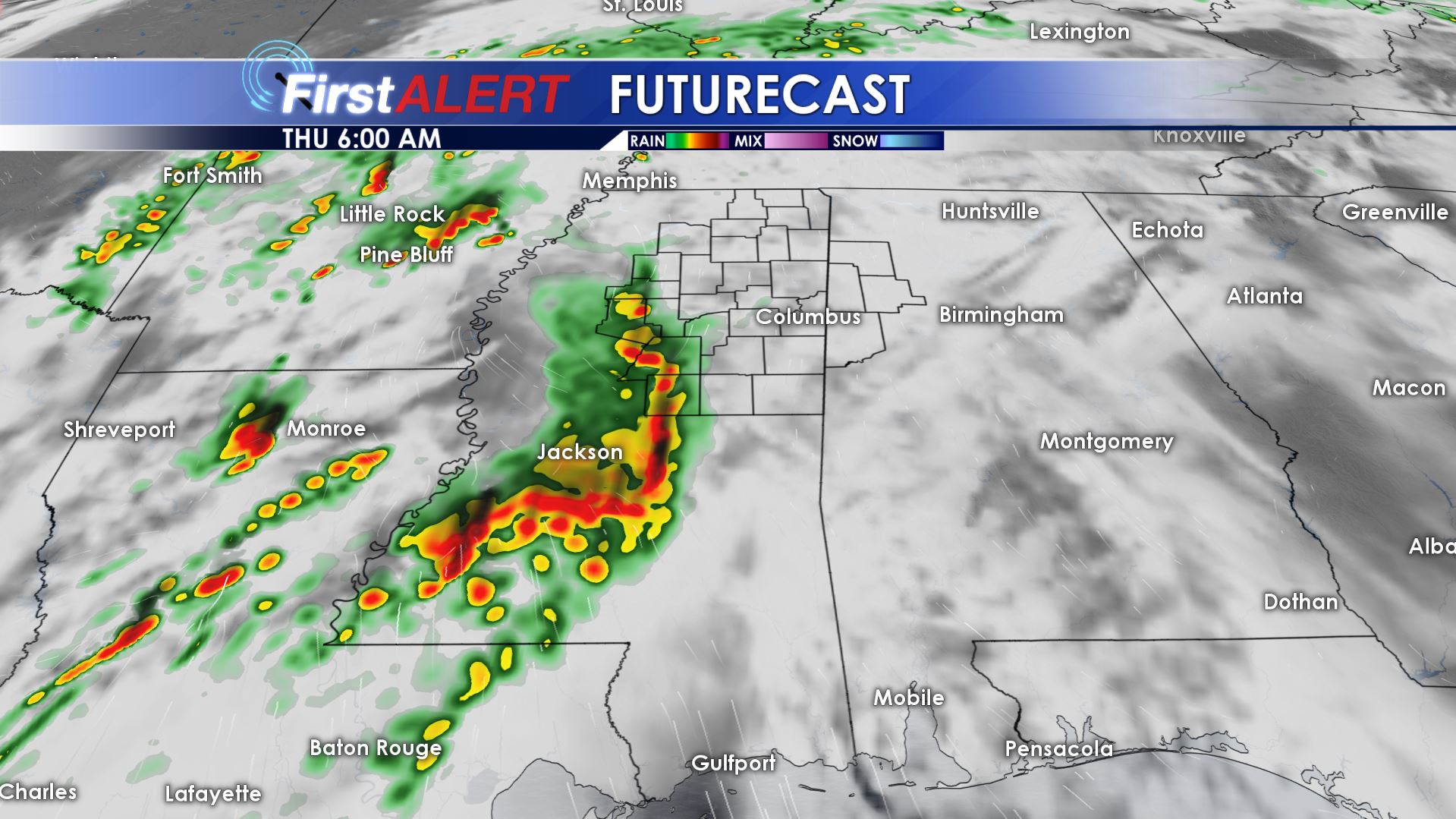
Futurecast 6 a.m.
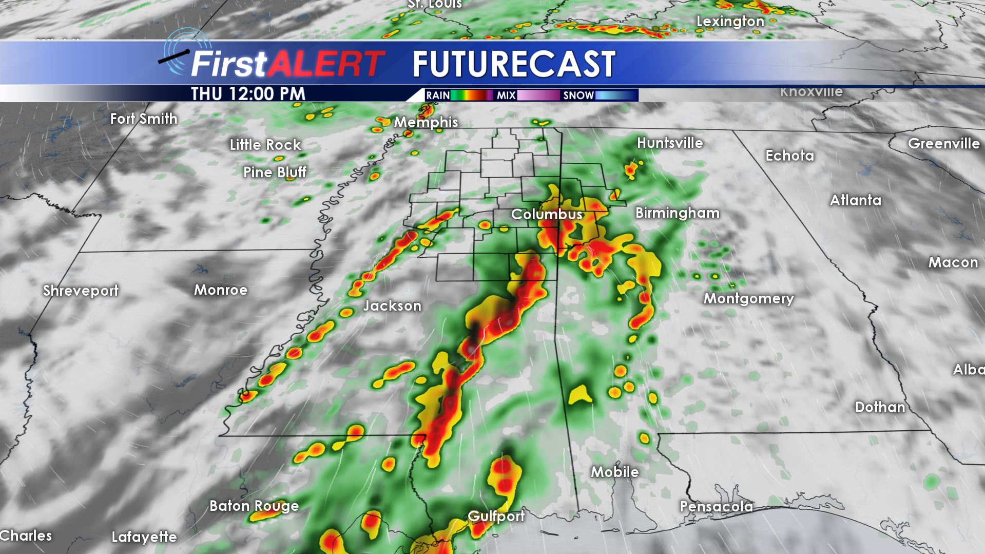
Futurecast 12 p.m.
FRIDAY: Sunshine redevelops as drier northwesterly breezes return. Plan on another nice day with highs in the 70s. Some upper 40s are possible Friday night under mainly clear skies.
SATURDAY: Mostly sunny and seasonably warm highs around 80 remain on track. It’ll be a good day to get out and about.
SUNDAY: We’re going to add just a 20% chance of rain with the possibility of a cold front getting as far south as north Mississippi. If this occurs then highs may top out in the mid to upper 70s. If the front stalls out to our north then we’ll have no rain and highs in the low 80s.
NEXT WEEK: Fairly quiet weather is likely through at least Wednesday. Highs are expected to climb back into the mid to possibly upper 80s during this time frame.
Follow @WCBIWEATHER on Facebook, Twitter, and Instagram


Leave a Reply