Rain And Storms Today. (UPDATED 11:20 AM).
TODAY: A very slow moving cold front pushes through and eventually stalls over the area. This front will trigger numerous showers and storms through the day. High temperatures will range from the low 60s to low 80s today due to the front. An isolated strong or severe storm cannot be ruled out this afternoon or tonight, mainly along and south of a line from Tupelo to Greenville.
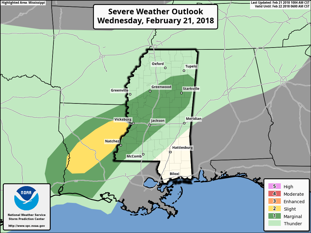
SPC OUTLOOK ISSUED AT 10 AM
THU/FRI: Highs in the upper 70s and low 80s Thursday and Friday. A few showers possible Thursday, especially in the morning. Rain chances dip Thursday night as lows drop into the low 60s. Friday, an isolated shower or two is possible. Otherwise warm and partly sunny.
SAT/SUN: The front again makes its way southeast across our area Saturday, mainly in the late afternoon and overnight hours. Before the front can pass, high temperatures will climb into the 70s and 80s. Conditions along and ahead of the front will be somewhat supportive for some strong to possibly severe storms. Most spots get wet with the chance for rain through the day and overnight at around 80%. Any spot not getting wet Saturday would likely see showers and storms early Sunday morning. Rain chance Sunday at around 60%, with the best chance of rain in the morning hours. Highs in the upper 60s Sunday. Drying out overnight, with lows in the 40s.
NEXT WEEK: We remain in the 60s Monday and Tuesday of next week. It also appears we will stay dry to kick off the workweek as well. Lows will remain in the low to mid 40s Monday night into Tuesday morning.


Leave a Reply