Rain & storms tonight
SUMMARY: A batch of rain and storms will move through the region Wednesday night. Heavy rain and gusty winds appear to be the main threats after midnight. The overall tornado risk is on the low end of the spectrum. Another chance of storms will come late Friday evening and early Saturday morning.
WEDNESDAY NIGHT: Rain and storms. Some severe weather is possible from late in the evening through sunrise. The main threats tonight will be gusty winds and heavy rainfall that could lead to flooding. Some hail is possible but the tornado threat is low. Lows will be in the upper 50s to low 60s. Winds remain breezy from the S 10-25 mph.


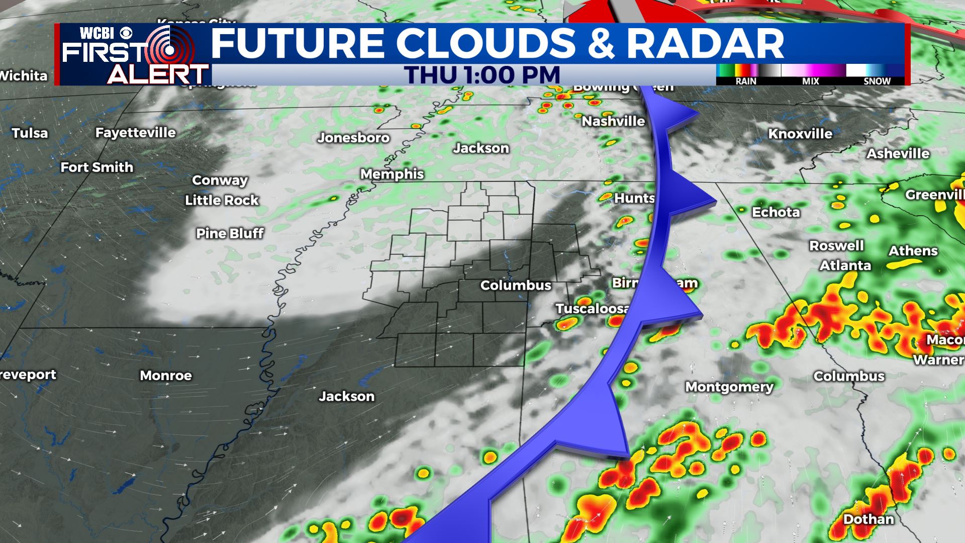
THURSDAY: Variably cloudy with some lingering showers. One thing we’ll have to watch out for is some storm redevelopment along the MS/AL border and points east by early afternoon. There may be some strong storms over in Alabama but we think they’ll stay JUST to our east. Breezy winds from the W 10-25 mph will help to dry things out. Temperatures are expected to warm into the mid to upper 70 during the afternoon.
THURSDAY NIGHT: Partly cloudy and quiet. Lows in the low 50s.
FRIDAY: Mostly sunny and warm. Highs in the upper 70s to around 80.
FRIDAY EVENING/NIGHT: Scattered showers and storms. Some could be strong with gusty winds and hail. Lows in the upper 50s.
SATURDAY: Some showers in the morning with developing sunshine as the day wears on. Highs in the low 70s.
SATURDAY NIGHT: Mainly clear. Lows in the upper 40s.
SUNDAY: Mostly sunny. Highs near 70.
NEXT WEEK: Another round of storms may come our way Tuesday night into Wednesday. We’ll continue to monitor that.
Follow @WCBIWEATHER on Facebook, Twitter, Instagram, and the WCBI News App


Leave a Reply