Some Rain Tonight, Stronger Storms Saturday
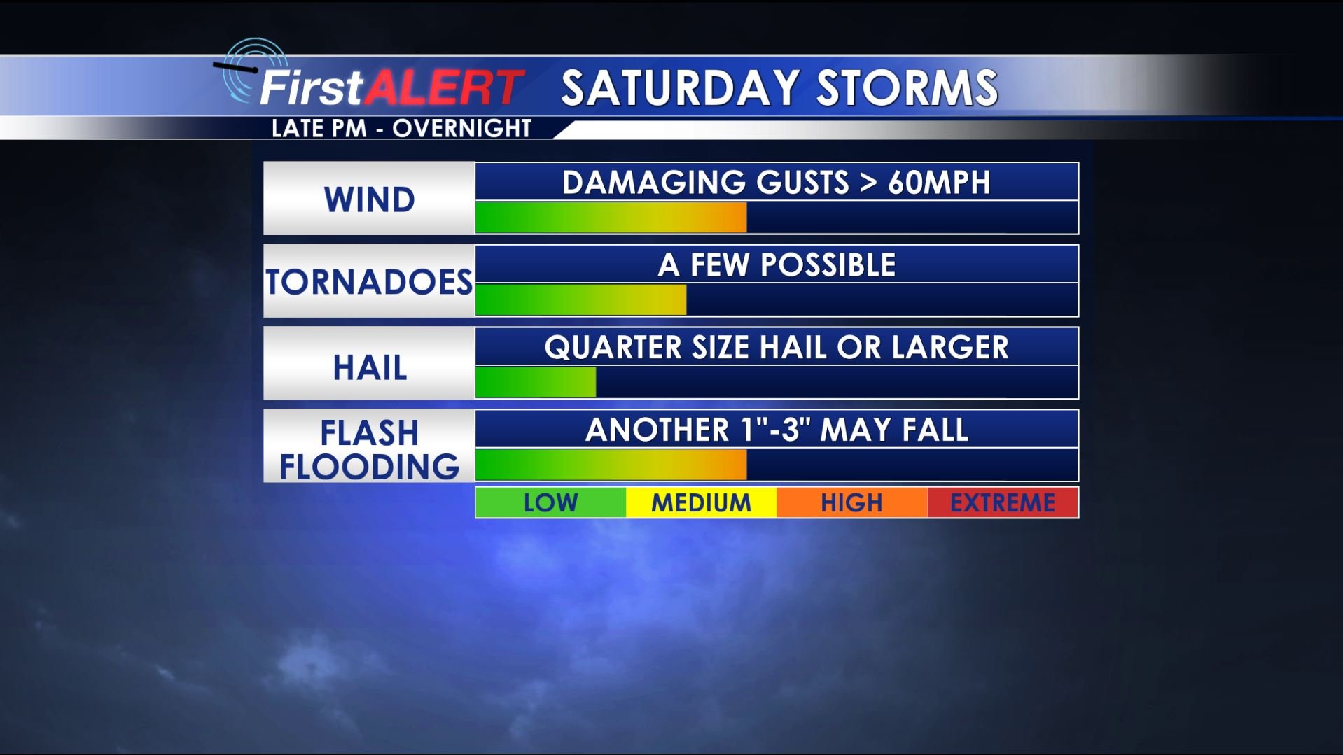
Severe Threat Saturday
OVERVIEW: Several rounds of strong to severe storms are possible over the next week. The first batch is slated for Saturday evening/night and additional active weather may develop next Wednesday into Thursday. Stay weather aware during and be sure to have multiple ways of getting warning information.
THURSDAY NIGHT: A narrow line of gusty showers and t-showers will push in from the west after midnight. No severe weather is expected. Overnight lows will fall back into the upper 50s by sunrise.
FRIDAY: A cold front stalls across the region and that means more clouds and cooler highs in the 70s. While a few showers or storms are possible it now looks like things won’t be too active in our neck of the woods. The chance of rain is just 20%.
FRIDAY NIGHT-SATURDAY MORNING: A band of showers and storms may develop as a warm front pushes from south to north across the area. No severe weather is expected at this time but lightning and locally heavy downpours are possible. Lows Friday night should be around 60.
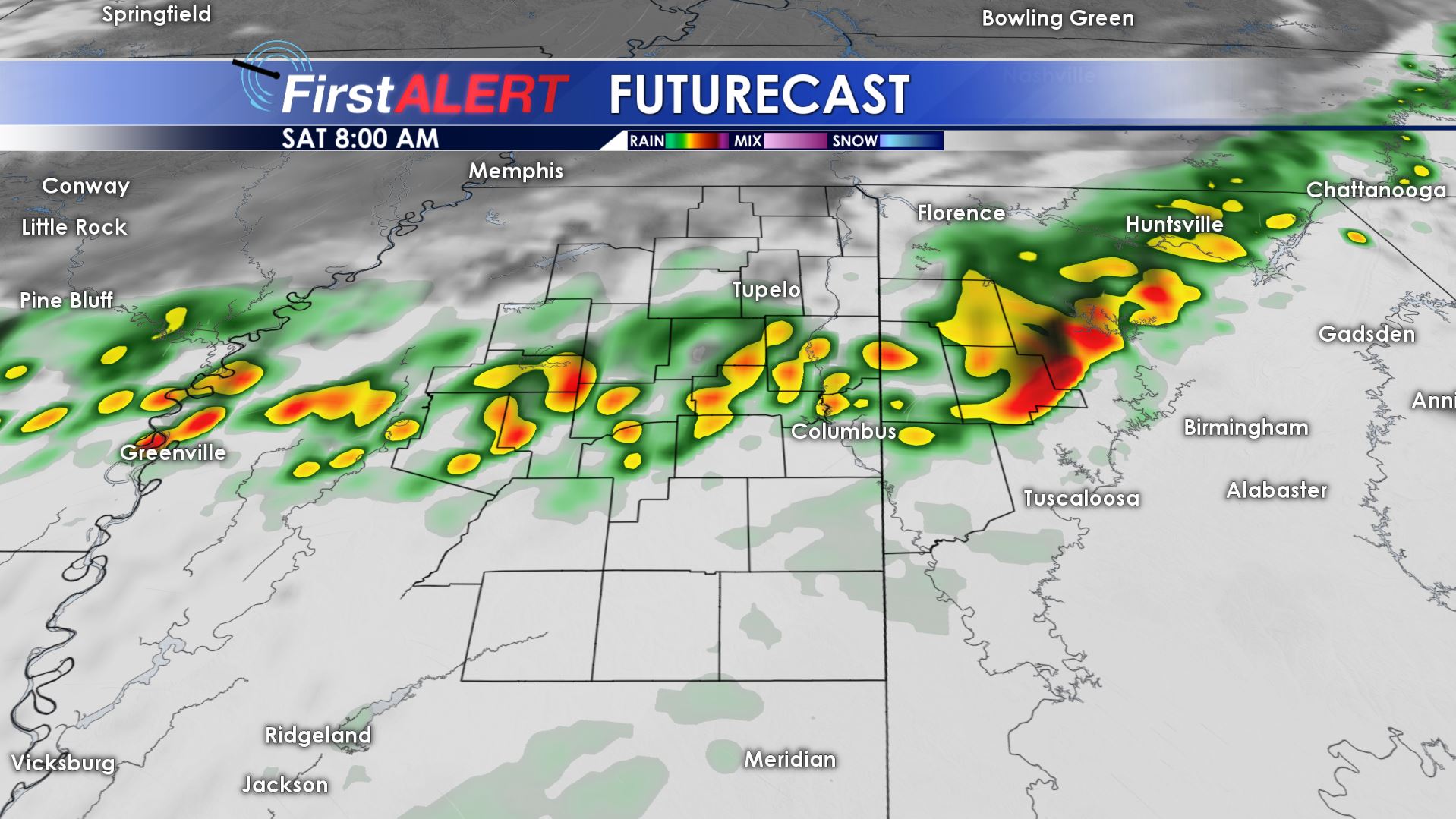
Saturday Morning Futurecas
SATURDAY AFTERNOON: A relative lull may take hold of our area even though there is still the chance of a few showers and storms. Highs top out mainly in the 70s. We’re hopeful that outdoor events that are scheduled can still take place. Just stay mindful of the weather.
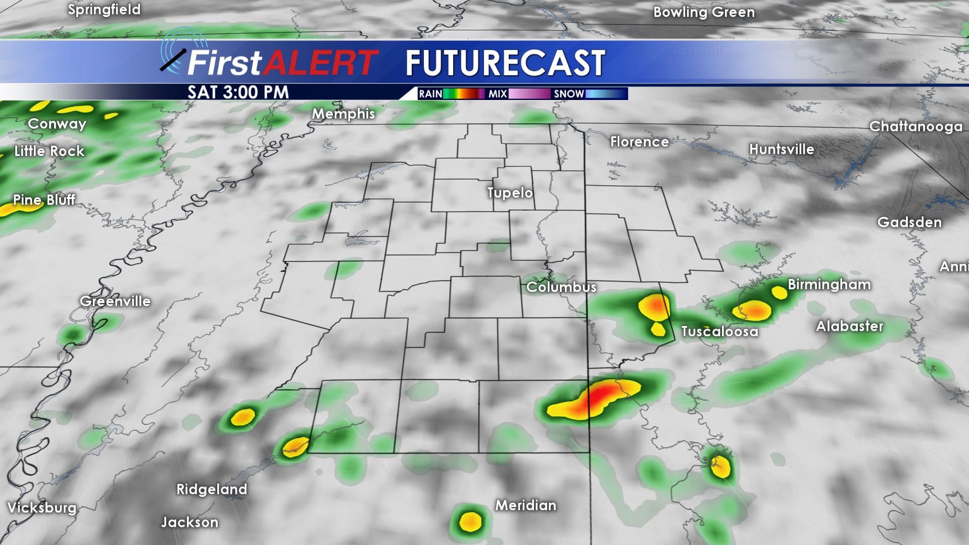
Saturday Afternoon Futurecast
SATURDAY EVENING/NIGHT: A bigger batch or line of storms is going to move in from the west during the evening. It will have the potential to produce damaging wind gusts, isolated tornadoes, and heavy rainfall as it moves across the area during the night. We expect any severe threat to be over by sunrise Sunday. Temperatures will hold in the 60s all night long.
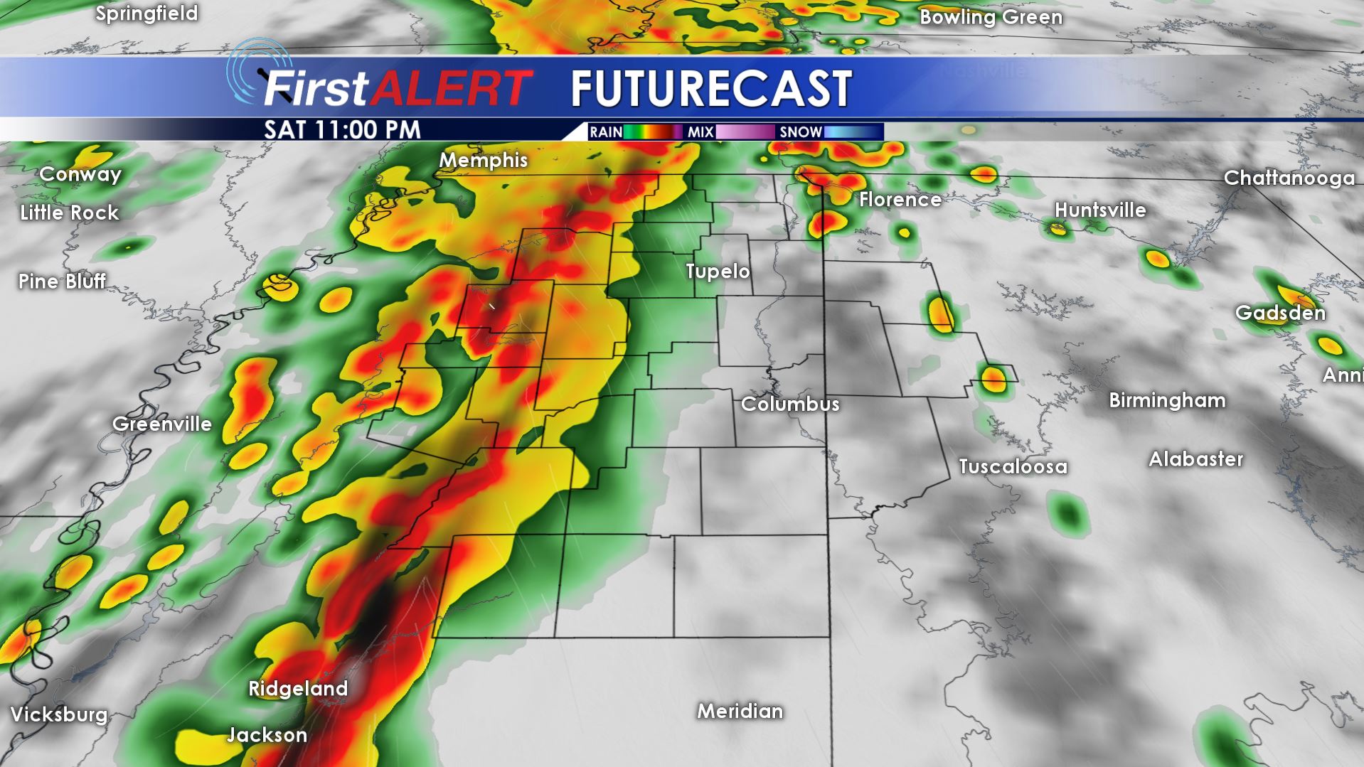
Saturday Evening Futurecast
SUNDAY: A mostly cloudy day is on tap but there is a 30% chance of showers, perhaps even an isolated storm as well. Cooler highs around 70 are likely during the first half of the day. Some computer model data suggest temperatures falling into the 60s and 50s during the afternoon and evening as cooler air wraps in from the northwest. Low 40s are on track for Sunday night.
NEXT WEEK: Mostly sunny to partly cloudy conditions settle back in for Monday and Tuesday. It’ll be pretty nice with highs in the 70s Monday and near 80 Tuesday. Lows are going to dip back into the 40s. Another round of strong to severe storms is possible sometime Wednesday into Thursday.
Follow @WCBIWEATHER on Facebook, Twitter, and Instagram


Leave a Reply