More Rain Wednesday And Perhaps A Little Wintry Mix Too
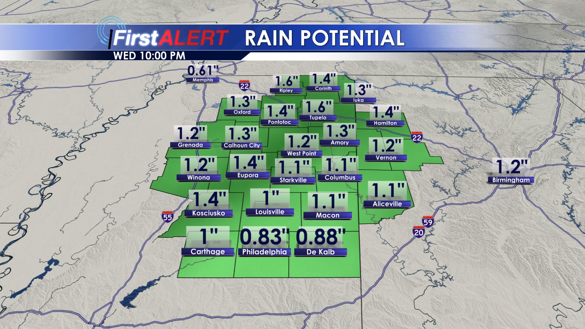
Rain Potential
MONDAY NIGHT: We’ll have a quiet night with increasing high clouds. Lows will be in the upper 20s to lower 30. Southeasterly winds pick up between 5 and 15 mph.
TUESDAY: Clouds will continue to increase across the area and they may yield some showers by late in the afternoon. Look for highs in the lower 50s. Noticeably stronger winds between 10 and 25 mph can be expected throughout the day.
TUESDAY NIGHT: Areas of showers are likely along with milder lows in the upper 40s to around 50.
WEDNESDAY: There is a 90% chance of rain during the day. Model data suggest the possibility of up to 2” of rain once again (something we certainly don’t need). Highs will be in the 50s early before falling during the 2nd part of the day. Lingering rain may become a light wintry mix during the late afternoon and early evening. Some impacts are possible but it all depends on how much moisture is left before the cold air arrives.
WEDNESDAY NIGHT: Clearing skies should allow for colder lows in the mid to upper 20s. Some slick spots may occur since temperatures will get below freezing.
THURSDAY: A pretty nice and sunny day is expected. Seasonably cool highs in the upper 40s remain on track.
FRIDAY: Lots of sun is in the offing but colder air will be present. Highs may struggle to around 40.
WEEKEND: Confidence is rather low but there may be another system that could provide some rain and snow to parts of the region. For now, however, we’re going to keep moisture chances low at 30% and highs in the 40s. Stay tuned for updates as we get closer.
Follow @WCBIWEATHER on Facebook, Twitter, & Instagram


Leave a Reply