Record cold tonight, warmer Wednesday
SUMMARY: Clear skies, dry air, and lighter wind will combine to produce a record cold night tonight with lows in the mid to upper teens. Temperatures will moderate starting Wednesday and we won’t be dealing with these extremely cold conditions for a while. There will be a storm system that will track along the Gulf Coast Thursday and Thursday night. For us that means an increase in cloud cover but the better rain chances will remain along and south of I-20. Another great weekend remains on track.

Tuesday Night
TUESDAY NIGHT: Clear and cold. Wind chills in the teens with actual lows in the mid to upper teens. Bring in your pets and plants. Be sure to protect your pipes or keep a little water flowing in the pipes during the night.
WEDNESDAY: Sunny skies. Highs in the mid to upper 40s. Light and variable wind turns southeasterly during the day.
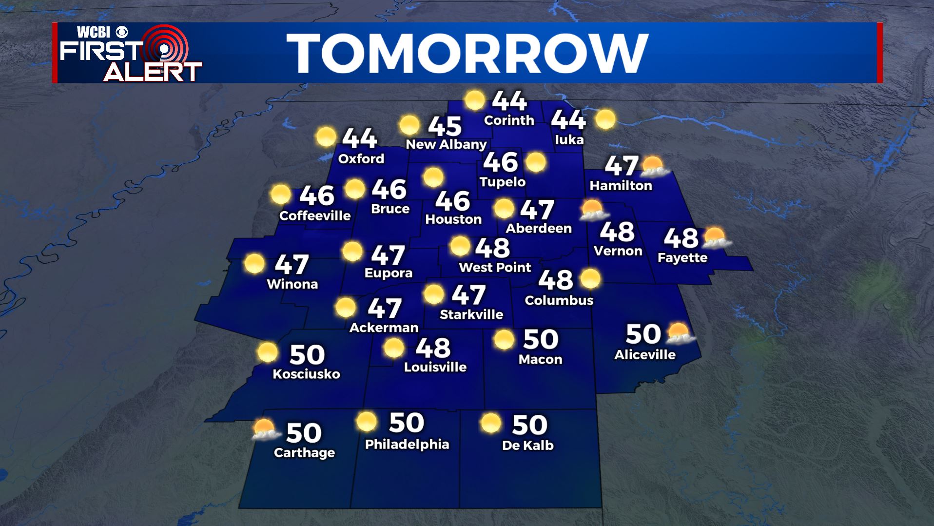
Highs Wednesday
WEDNESDAY NIGHT: Increasing cloud cover and not as cold. Lows near 30.
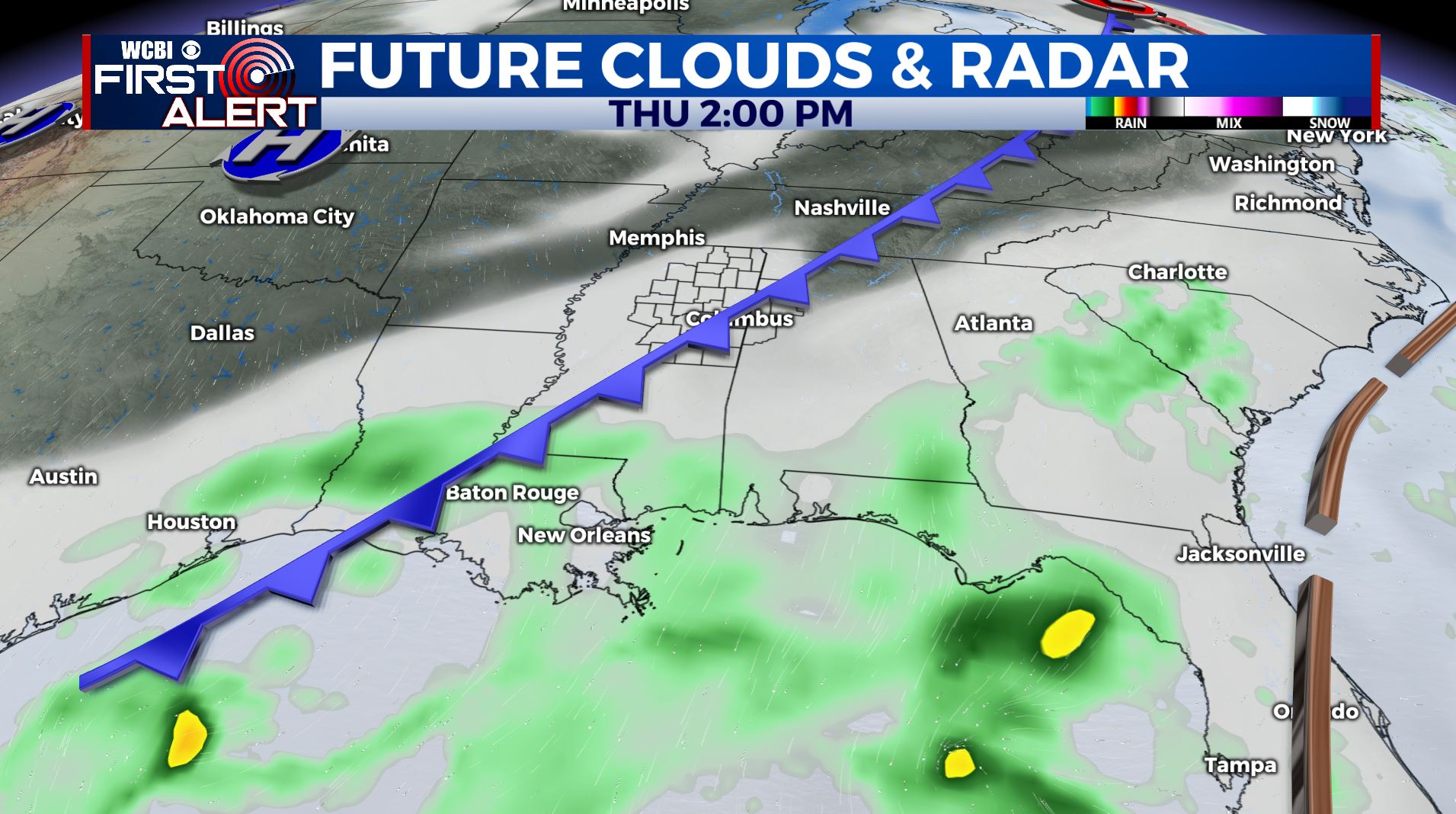
THURSDAY: Mostly cloudy and cool with highs in the mid to upper 40s. While a stray shower or two can’t be ruled out here better moisture chances will be found along and south of I-20.
THURSDAY NIGHT: Mostly cloudy and quiet. Lows near 30.
FRIDAY: Becoming mostly sunny. Highs in the low 50s. Conditions look pretty good for high school football, just chilly again in the evening after sunset. Lows Friday night look to be in the upper 20s.
WEEKEND: Mostly sunny to partly cloudy both Saturday and Sunday. Highs in the mid to upper 50s with lows near 30.
Follow @WCBIWEATHER on Facebook, Twitter, Instagram, and the WCBI News app


Leave a Reply