Relatively dry start to the week, much wetter to end it
SUMMARY: Hot and humid to start the week, with temps in the low 90s. As we get towards the middle of the week, an increase in moisture will cause rain chances to go up and temperatures to cool a bit. Ending the week we will see almost universal rain chances on Friday, and potentially Saturday as well. For 4th of July, models are uncertain if a front will actually make it through the area. If it does, we could see a very nice and dry 4th. If not, we could see scattered showers and storms in the afternoon.
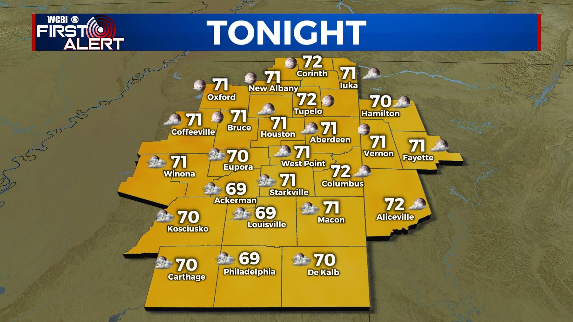
TONIGHT: Another mild and muggy night for us, with a low in the low 70s and partly cloudy skies. Any lingering showers and storms will dissipate after sunset.
MONDAY: The theme to start the work week: hot! Highs reach the low 90s again, with another chance of stray/isolated afternoon showers and storms. Feels like temps around or over 100 degrees. Most of us will stay dry though under partly cloudy skies.
MONDAY NIGHT: Once again, any showers or storms quickly dissipate as we lose the heat of the day. Lows around the 70 degree mark under partly cloudy skies.
TUESDAY: Better rain chances are back for Tuesday, and we should see scattered coverage of afternoon t-storms. Highs will once again be around the 90 degree mark.
TUESDAY NIGHT: Copy and paste for Tuesday night. Lows around 70 with partly cloudy skies. Showers dissipate once the sun is gone.
WEDNESDAY TO 4TH OF JULY: Rain chances continue to increase for Wednesday, with scattered to numerous afternoon showers and storms and a high near 90. Even more widespread coverage for Thursday, but the cloud cover and rain will bring us cooler temps in the mid to upper 80s. Temps markedly cooler for Friday, as we are looking at a washout with rain and storms throughout the day. Highs around 80 degrees. Saturday, a front will try to push into the area. Models disagree on timing, and it is very hard to get a cold front to clear the area in July. If it does, Saturday will start out wet and end dry, if not it could stay pretty wet. The same story goes for the 4th. If the front makes it though, we could see drier air and comfortable temps, which would be great for the holiday. If the front lingers/stalls, we could see scattered showers and storms. Highs in the mid 80s, and lows in the mid 60s.
CONNECT WITH @WCBIWEATHER ON TWITTER, FACEBOOK, AND INSTAGRAM


Leave a Reply