Remnants of Delta pass through Saturday
SUMMARY: The remnants of Hurricane Delta will cross north Mississippi and west Alabama between late Friday night and Sunday. The highest severe impacts should occur between sunrise and sunset Saturday. Rainfall between 1-4″, wind gusts 30-40+ mph, and isolated tornadoes remain possible. Some rain and clouds will linger Sunday but the upcoming work week is looking pretty nice.
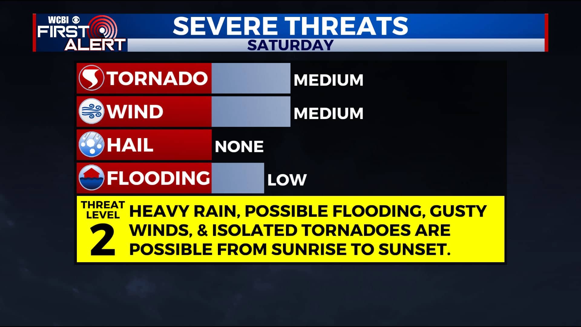
Severe weather threats
FRIDAY NIGHT: Cloudy with areas of rain developing. Lows in the low 70s. Winds ENE 10-20 mph.
SATURDAY: Mostly cloudy with areas of locally heavy rain. One or two arcing rain bands east of Delta’s center of circulation will lead to most of the active weather in our region. Between 1-4″ may fall and that could lead to some flooding issues. Sustained winds between 15-25 mph with gusts 30-40+ or higher may occur leading to some scattered power outages and downed trees. A few isolated tornadoes also can’t be ruled out at any time from about sunrise to about sunset. The highest odds of them may occur during the afternoon hours during peak heating. Temperatures hold steady in the 70s all day long.
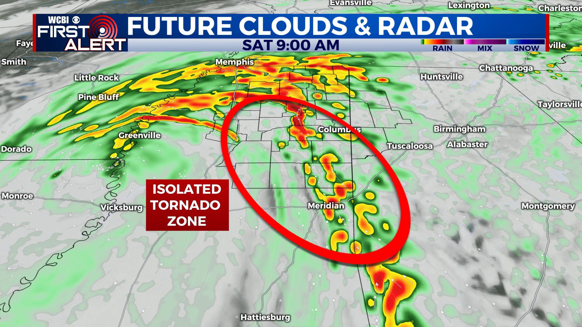
Morning rain band
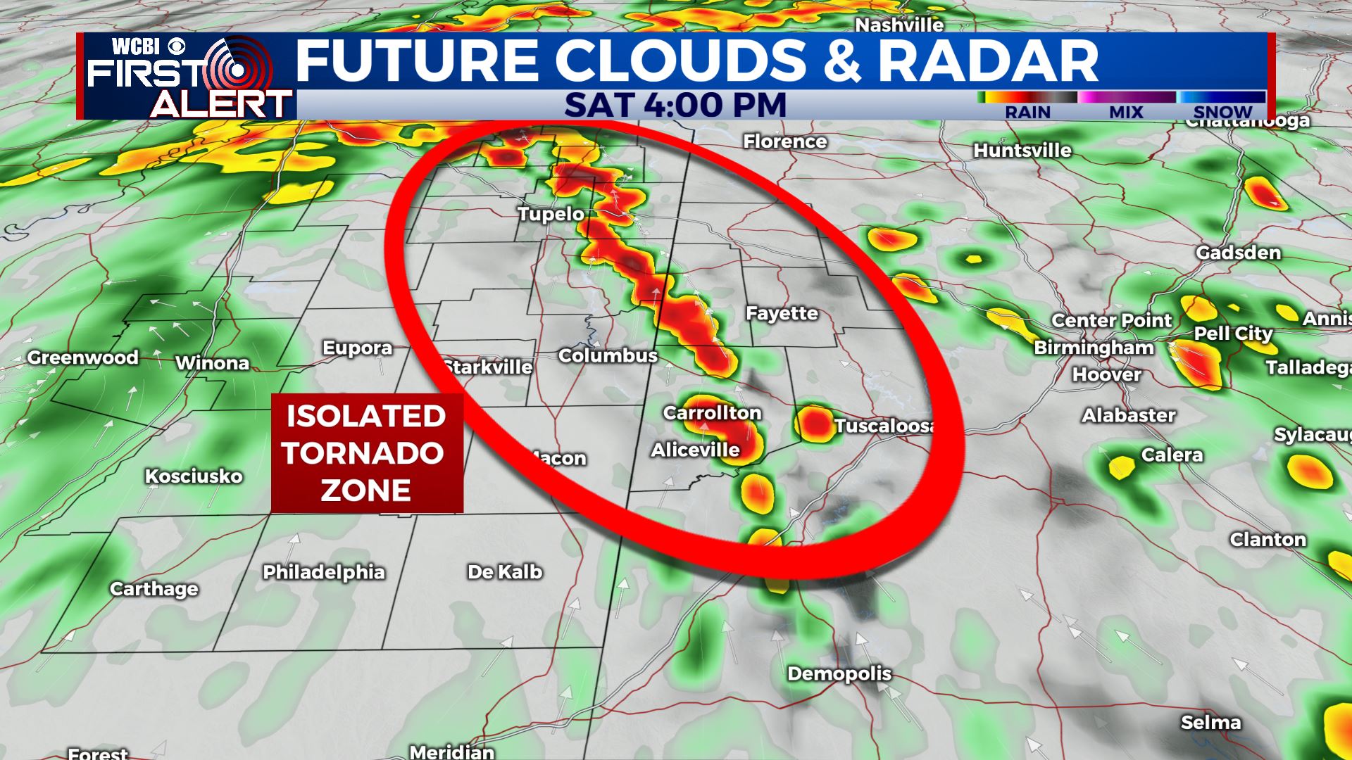
Afternoon rain band
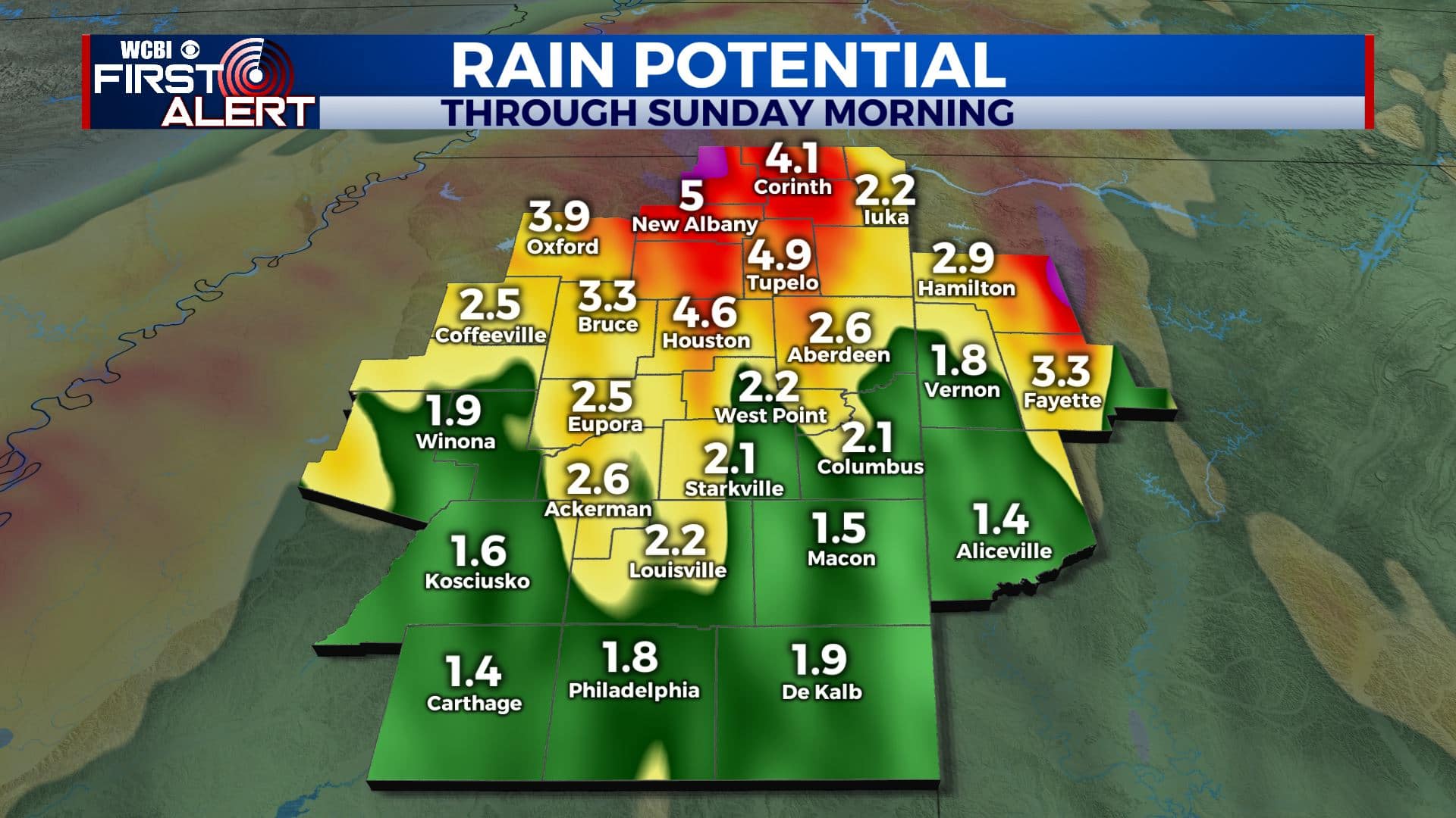
1-4″ of rain could lead to flooding
SATURDAY NIGHT: Cloudy with areas of rain. Lows in the upper 60s.
SUNDAY: Mostly cloudy with lingering showers. Highs in the mid to upper 70s.
SUNDAY NIGHT: Partly to mostly cloudy. Lows in the 60s.
MONDAY: Turing partly cloudy. Warmer highs in the mid to upper 80s.
TUESDAY-FRIDAY: Mostly sunny and quiet. Highs in the upper 70s and 80s are favored through Thursday with sharply cooler upper 60s and lower 70s by Friday.
Follow @WCBIWEATHER on Facebook, Twitter, Instagram, and the WCBI News App


Leave a Reply