Roller coaster of cold continues with another system on Tuesday
COLUMBUS – SUMMARY: Our pattern of relatively cold temperatures remains in place for at least the next 7 days as a mid-week system keeps the chilly air in the region. Tuesday and Friday will be the days to watch rain-wise, as the rest of the week is mostly dry. More sunshine this week than last week means that at the very least the days will look better outside.
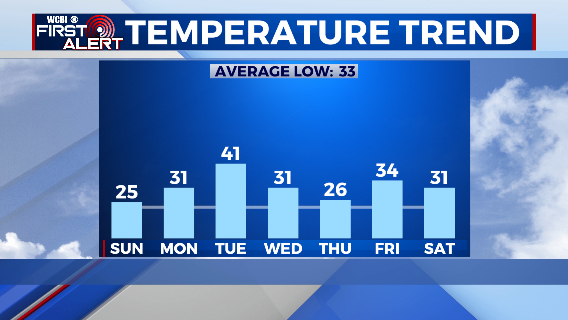
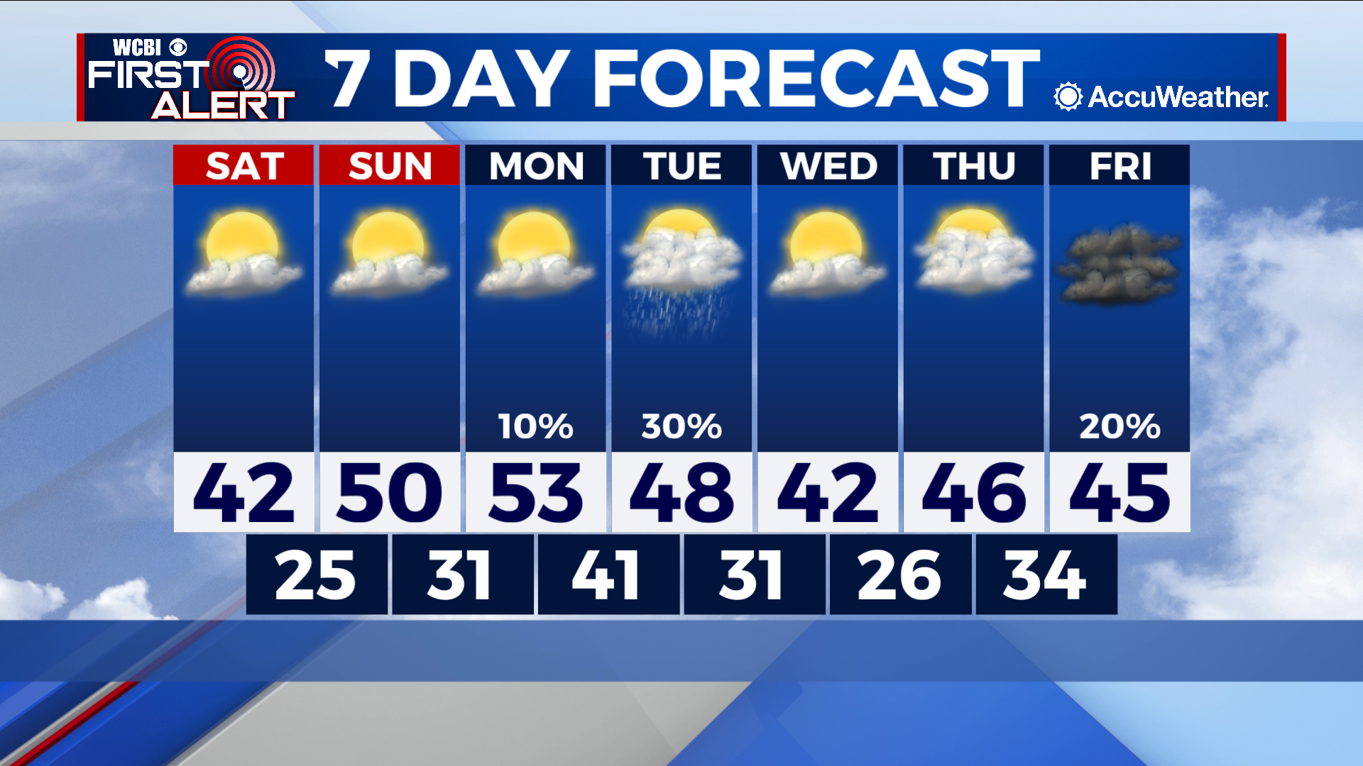
SATURDAY: Highs top out in the low 40s Saturday afternoon as we gradually move out of what has been a frigid few days. Partly cloudy and dry skies accompany what would be an otherwise nice day outside. Lows do drop back into the mid 20s overnight however, so we are not quite out of the woods yet.
SUNDAY: Some improvement can be expected Sunday as the sunshine we are getting heats up the air. Highs this time around touch a much milder 50 in the afternoon hour, although lows remain below freezing in the low 30s overnight. The pattern of partly cloudy skies remains on station, which will further improve highs into our Monday.
NEXT WEEK: We only reach the low 50s by Monday before yet another system moves through the south on Tuesday. The timing and path of the system is not clear yet and models so far have shown the system trending south through southern Mississippi and Alabama. Rain-wise this would mean less of a rain impact for us in the north but we will continue to keep you updated on the forecast as it evolves. Regardless of how much rain falls, a system in the far north will bring a cold front through the area the same day and we can expect lows to drop back into the mid to upper 20s by Thursday morning. Highs will hover around the mid 40s throughout the rest of week beyond Tuesday, and the prospect for significant warming appears limited. Potential for some more rain exists on Friday as well although it appears to be an overnight affair at the moment.


Leave a Reply