Sally’s effects on us looking to be minimal
SUMMARY: It’s a quiet start to our Tuesday, but we’ll have a few passing clouds & showers thanks to the far outer rain bands from Hurricane Sally. Sally will be making landfall along the Gulf Coast on Wednesday, but we’ll be dogging the worst of it as its track will stay out to our east.
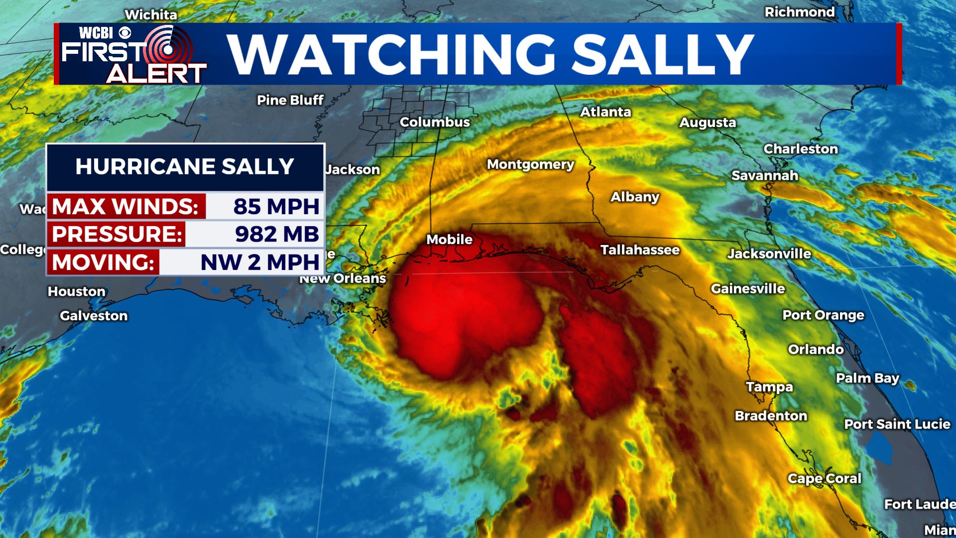
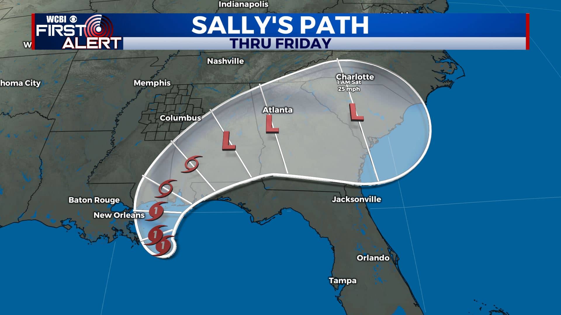
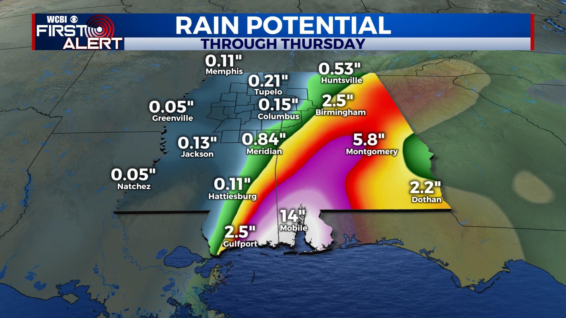
HURRICANE SALLY: As of 8am Tuesday, Sally has weaken to a Category 1 storm with 85 mph winds, landfall not until Wednesday afternoon. But it has slowed down some more. Landfall may not happen now until late Wednesday morning or early Wednesday afternoon. The storm will come ashore somewhere along the MS or AL coast. The remnant low is expected to slowly move northeast, staying southeast of the I-20/59 corridor. The heaviest rain, flooding, and tornado threat should stay well southeast of the WCBI coverage area. There is still the potential for maybe 1 to most 2 inches of rain across our far southeastern areas including parts of Noxubee, Lowndes, and Pickens Counties Wednesday into Thursday (but that could even be generous if a more eastward track continues). In general, no significant weather issues are expected at this time in our area due to Sally.
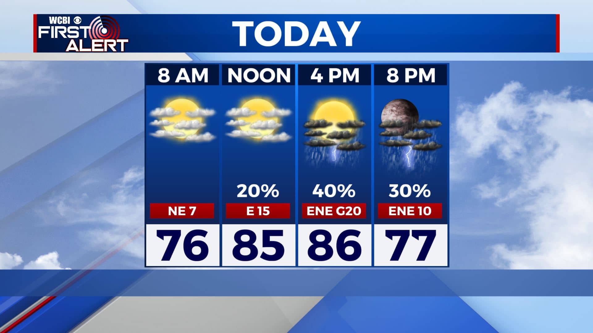
TUESDAY: It’s a quiet start to our Tuesday across north MS & west AL with mostly clear skies. We’ll have a few passing showers and storms during the afternoon and evening thanks to the far outer rain bands from Sally. Breezy ENE winds 10-20 mph. Highs in the mid 80s.
TUESDAY NIGHT: Mostly cloudy skies with some rain possible. Overnight lows near 70. Breezy E winds continue.
WEDNESDAY-THURSDAY: Mostly cloudy with areas of rain, especially across the southeastern part of the area. The amounts will all depend on where the remnants of Sally go. Breezy E winds 10-25 mph. Highs ranging from the upper 70s to lower 80s. Overnight lows in the 60s.
FRIDAY: The sunshine starts to make a comeback with a few clouds. Highs could range in the upper 70s to near 80. Friday night high school football weather is looking great!
WEEKEND: Mainly sunny and much more fall-like. Models still going back and forth on high temperatures ranging from the upper 70s to lower 80s, but we’ll have lower humidity values that will make it feel very nice outside. Overnight lows could tumble well into the 60s if not the upper 50s.
Stay connected with @WCBIWEATHER on Facebook, Twitter, Instagram, and the WCBI News App


Leave a Reply