Scattered rain chances continue for Wednesday; Summer heat making a comeback
SUMMARY: Rain chances will gradually lower heading into the weekend allowing for much warmer air to return. Heat indices in the 100-105°+ range are looking likely by early next week.
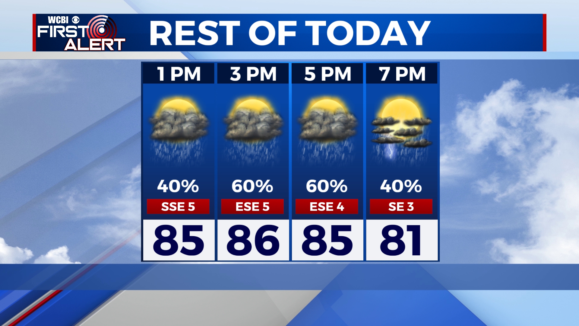
WEDNESDAY: After a mostly cloudy start to our day, another round of scattered showers and thunderstorms is in the forecast once again for our Wednesday. Any storm may produce heavy rain. Highs in the mid 80s. Winds SE 5-10 mph.
WEDNESDAY NIGHT: Early lingering showers making way for partly cloudy skies overnight. Muggy lows in the low 70s.
THURSDAY & FRIDAY: We’ll dry out a bit with more sunshine with a few clouds. Warm and muggy. Highs in the upper 80s to around 90°. A continuing chance of pop-up showers and storms. Lows in the low 70s.
WEEKEND: Afternoon rain & storm chances will be possible. Highs in the low 90s with heat indices creeping back into the 100s. Lows in the 70s.
MONDAY: A few isolated showers or storms remain possible. Temperatures back up to near average with highs in the lower to mid 90s.
NEXT WEEK: While stray storms are possible, the big story will be extreme heat and humidity. Highs in the mid 90s are a good bet with heat indices in the 100-105°+ range.
Stay connected with @WCBIWEATHER on Facebook, Twitter, Instagram and the WCBI News App


Leave a Reply