Scattered Strong Storms Still Possible Tonight
SATURDAY NIGHT: A batch of strong to severe storms remains possible with a cold front, with better chances for such being along I-55. Still, a few strong storms could remain through the rest of the area as it remains a ‘wait and see’ scenario for how storms form to our north. The main concerns with stronger storms will damaging wind gusts, hail, and torrential rainfall. Most if not all of the activity should be done by sunrise Sunday or shortly thereafter. Lows in the upper 60s and 70s are likely.
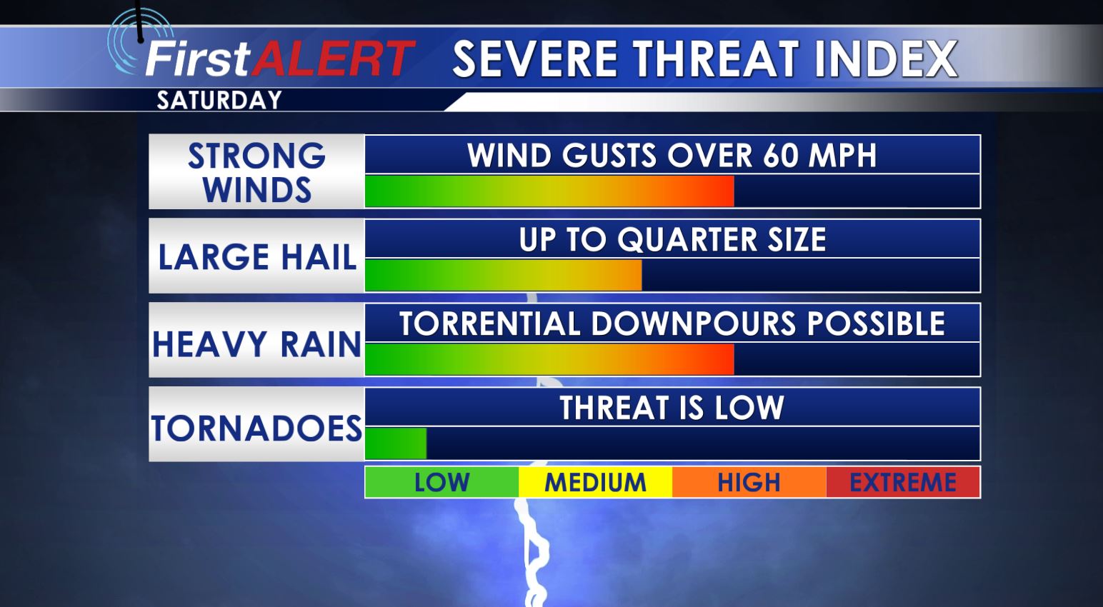
Any storms tonight will have the chance for gusty winds, large hail and even flash flooding.
SUNDAY: Seasonably warm highs in the mid 80s will continue but it won’t feel as bad as the last few days. A refreshing north breeze should make things feel pretty good too as it ushers in lower humidity levels. Mostly sunny to partly cloudy skies look to be the general rule of thumb.
MONDAY – TUESDAY: Look for drier air in place with warm days and cool nights. It will be a bout of relief from the summer mugginess we have. Highs in the day look to be in the mid to upper 80s with lows at night near 60.
WEDNESDAY – WEEKEND: Gulf moisture starts to make a return with the chance for an isolated shower Wednesday/Thursday. Better chances for storms will occur Friday into the weekend as temperatures climb back into the low to mid 90s.
Follow @WCBIWEATHER on Facebook, Twitter, Snapchat, and Instagram


Leave a Reply