Sct’d storms Friday, still watching Cristobal
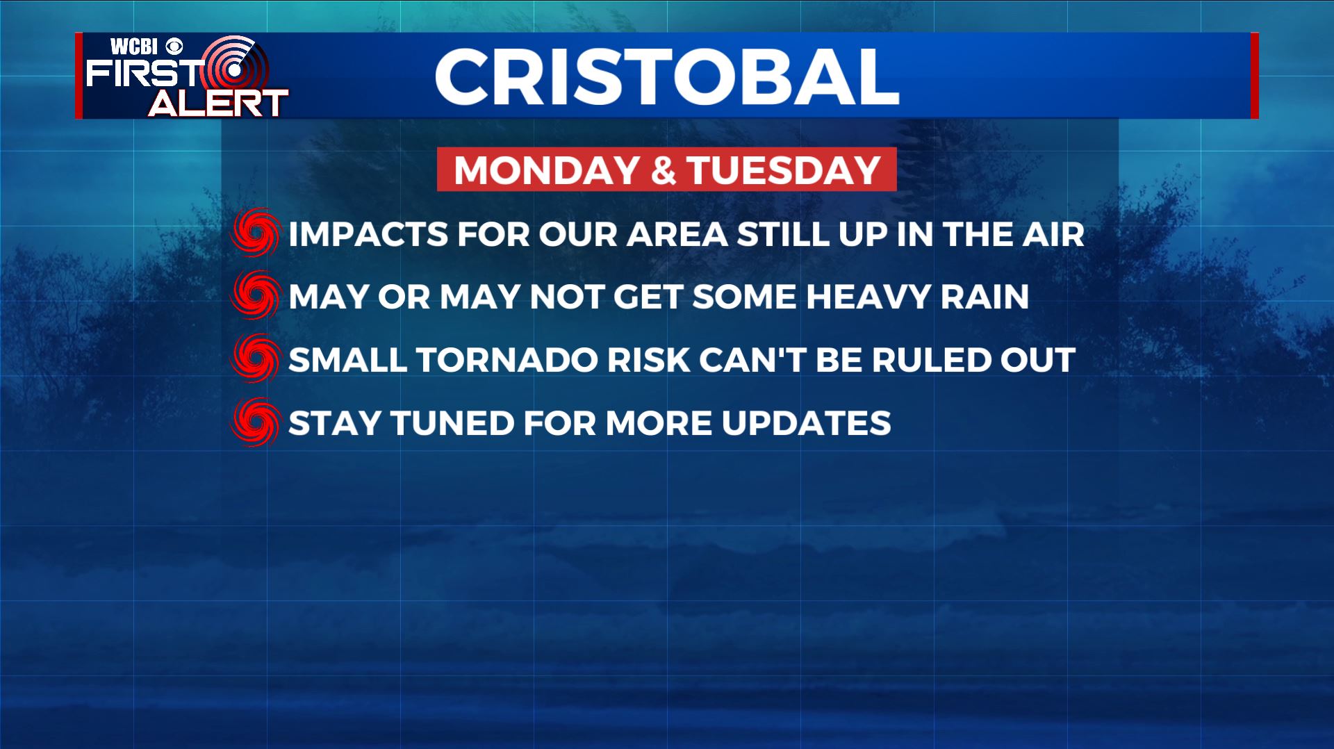
SUMMARY: Scattered storms will remain a possibility on Friday as we close out the work week. Rain chances lower dramatically for the weekend but our area is going to stay plenty warm and humid. The remnants of Cristobal could still affect our area Monday & Tuesday with heavy rain and perhaps an isolated tornado threat but details remain sparse at this time.
THURSDAY NIGHT: Variably cloudy, mild, and muggy. Lows in the upper 60s to around 70 with light wind. A few lingering showers or storms are possible.
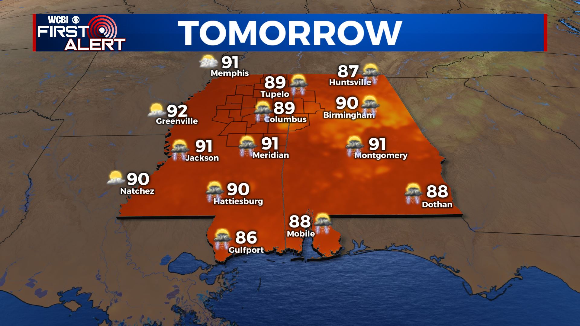
FRIDAY: A 50% chance of rain and storms with highs in the upper 80s to around 90. Any storm may produce frequent lightning and torrential downpours. Winds SSW 5-10 mph.
FRIDAY NIGHT: Partly cloudy and muggy. Lows around 70.
WEEKEND: A mix of sun and clouds. While a few spotty storms or showers can’t be ruled out most locations will stay dry. Look for warm highs in the low 90s with mild overnight lows in the low 70s.
MONDAY-TUESDAY: The remnant low of Cristobal will likely track to the west of the Mississippi River. That would put us on the eastern, wetter, and generally more active side. Many questions still remain as to the extent of what we may experience but heavy rain and even a small tornado risk can’t be totally ruled out at this time. Stay tuned for updates during the course of the weekend.
Follow @WCBIWEATHER on Facebook, Twitter, Instagram, and the WCBI News App


Leave a Reply