SEVERE POTENTIAL THIS WEEKEND, ARCTIC AIR FOR NEXT WEEK
FRIDAY NIGHT: Isolated showers will be possible once again Friday night. I don’t expect any severe weather; however, a few storms could have some gustier winds or small hail associated with them. We will bottom out in the upper 40s overnight, with some partial clearing late.
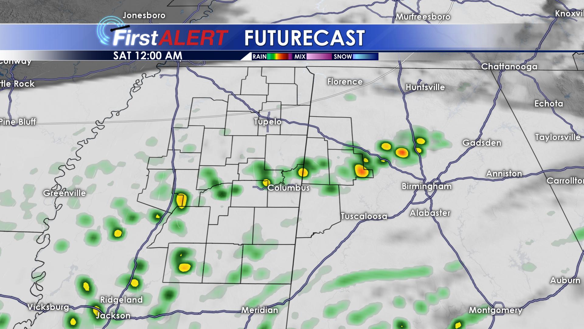
FRIDAY NIGHT SHOWERS
SATURDAY: Saturday will be our last warm day for a little while. Get out and enjoy it if you can! Highs will top out in the lower to middle 60s, with skies remaining mostly cloudy. Saturday night will be mild with lows only getting down into the lower 50s. Our next major weather system begins to move into the twin states overnight Saturday, bringing us another chance of severe storms and heavier rainfall. Our severe threat does not appear to be as high as it was this past weekend.
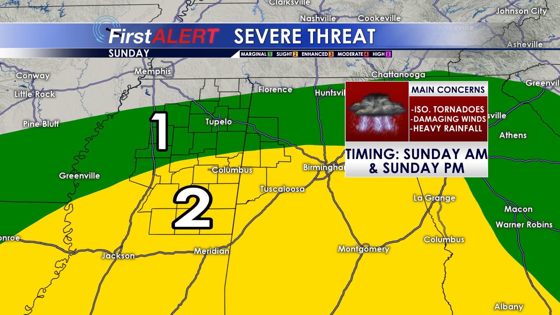
SEVERE THREAT ON SUNDAY
SUNDAY: Severe storms will be likely during the morning hours of Sunday, lasting into the afternoon hours. Right now, damaging winds appear to be the main threat, but we cannot rule out the possibility of a tornado or damaging hail. Highs on Sunday will occur in the early morning hours! We will start the day off in the middle 60s, and fall into the 30’s overnight! Winds will shift from the southeast to the northwest, ushering in some much colder air. Before all is said and done with, we could pick up a good 1 to 2 inches of rain across the area, with some of us seeing locally higher amounts. Flash flooding is possible.
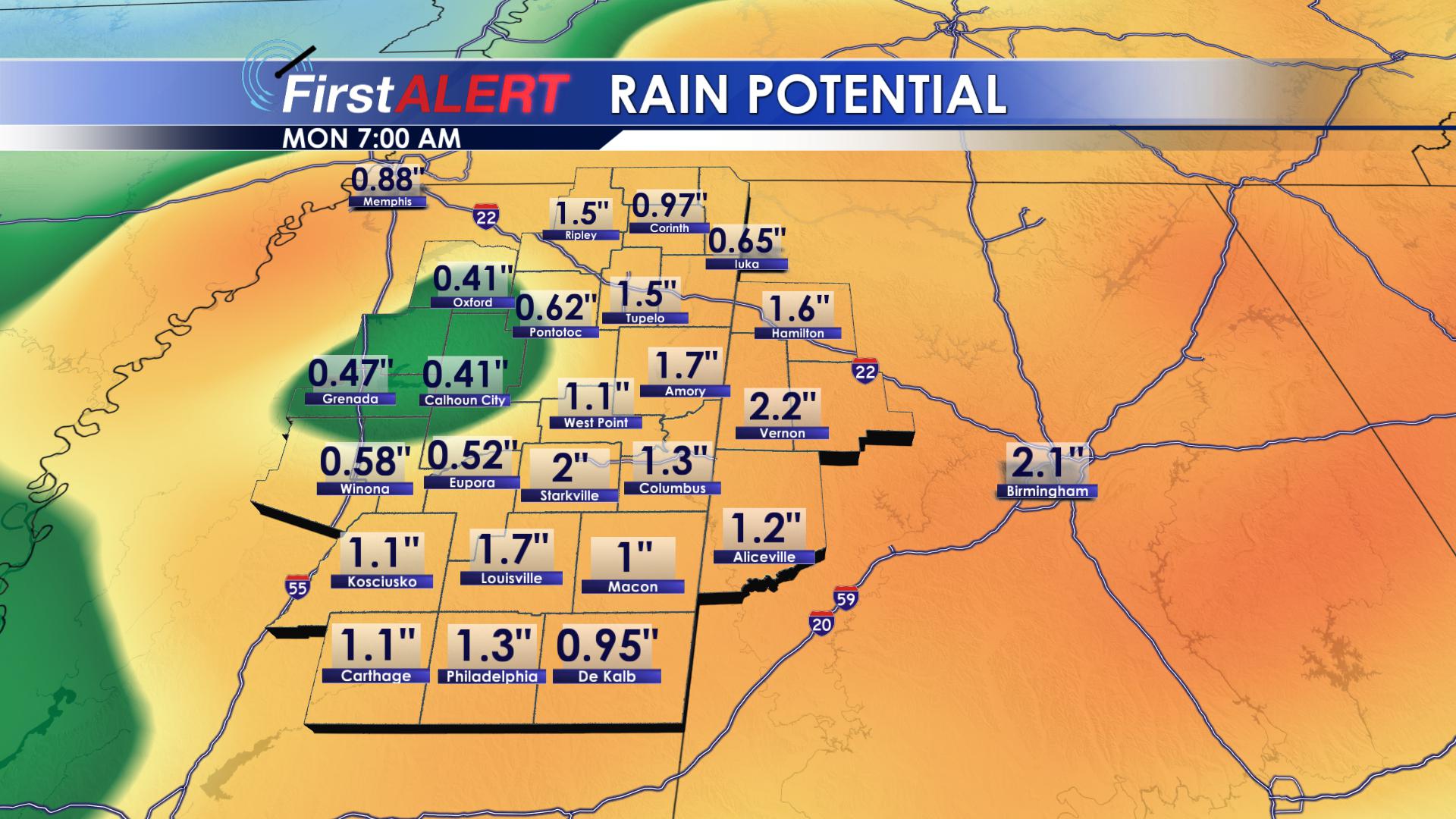
HEAVY RAINFALL LIKELY
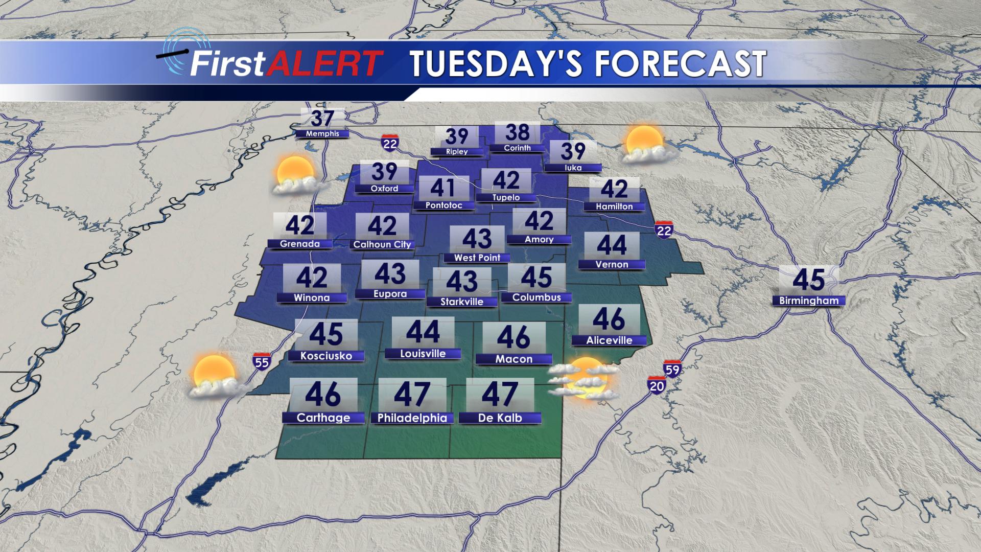
MONDAY, TUESDAY and WEDNESDAY: I have got some good news for all of you Winter lovers! During the first half of next week, our highs will struggle to make it into the middle and lower 40s! Hopefully you haven’t started you garden yet, because morning lows on Monday, Tuesday and Wednesday will be WELL below freezing. Most of us will drop all of the way down into the middle 20s, with wind chill values in the lower 10’s! On the bright side though (pun intended), we will see sunshine return as early as Monday morning, lasting through Wednesday evening! We won’t have any rain to worry about!
ARCTIC AIR RETURNS
THURSDAY: Highs on Thursday will warm significantly, peaking out in the upper 50s. Clouds will increase on Thursday, with an isolated shower or two during the afternoon. Thursday night will be much warmer, only dropping down into the middle 40s.
FRIDAY: Another cold front will begin to push into the southeast as we head into next weekend! Highs on Friday will warm into the middle 60s ahead of the front, with scattered rain showers possible throughout the day.
BE SURE TO FOLLOW US ON: Facebook, Twitter, Instagram and Snapchat @WCBIWEATHER


Leave a Reply