Severe Storms Expected on Monday
SUNDAY NIGHT: Showers and thunderstorm are expected with a warm front surging north. Some heavy rain is possible in spots. Temperatures will climb all night long, as we start out in the low to mid 50s Sunday Evening and end up in the 60s by Monday morning.
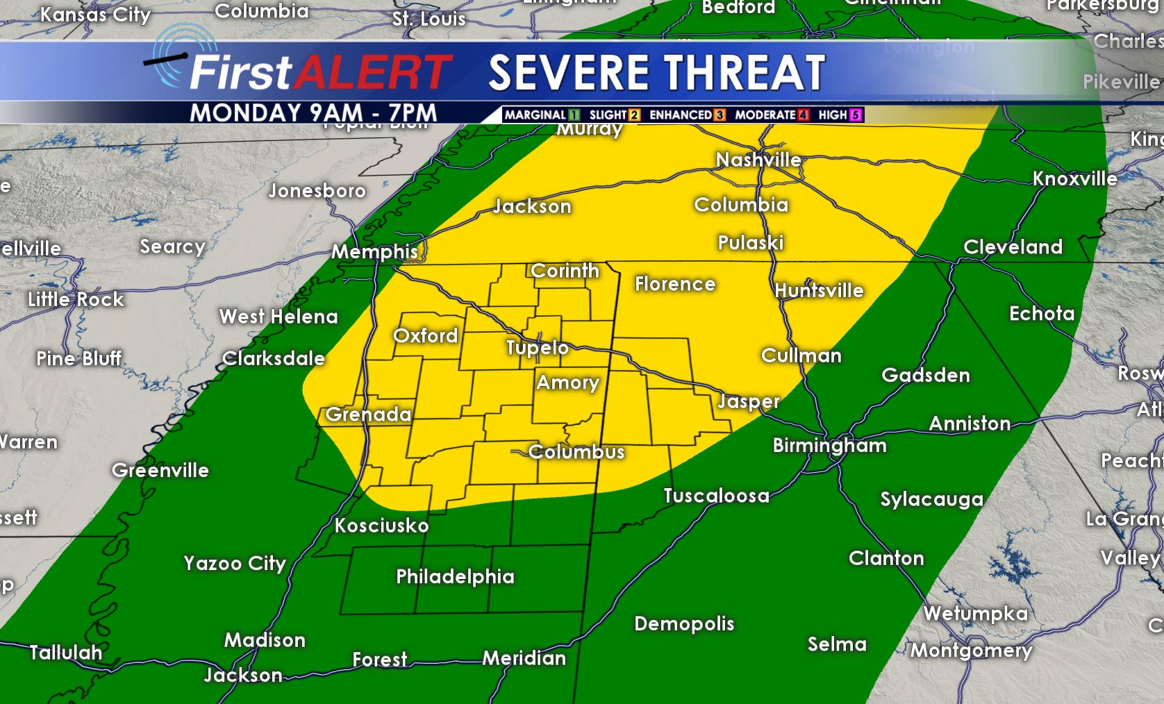
A SLIGHT RISK (2/5) has been issued for parts of our area. Damaging winds will be the main threat but a few spin-up tornadoes can’t be ruled out.
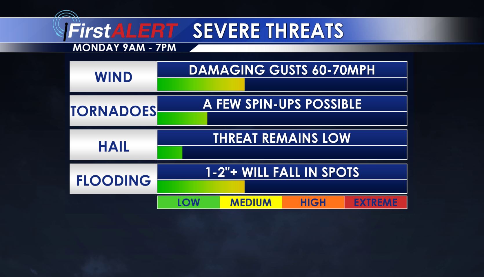
MONDAY: We’re expecting showers and thunderstorms across the area with more clouds than not. Breezy south winds will also exist with gusts as high as 35 mph at times. Highs will climb into the upper 60s and low 70s. Given we’ll be in the warm sector of this system, some severe storms will occur. The main threats will be gusty winds and flash flooding. A few spin-up tornadoes are possible through the day. The main timing looks to be between 9AM and 7PM, with things clearing out Monday Night with the passage of a cold front. Late New Years Eve events should be good to go in our area.
NEW YEAR’S DAY: A cooler, drier air mass settles in briefly. It should be a decent day with highs in the 50s and variably cloudy skies.
WEDNESDAY-THURSDAY: The potential exists for a cold rain and perhaps even some wet snow/flurries mixing at some point. There are still lots of variables that can change but it’s certainly all on the table still. Highs in the 30s and/or 40s appear likely.
NEXT WEEKEND: Things will dry out and turn more seasonal with highs in the 50s and perhaps 60s, with nighttime lows in the 30s and 40s.
Follow @WCBIWEATHER on Facebook, Twitter, Instagram, and Snapchat


Leave a Reply