Severe Storms Expected Saturday Morning
GET THE LATEST WEBCAST DISCUSSION UPDATE HERE.
LEARN WHERE LOCAL SHELTERS ARE AND HOW TO STAY SAFE HERE.
SEVERE WEATHER IS LIKELY SATURDAY MORNING IN THE AREA. DAMAGING WINDS AND TORNADOES ARE THE MAIN THREAT. WHILE TORNADOES ARE POSSIBLE, DON’T LET THAT DISTRACT YOU FROM THE POTENTIAL FOR WIDESPREAD DAMAGING WINDS 60 – 80 MPH IN THE REGION, CAUSING THE POTENTIAL FOR SERIOUS TREE AND POWER LINE DAMAGE.
TONIGHT: Some scattered showers and storms are expected overnight tonight, but those will not be severe. Winds will be breezy from the south and east 15-25 mph with gusts as high as 40 mph. Look for a cloudy sky with temperatures remaining in the 60s.
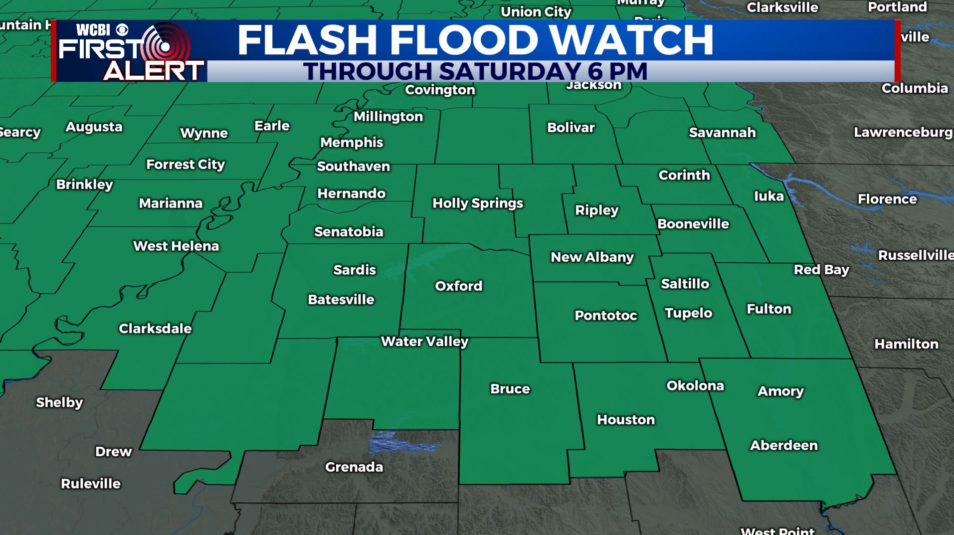
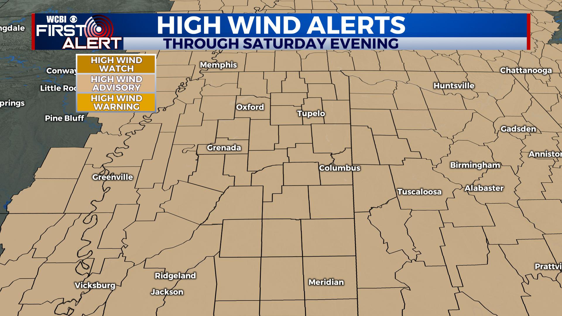
Flash Flood Watches and High Wind Advisories are in effect through Saturday Evening. Get the latest updates on warnings, watches and advisories through the WCBI Mobile App and on WCBI.com/weather.
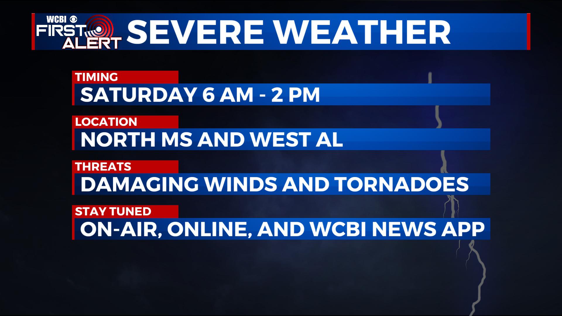
SATURDAY MORNING: An overnight line of severe storms will push from west to east across the south. Locally, those will approach I-55 as early as 6 AM and push to the east, exiting before 2 PM. These storms will be severe with damaging winds and tornadoes the main threats.
Regardless of colors, words, terminologies and more, don’t focus on where you are on a map or even at what ‘threat level’ we are advertising. The potential is there for anyone who watches WCBI on TV for widespread 60-80 mph damaging straight line winds. While the focus is often placed on tornadoes, we believe this will be the most widespread impact, causing damage to trees and power lines. Power outages are likely across the region. We encourage no travel Saturday morning as these storms pass through.
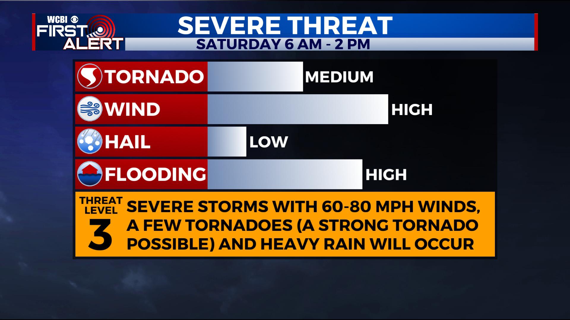
This threat-meter covers everyone in the WCBI Viewing Area. We should not discount the damaging wind threat, as that will cause the most widespread damage in the region.
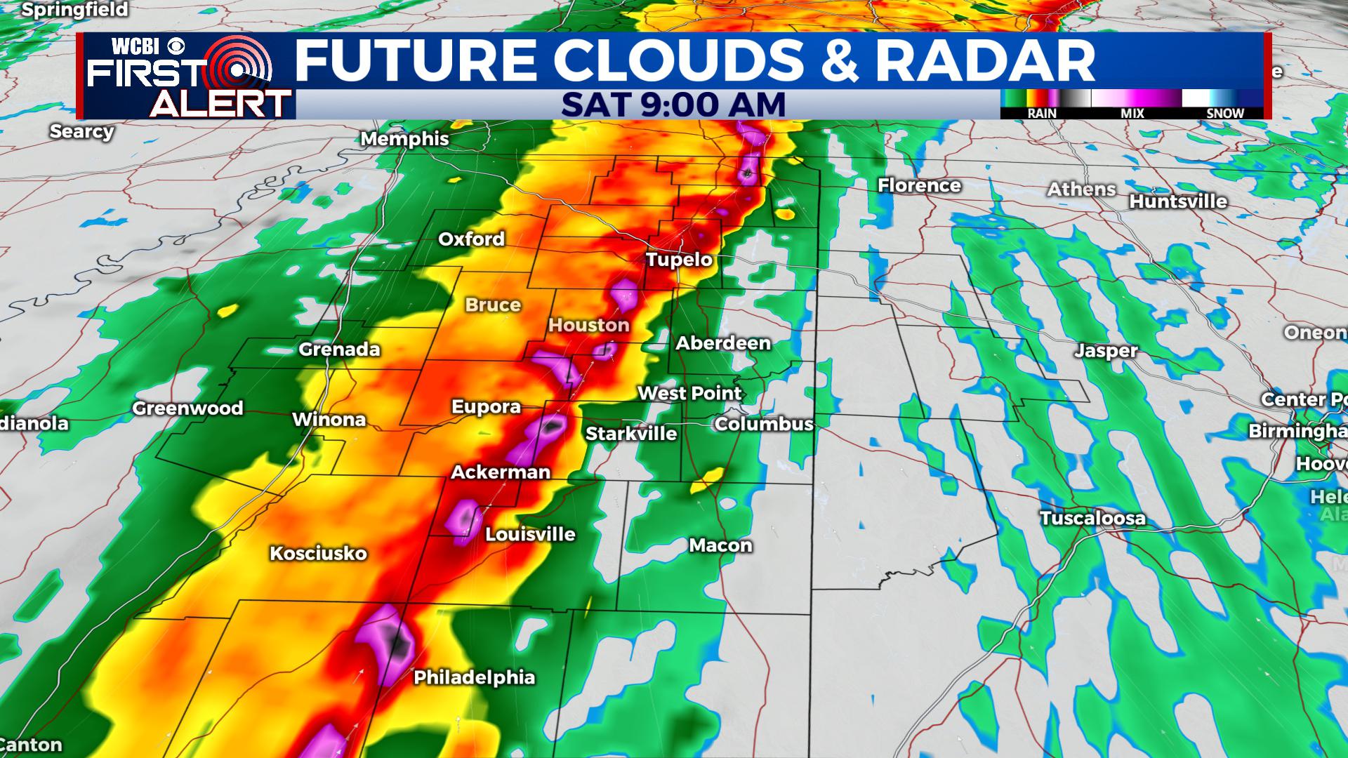
Futurecast says a line of storms pushes through in the early morning hours.
We also believe there will be some embedded circulations within the line. This scenario lets us believe that a few tornadoes are expected in the region, and a strong tornado can’t be ruled out. The chance for a strong tornado will be highest on any supercell that develops and remains isolated ahead of the line of storms. However, with this event, severe thunderstorm warnings should be treated similarly to tornado warnings in vehicles, mobile homes and for those with outdoor activities. With a saturated ground, damaging winds have the chance to knock down trees and power-lines area-wide.
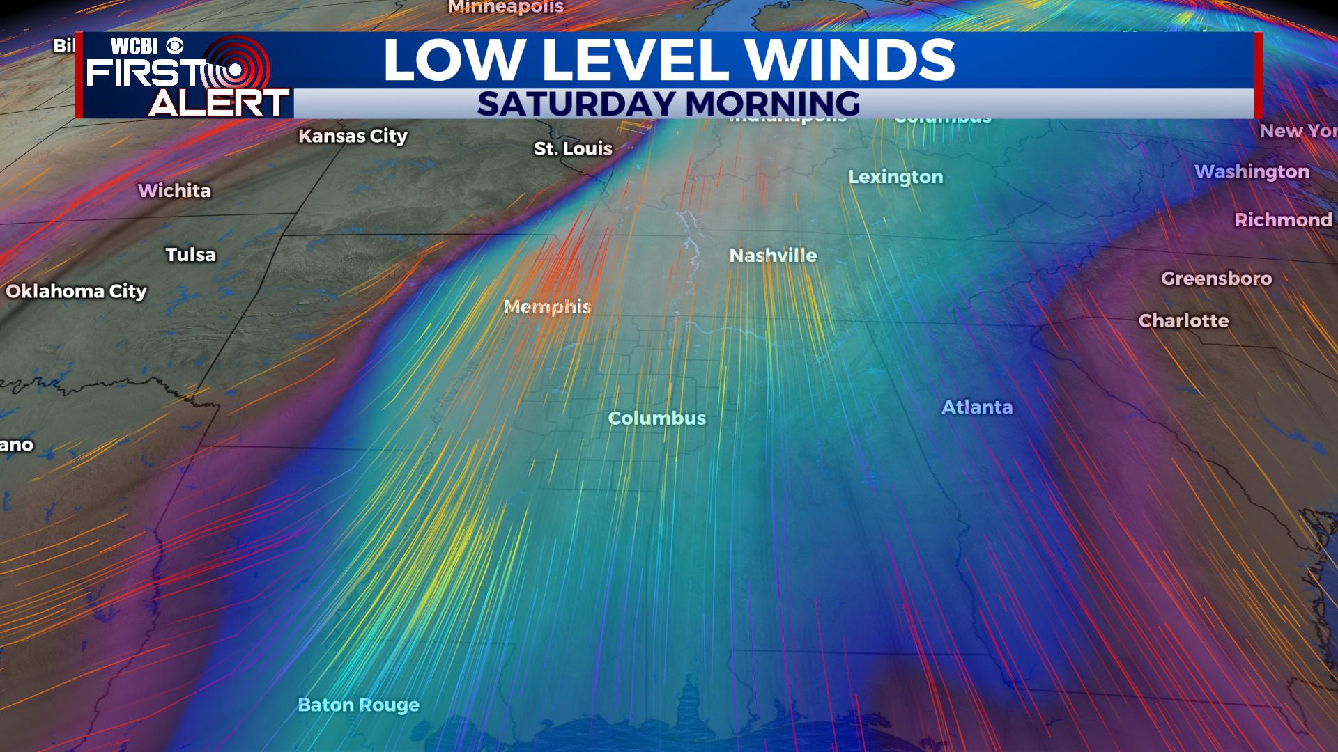
Low level winds are very high in this system. Less than 1 mile above the surface, winds will be between 80-100 mph, meaning winds will mix down to the surface at 60-80 mph fairly easy along the line.
SATURDAY AFTERNOON: Winds remain breezy behind the line of storms but turn out of the west and slowly diminish through the day. We expect a mostly cloudy sky to continue with falling temperatures after the front passes through. Look for lingering showers through about sunset.
SATURDAY NIGHT: We’ll be much quieter with thinning clouds and some light west and northwest breezes. Temperatures fall into the mid to upper 30s.
SUNDAY: It’s a quiet day with a mix of sun and clouds. Look for highs in the upper 50s and low 60s. Lows at night are down in the low 40s.
NEXT WEEK: A boundary lifts north out of the Gulf and stalls somewhere in the region. Look for several batches of showers and storms, but it won’t be a wall-to-wall washout. There will still be some dry time. By late week into next weekend, we’re thinking the boundary will erode away and bring some drier and cooler weather, though confidence remains low on when that occurs.
STAY CONNECTED WITH THE @WCBIWEATHER FIRST ALERT FORECAST ON FACEBOOK, TWITTER, INSTAGRAM AND ON THE WCBI MOBILE APP.


Leave a Reply