A Few Severe Storms Tonight, More Possible Saturday
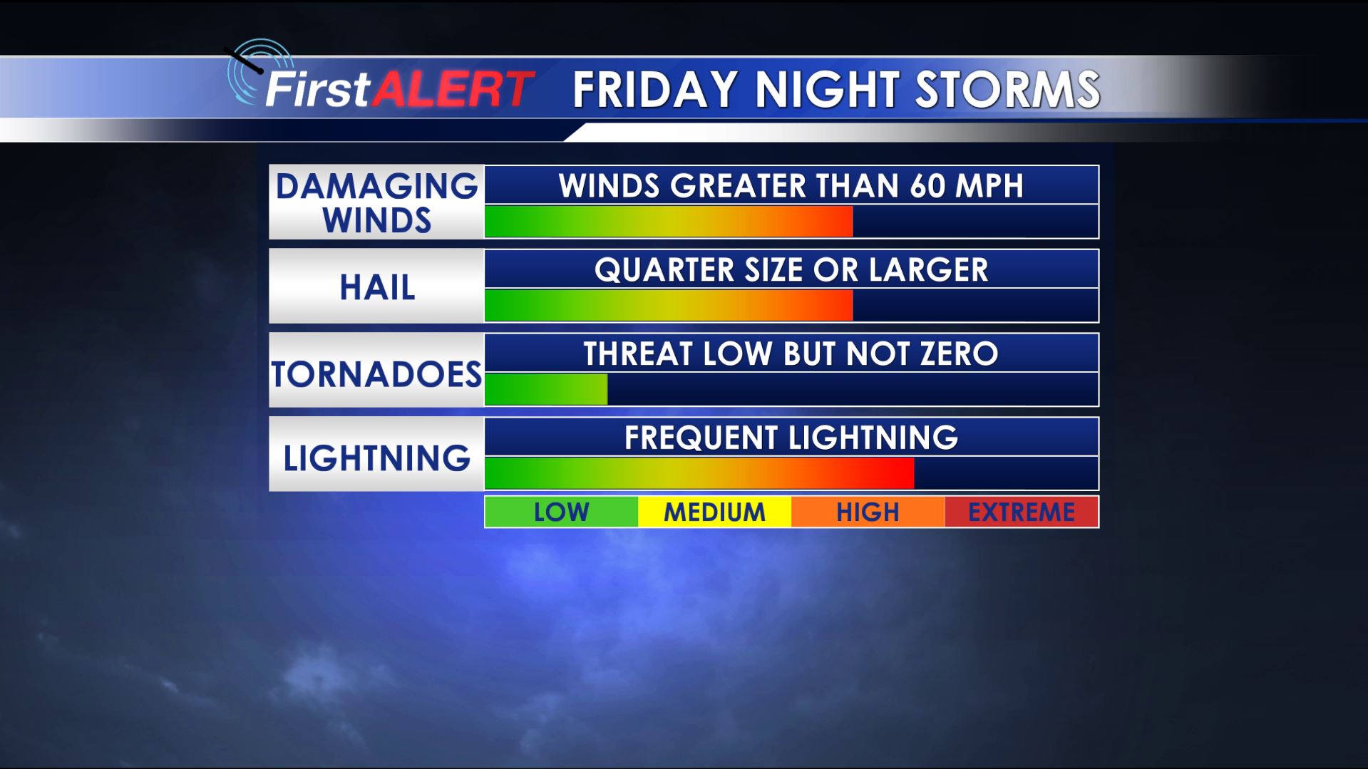
Severe Threat Index
CLICK HERE TO USE OUR INTERACTIVE RADAR
SEVERE T-STORM WATCH FOR AREAS ALONG AND WEST OF I-55 UNTIL 10AM.
TONIGHT: Strong storms in Arkansas are sliding to the south and east. These will affect areas along and west of I-55 through 10AM. Other pop-up storms can’t be ruled out across the area overnight. Damaging wind winds and large hail remain the primary concerns but we can’t rule out an isolated tornado or two. Any storm may produce frequent lightning and torrential downpours. Lows will be in the 70s.
SATURDAY: More severe storms in the area are expected. Damaging winds and large hail will again be the primary concern. The best chances for storms in the area looks to be from the early afternoon through the evening as the cold front pushes through. Look for highs in the low 90s with westerly winds between 5 and 15 mph.
SATURDAY NIGHT: Mainly clear and cooler conditions set up shop for a change. Lows may be down to into the low 70s.
SUNDAY: Relatively pleasant weather for mid July returns. Plan on mostly sunny skies and highs around 90. The chance of rain is just 10%.
NEXT WEEK: Daily rain chances return as an upper level low slowly drifts around the region. We’re going to keep a 30% chance going each day. Highs should be around 90 with lows around 70.
Follow @WCBIWEATHER on Facebook, Twitter, Instagram, and Snapchat


Leave a Reply