Severe Storms Thursday Afternoon
WEDNESDAY NIGHT: Mainly cloudy and quiet with just a slight chance for a passing shower. Lows in the upper 50s to lower 60s.
THURSDAY: An band of showers and storms will be in a weakening phase as it approaches during the morning hours; however, storms will intensify during the afternoon and early evening as they move east across the region. Our window of severe weather potential appears to be between 2 p.m. and 8 p.m. Damaging wind gusts and isolated tornadoes remain the key concern in addition to several inches of rain that may cause some localized flash flooding. Some hail can’t be ruled out either. Daytime highs should generally be in the 70s with southerly winds picking up between 10 and 25 mph.
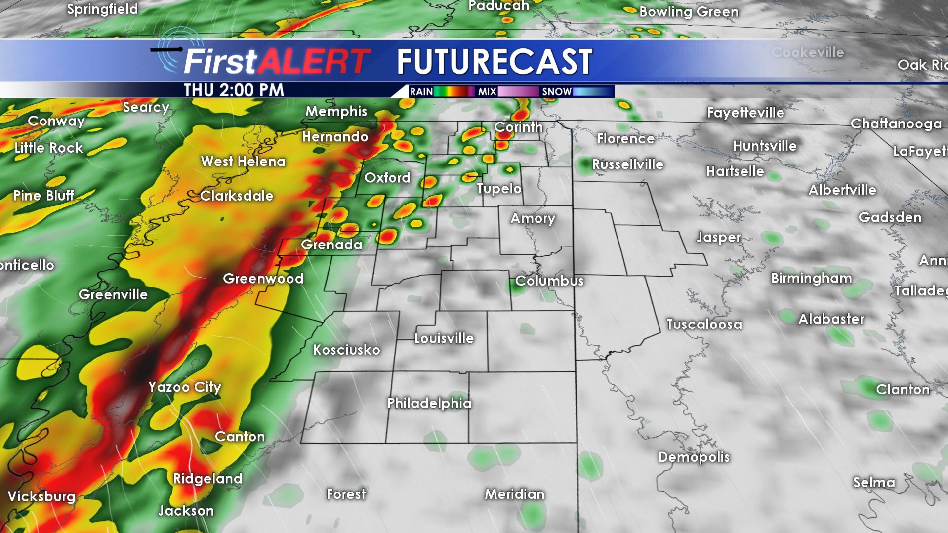
Futurecast 2 p.m. Thursday
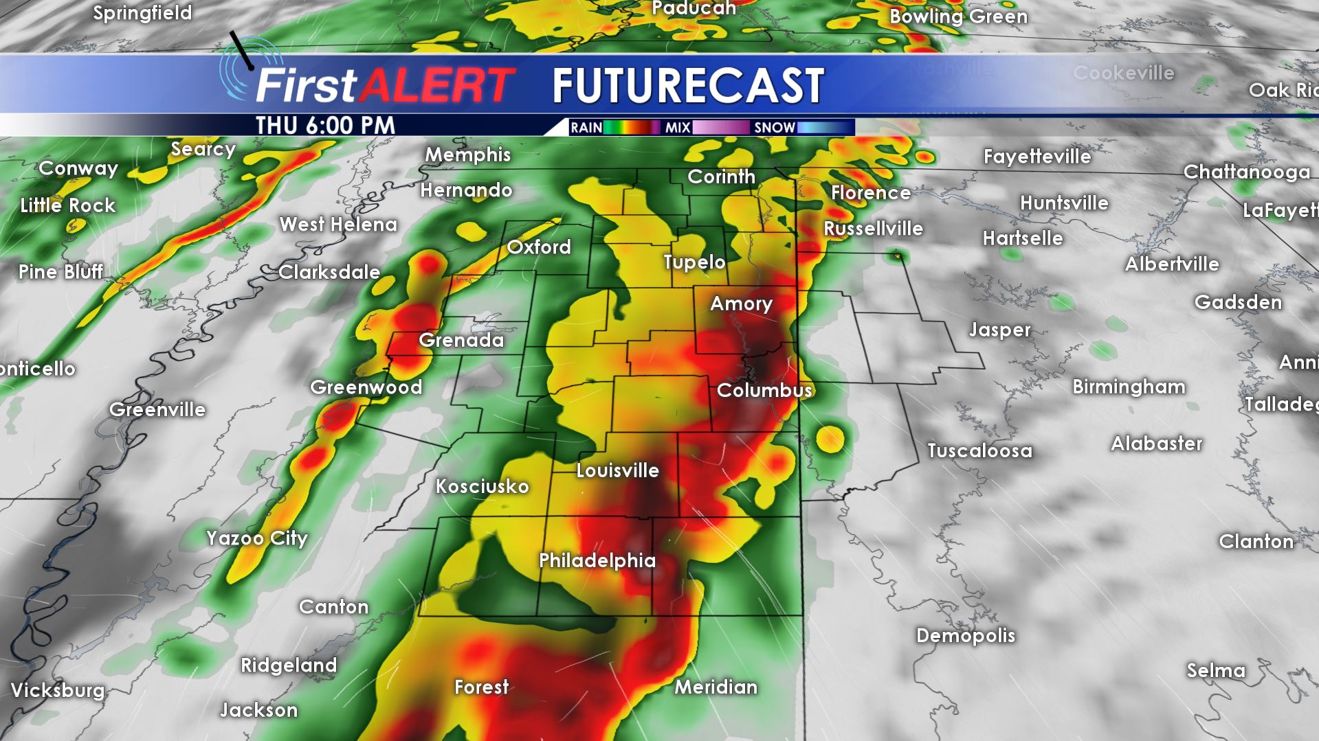
Futurecast 6 p.m. Thursday
THURSDAY NIGHT: Storms will clear out by mid evening but some showers may linger during the night under mostly cloudy skies. Temperatures fall to around 50 by daybreak Friday.
FRIDAY: A mostly cloudy, cool, and breezy day is on tap once again. Look for highs mainly in the 50s to lower 60s. There is a 40% chance of scattered showers.
FRIDAY NIGHT: Clouds should generally thin out and that will allow temperatures to cool into the lower 40s. Some spots may dip into the upper 30s again.
SATURDAY: Mostly sunny and pleasant with highs in the upper 60s. Mid 40s for Lows Saturday night.
EASTER SUNDAY: Mostly sunny, warm, and pleasant. Temperatures should top out in the upper 70s to around 80.
Follow @WCBIWEATHER on Facebook, Twitter, and Instagram


Leave a Reply