Severe Weather Expected Today
WATCH THE LATEST SEVERE WEATHER DISCUSSION HERE
Strong to severe storms are expected today from 11AM to 9PM, with prime time severe weather likely from 2PM to 8PM. Hail, wind, and the potential for tornadoes are all still in play. Water logged soil may allow trees to topple over even without severe wind gusts during the next 24 hours and that may contribute to some power outages around the region. Widespread flooding issues will continue into next week even after the rain comes to an end Saturday evening.
BUILD A SEVERE WEATHER PLAN AND FIND STORM SHELTERS AT WCBI.COM/SAFETY
SATURDAY: Unseasonably warm and humid air returns to the area and highs should be well into the 70s. Gradient winds from the south will be sustained in the 10 to 25 mph range with higher gusts. These winds could allow some trees to topple over due to the water logged soils so don’t be surprised if there are issues with power outages during the day even outside of thunderstorms. 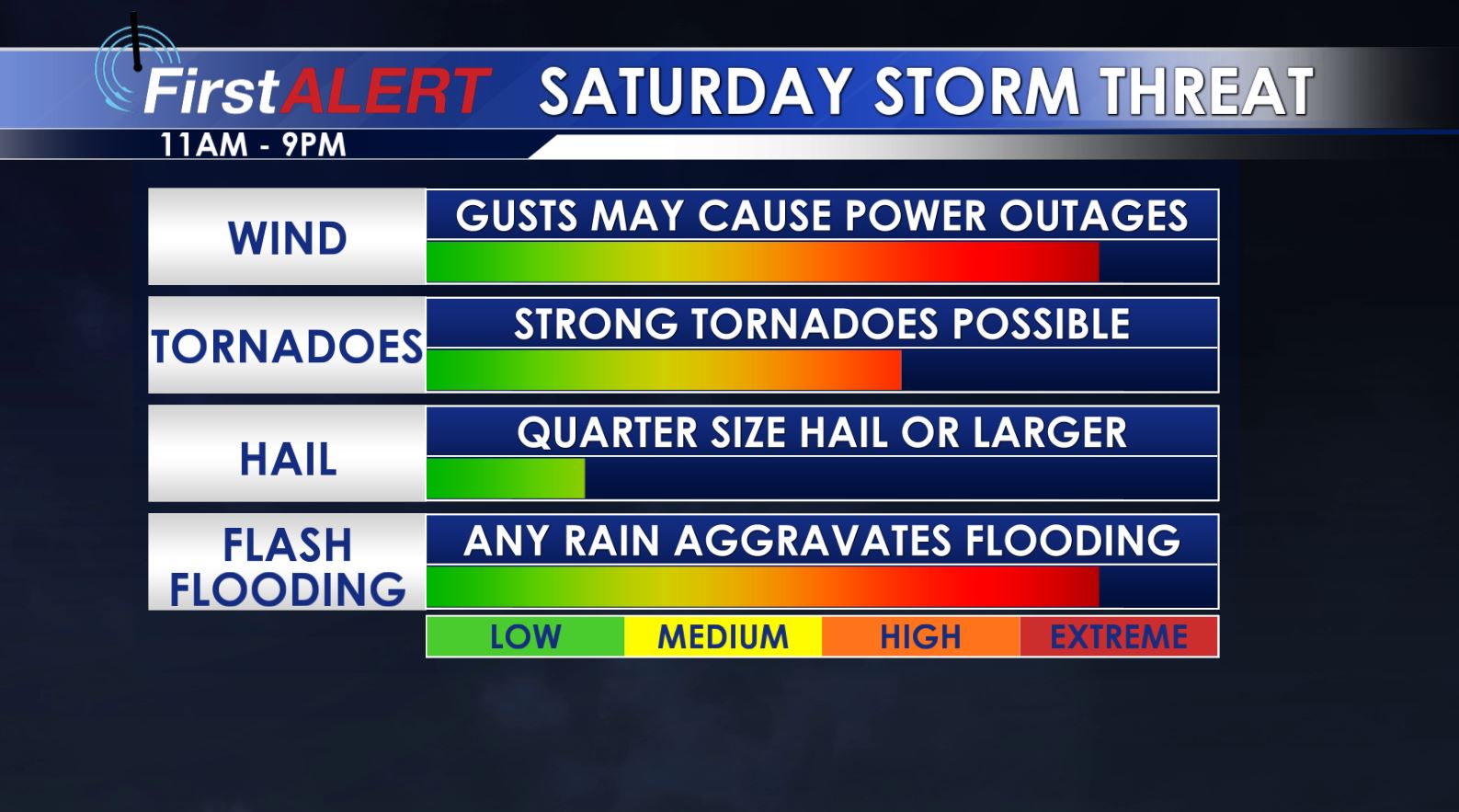
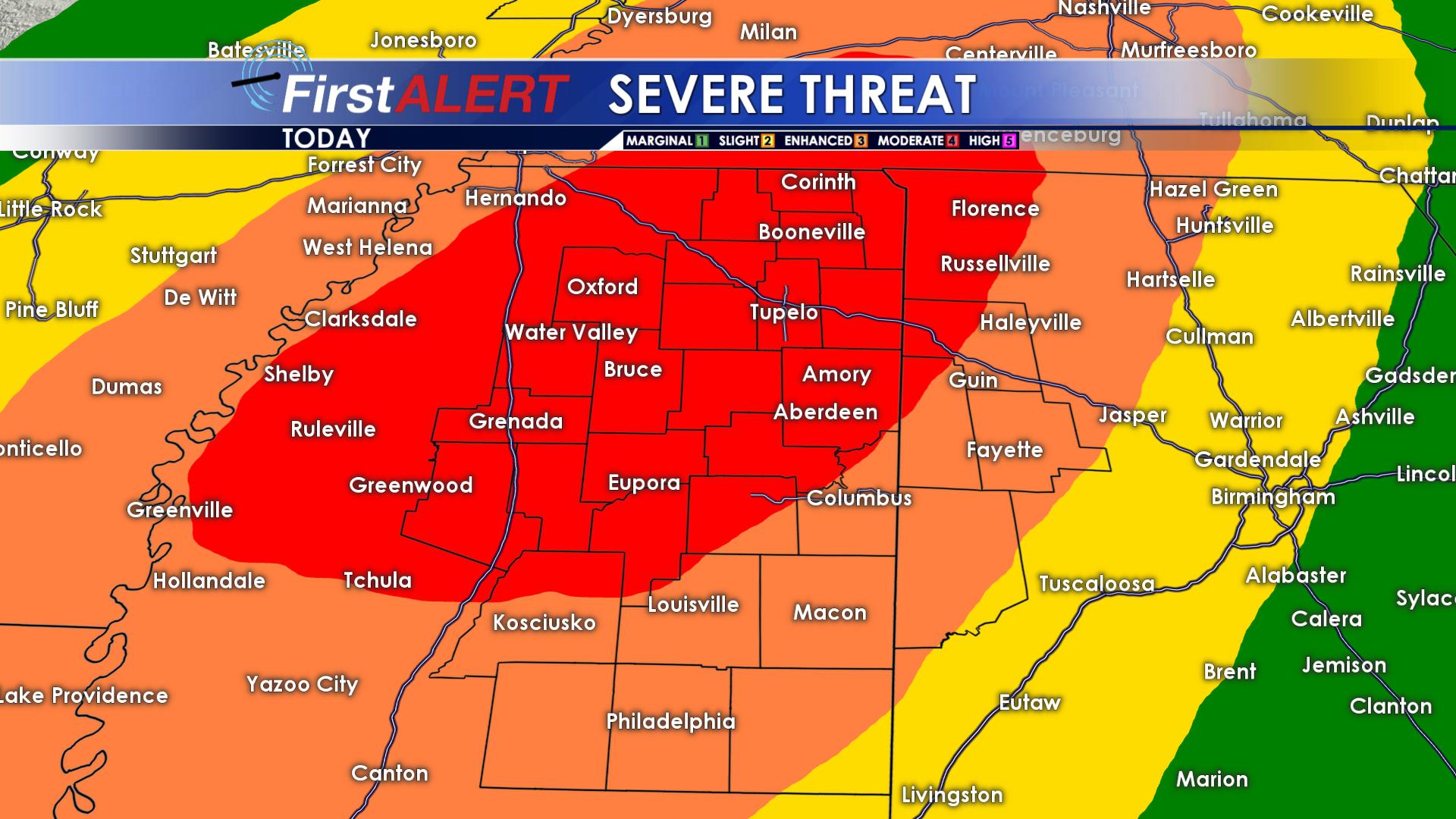
While some rain and storms may be around during the first half of the day, the best strong to severe storm potential seems to be from about 11AM through 9PM. Damaging wind gusts, hail, and tornadoes are all expected. A few strong, long track tornadoes can’t be ruled out. Storms will initially be isolated to scattered in nature, which may very well enhance the tornado threat. Questions remain on how storms will interact with surface features, but the potential is there for at least severe weather by the lunch hour.
Stay weather aware going into the afternoon hours and stay with WCBI on TV and on social media as we continue to update the situation in real time.
SATURDAY NIGHT: Clearing skies will take place as drier air pushes in from the northwest. Lows will be in the upper 40s to around 50.
SUNDAY – TUESDAY: A much needed dry stretch takes hold of the region and boy do we need it! Look for mostly sunny skies and seasonable temperatures in the 50s and 60s during the day with cool overnight lows in the 30s. It’ll take some time to get water to recede even after the rain stops so flooding issues will continue through the week ahead.
LATE NEXT WEEK: The chance for some showers return by Wednesday, but we remain seasonal with highs in the 60s and lows in the 40s.
Follow @WCBIWEATHER on Facebook, Twitter, and Instagram


Leave a Reply