Showers again Thursday, more rain Saturday night
COLUMBUS, Mississippi (WCBI) – The weather stays active for a few more days, but quieter conditions move in by Sunday.
THURSDAY: Chilly air with areas of fog and mist highlight the morning forecast. Retreating warm air will likely reach the Golden Triangle and west Alabama this afternoon, leaving a wide temperature spread. Areas northwest of the Natchez Trace will stay in the 30s and 40s, while areas like Macon into west Alabama will see mid 70s. Steady showers are expected in the cooler air much of the day.
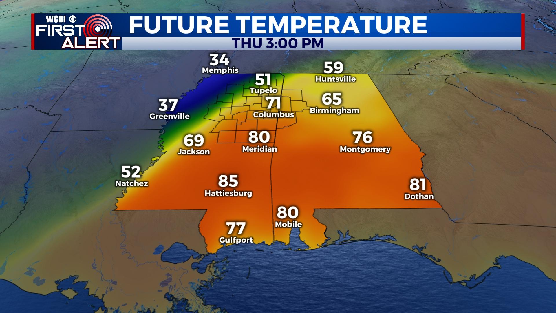
THURSDAY EVENING: Briefly heavy rain and an embedded thunderstorm are possible as a shallow front moves through after sunset. For now, no severe weather is expected.
FRIDAY: Spotty rain and chilly air will once again highlight the morning forecast. Limited clearing is expected for the rest of the day as highs struggle to reach the low 50s. Late-night drizzle could redevelop after midnight, but temperatures stay above freezing.
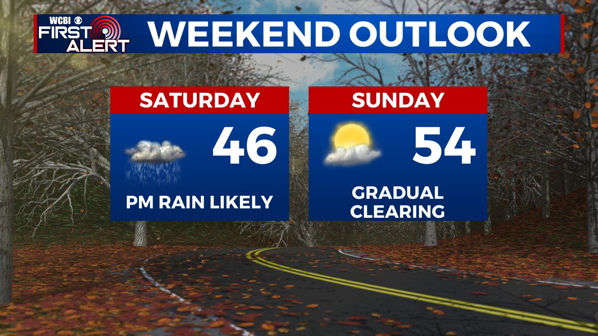
SATURDAY: The day stays cloudy and quite chilly with temperatures remaining in the 40s. Widespread rain is expected to develop into the region during the late afternoon and evening hours. Additional rain amounts of at least one half inch are expected.
SUNDAY: Showers could linger into the morning hours, but gradual clearing is expected by afternoon and evening.
NEXT WEEK: Finally, some sunshine is in the forecast! Temperatures should climb back into the 60s with morning lows in the 30s to near 40 degrees.


Leave a Reply