Showers and thunderstorms make for messy week
COLUMBUS – SUMMARY: Temperatures reach and struggle to maintain in the 70s before a cold front knocks highs back down into he 40s Friday. Chances for showers and thunderstorms remain relatively high throughout the first half of next week, followed by gradual clearing through the end of the week. The potential for some severe weather also exists on Monday and Tuesday, but should be mainly confined to severe winds in terms of threats.
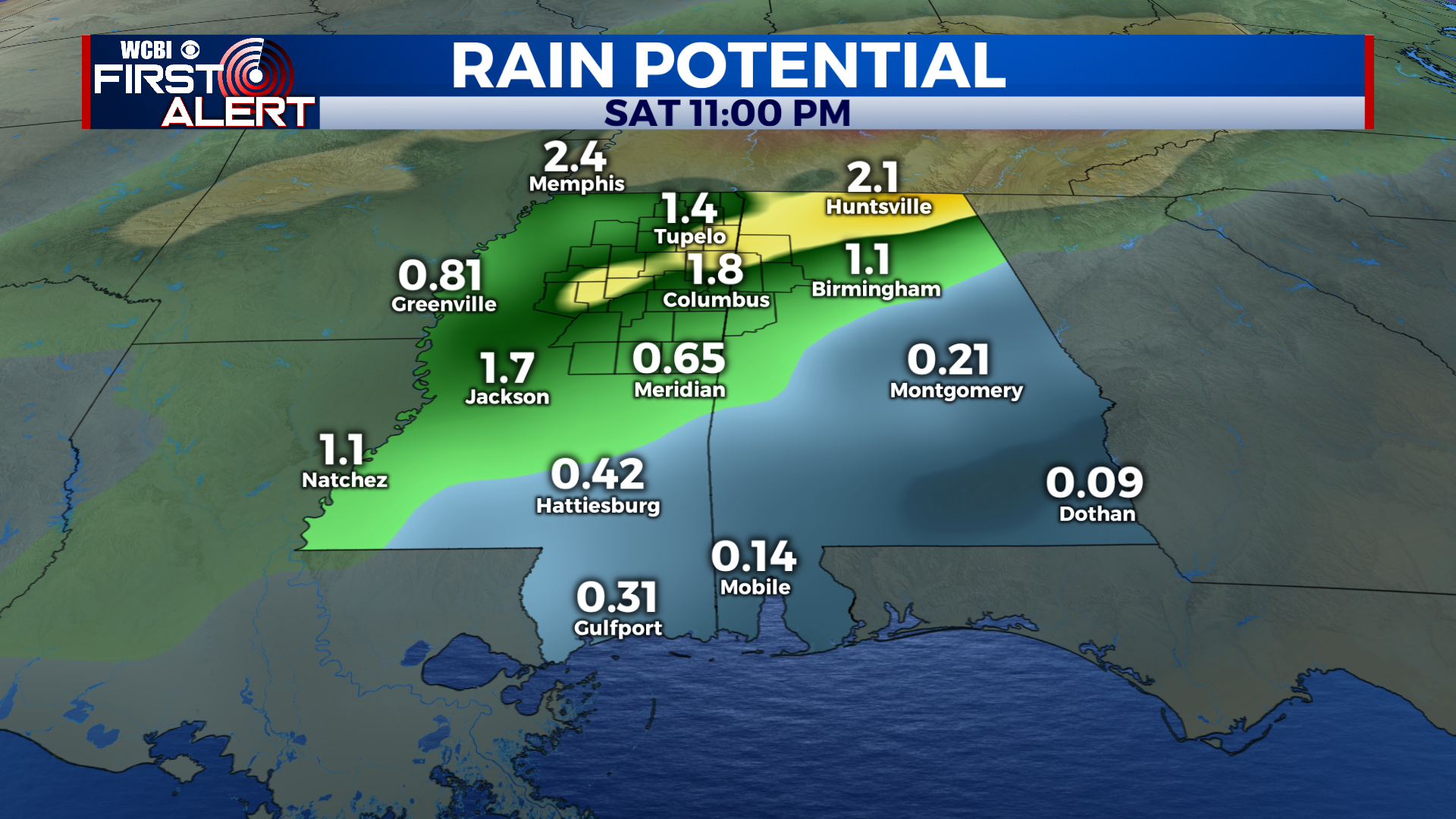
MONDAY: Afternoon temperatures reach stalemate Monday, and advance no further than the low 60s. Widespread thunderstorms throughout the region aid in stalling the warming trend, while also bringing healthy rain totals and the potential for some severe weather to the region. Damaging winds will be the primary threat Monday, although the stray tornado cannot be ruled out. Lows bottom out in the upper 50s overnight.
TUESDAY: Some light clearing Tuesday combined with the stalling out of a weak cold front means that highs will reach into the low to mid 70s Tuesday. The chance for showers and thunderstorms decreases a bit from Monday but the severe threat does not. Like Monday, the primary threat Tuesday will be strong winds as well as a slightly higher chance of the isolated tornado. Lows bottom out in the upper 50s once again.
NEXT WEEK: Rain chances will gradually decrease heading later into the week, diminishing altogether by the weekend. Skies remain mostly cloudy to overcast and will help keep highs in the 40s after Friday’s cold front moves through. Lows drop down below freezing after the front passes and remain that way through Sunday.


Leave a Reply