Showers early Sunday morning, nothing but sunshine next week
A cold front will move through the area overnight Saturday into Sunday, bringing a very brief period of showers early Sunday morning. Temperatures will drop slightly as skies remain completely sunny going into next week.
TROPICAL UPDATE: The record breaking hurricane season continues with Tropical Storm Iota forming in the western Caribbean. The storm is expected to strengthen into a hurricane and impact Central America before crossing into the Pacific. There is no threat to the United States.
SATURDAY NIGHT: Clouds will slowly increase after sunset Saturday night with showers likely between 2 am and 5 am Sunday morning. Any rain will be rather brief and we aren’t expecting rainfall amounts over a quarter of an inch. More than likely, all rain will be gone by sunrise on Sunday.
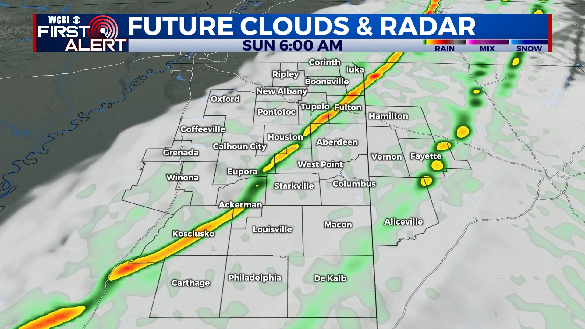
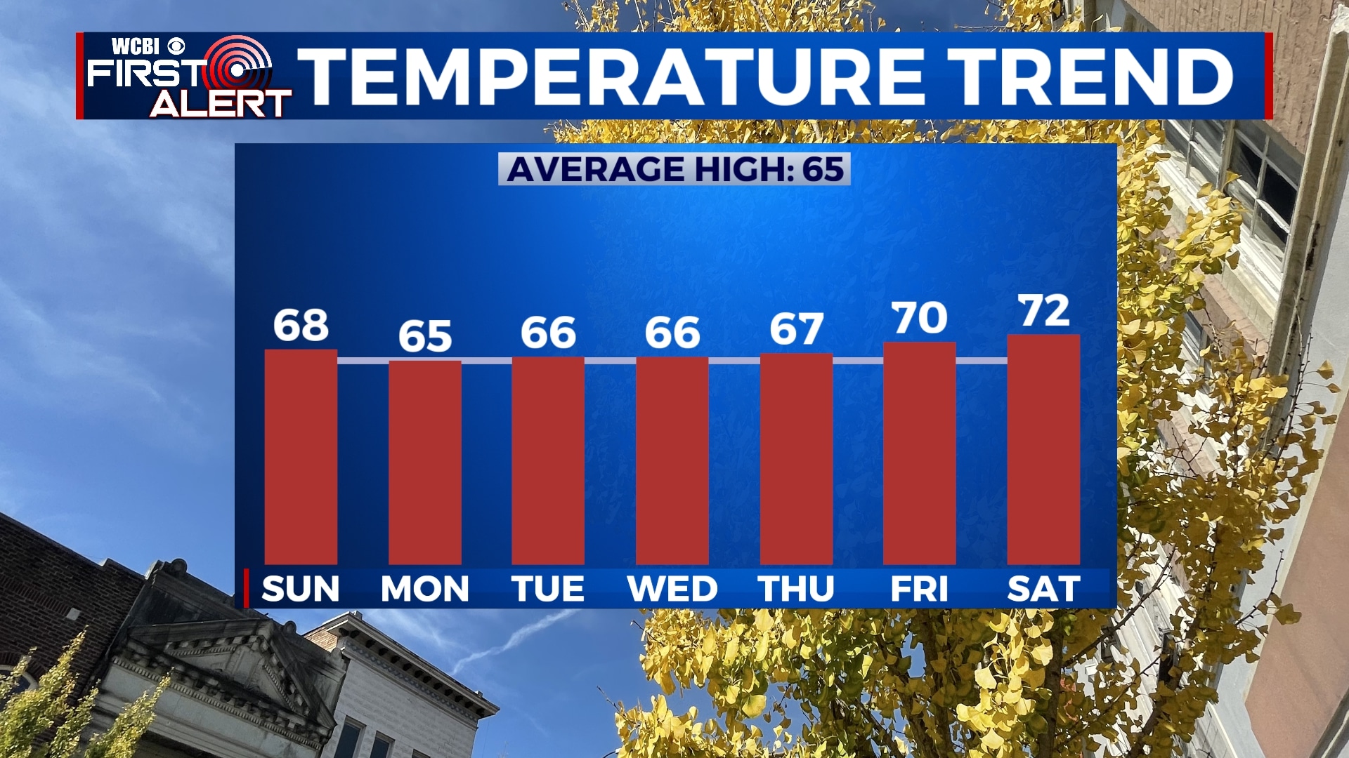
SUNDAY: We could see a lingering sprinkle or two after sunrise on Sunday, but it looks like most of the day will be dry. We’ll start out with some morning clouds and end up sunny by the afternoon. Highs will be in the mid to upper 60s.
MONDAY-FRIDAY: Let’s make it short, sweet, and to the point…all of next week will be spectacular. You’ll be hard pressed to find a single cloud in the sky from Monday through Friday. Temperatures will be a bit cooler, but not much. We’re looking at highs in the mid 60s for the first half of the week and closer to 70 by Thursday and Friday. Morning lows will be in the mid to upper 30s for Monday, Tuesday, and Wednesday, and the low to mid 40s for Thursday and Friday.
Follow WCBI Weather on Facebook, Twitter, and Instagram
Follow Meteorologist Trevor Birchett on Facebook and Twitter


Leave a Reply