Showers Friday, Storms Monday
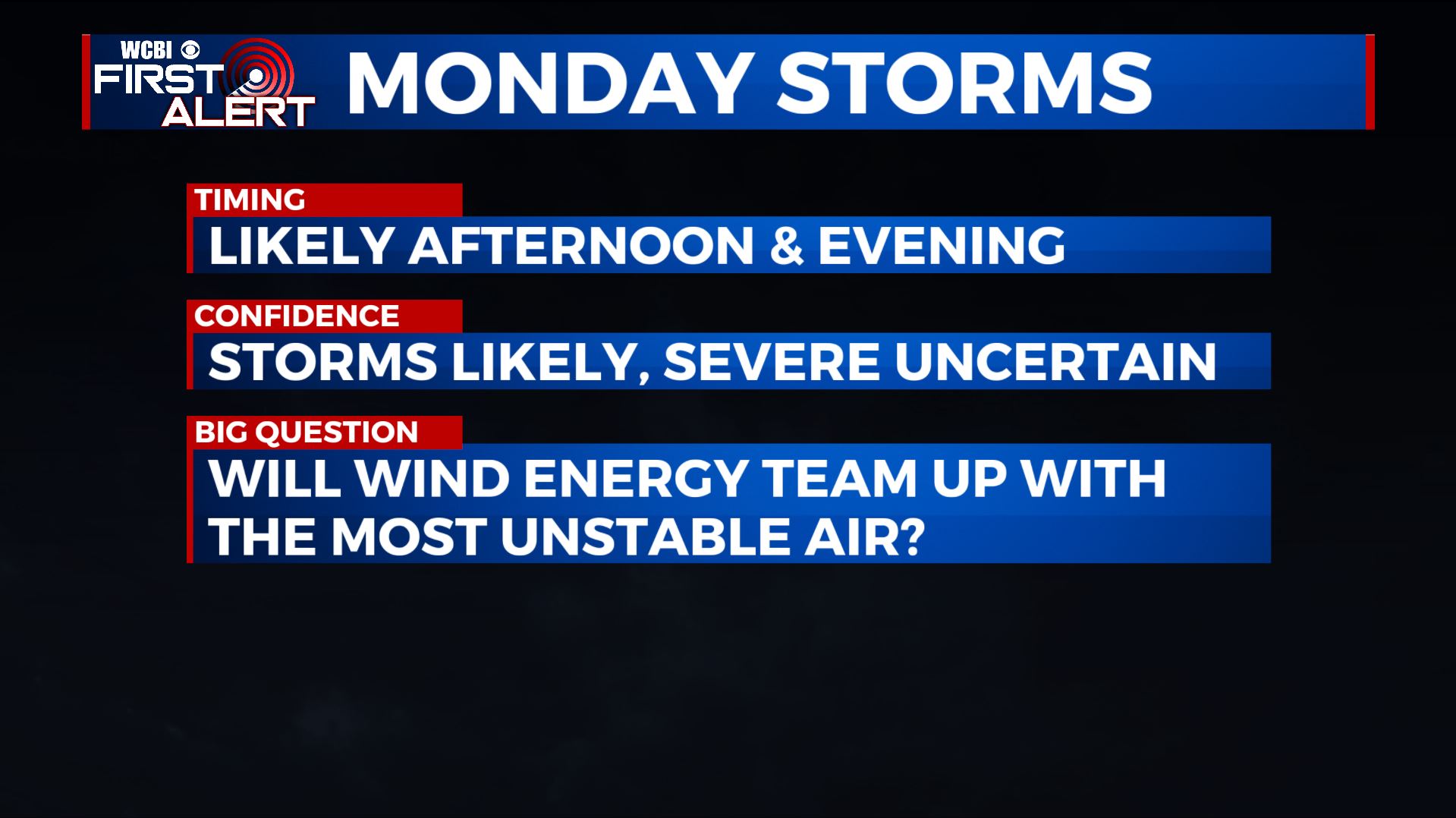
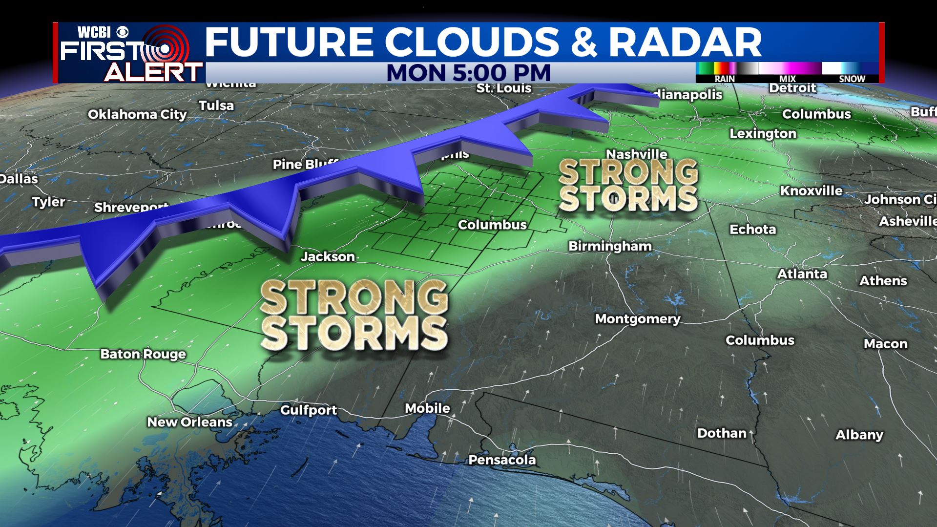
SUMMARY: Scattered showers are possible on Friday as a disturbance swings across the region. The heaviest rain will stay to our east but we may have up to 1/4″ an inch of moisture in some places here. Generally quiet weather should hold for the weekend but heavier rain and storms are likely Monday. We continue to monitor the potential for strong to severe storms Monday afternoon and evening but it’s still uncertain if the ingredients will team up. Stay tuned!
THURSDAY NIGHT: Mostly cloudy with some showers developing. Lows in the 40s. Winds SE 5-10.
FRIDAY: Mostly cloudy with a 30% chance of scattered showers. Highs in the 50s. Winds variable 3-6 mph.
FRIDAY NIGHT: Mostly cloudy. Some showers could linger. Lows in the upper 30s to lower 40s.
SATURDAY: Morning clouds giving way to sunshine as the day wears on. Seasonable highs around 60. Lows in the upper 30s Saturday night.
SUNDAY: Variably cloudy. A few showers are possible in the afternoon and evening, mainly across the northwestern part of the area. Highs remain in the 60s. Much milder 50s for lows Sunday night.
MONDAY: Areas of rain and storms develop with the heaviest activity most likely during the afternoon and evening. Some strong to severe storms are possible if the most unstable air can team up with the strongest wind energy in the atmosphere. We’ve had a few rounds this fall where the ingredients have struggled to team up but each time a situation like this arises we need to watch carefully. Stay tuned for additional updates during the next few days. Highs may top out in the upper 60s to around 70.
MONDAY NIGHT: Rain and clouds will gradually taper from west to east as cold, dry air moves in from the northwest. Temperatures may tumble into the upper 30s by sunrise Tuesday.
TUESDAY-WEDNEDAY: Abundant sunshine with much cooler highs in the 40s. Lows fall back into the mid 20s.
Follow @WCBIWEATHER on Facebook, Twitter, Instagram, and the WCBI News app


Leave a Reply