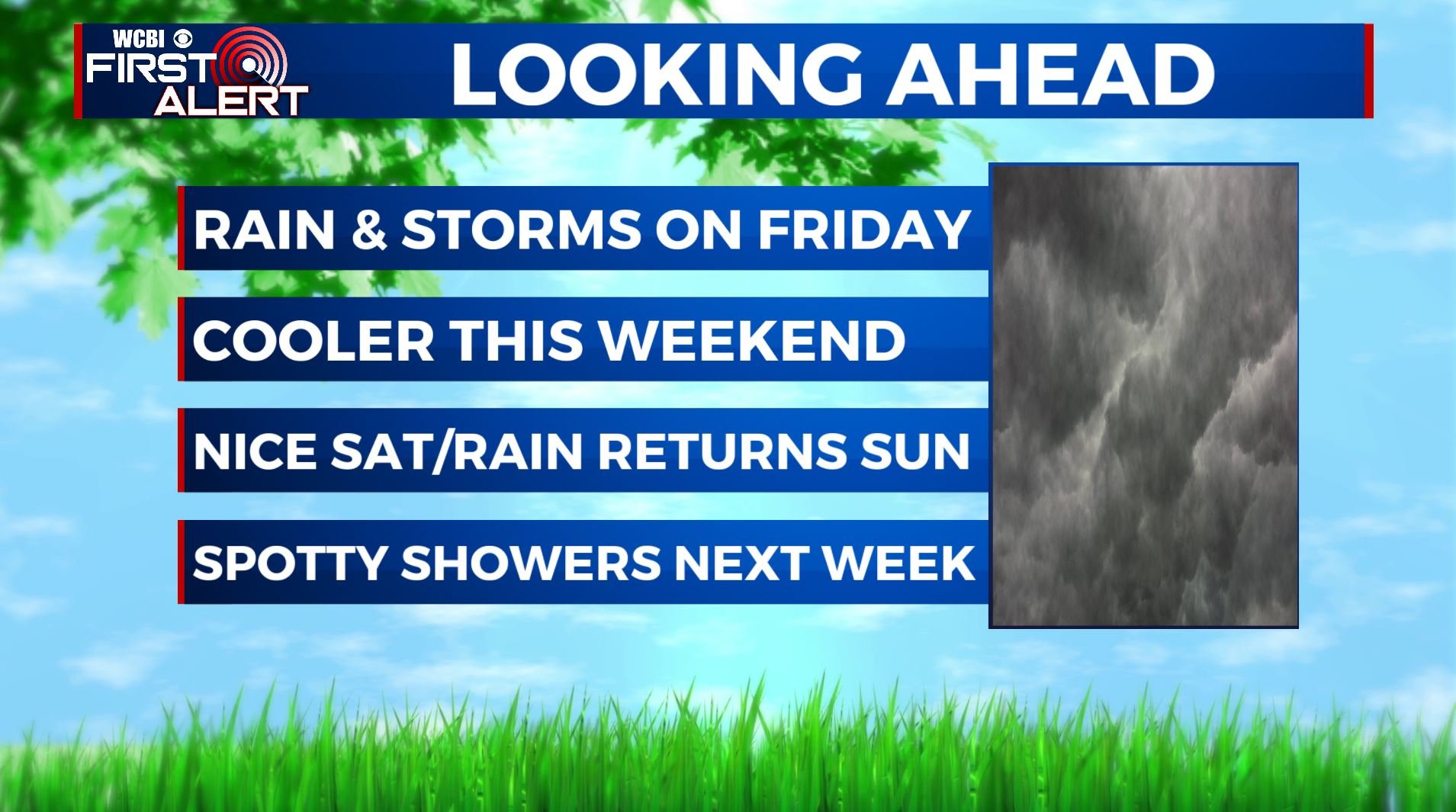
Showers & storms for Friday, cooler temperatures this weekend
SUMMARY: We are waking up to a few heavy downpours and thundershowers in our northern counties this Friday morning. An approaching cold front will bring the chance for rain and some storms through the day on Friday. Cooler temperatures moving in behind the front for the weekend. Aside from some morning showers on Saturday, much of the day will be dry before more rain moves in for Sunday. Chances for off-and-on showers will continue into next week along with the return of warmer temperatures.
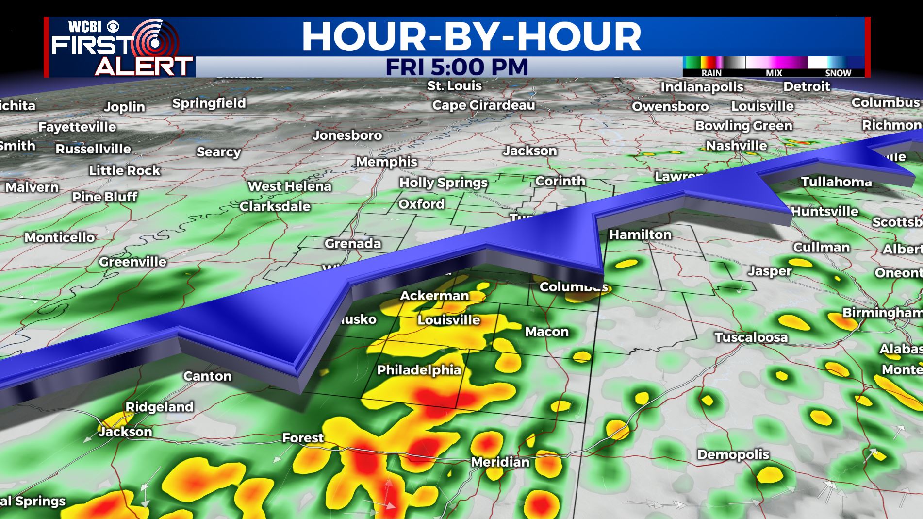
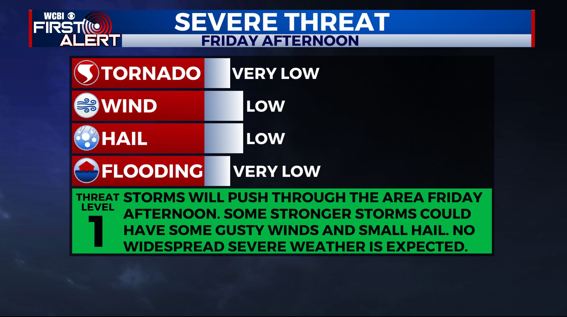
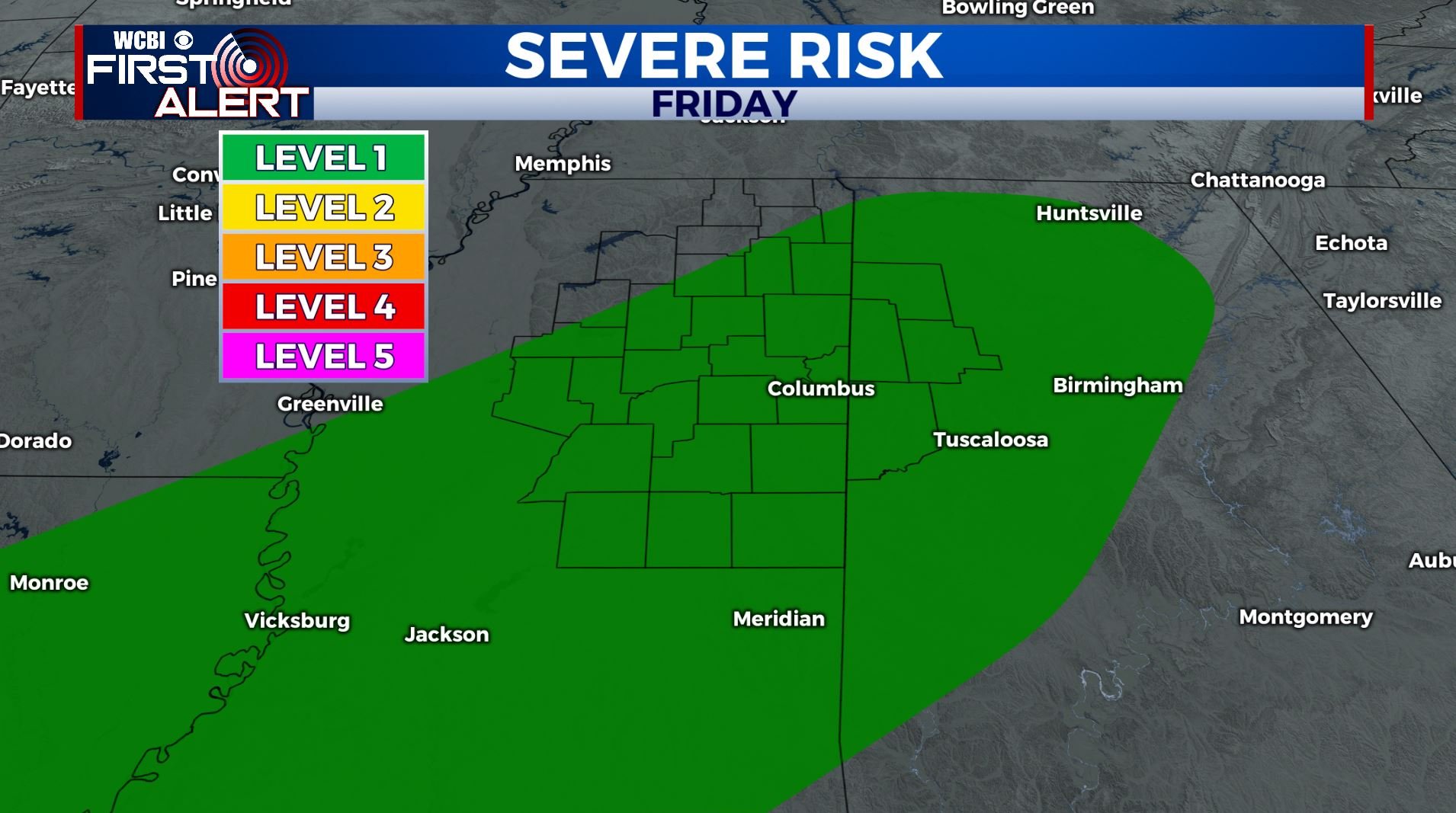
FRIDAY: Rain is likely through the day for your Friday with a couple of thunderstorms possible. Fortunately, the threat for severe weather is low aside from some gusty winds and maybe some small hail, but 1-2″ of rain is possible. Temperatures will start out in the mid 70s in the morning before falling into the 60s by the evening. Winds will switch from the south to the northwest, gusting to 20 mph at times.
FRIDAY NIGHT: Lingering showers and cooler. Lows in the upper 40s.
SATURDAY: The chance of some morning showers. Otherwise a mix of sun & clouds and quiet & nice weather for the afternoon with highs in the 60s.
SUNDAY: Mostly cloudy with areas or rain likely. Highs the lower to mid 60s.
MONDAY: Mostly cloudy with another chance of on/off again rain chances. Highs back up into the mid to upper 60s.
TUESDAY: Staying unsettled with a continuing chance of some rain. Highs back up into the 70s.
MIDWEEK: Highs will remain above average with temperatures in the mid to upper 70s on Wednesday & near 80 on Thursday. If you’re looking to get outdoors and get some fresh air next week, the best chances of dodging any showers will be on Wednesday and Thursday.
Stay connected with @WCBIWEATHER on Facebook, Twitter, Instagram, and the WCBI News App


Leave a Reply