Showers Wednesday
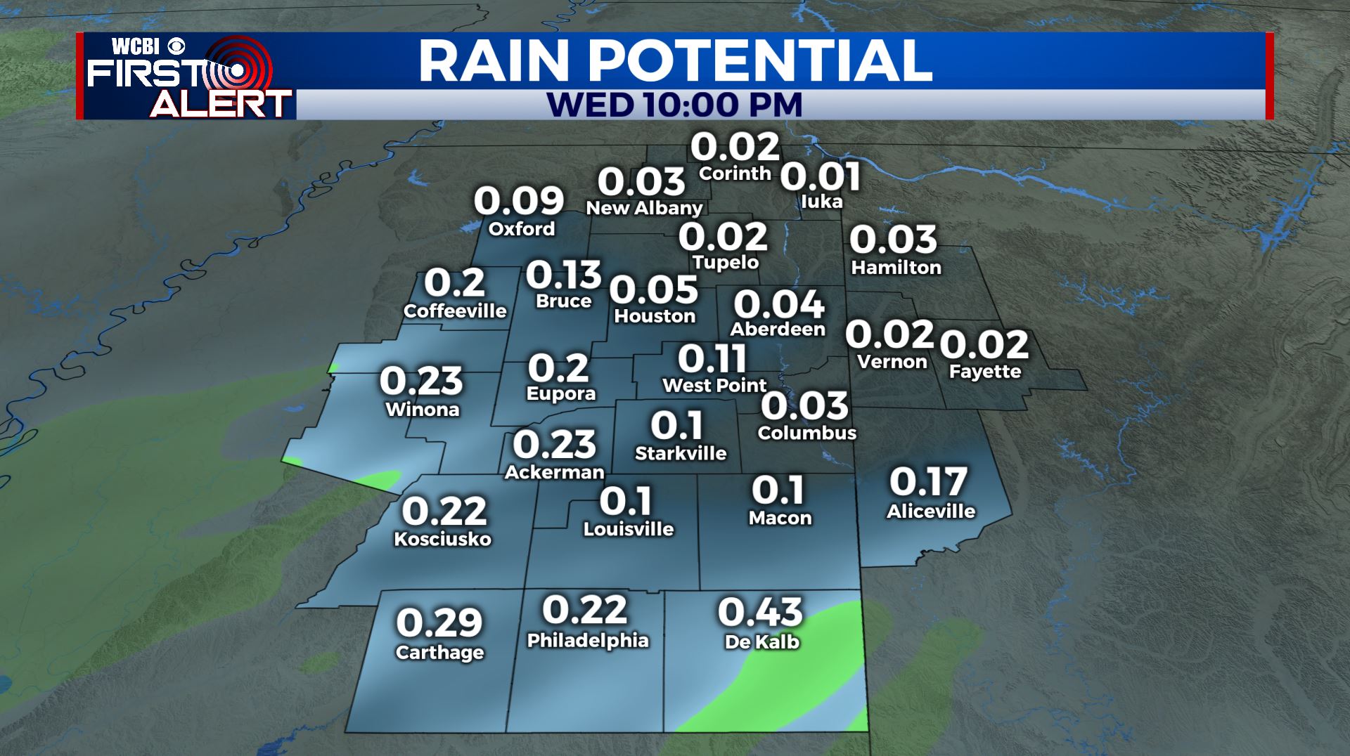
SUMMARY: Scattered showers return to the region Wednesday but rainfall amounts will be on the lighter side, mainly less than 1/4″. We’ll get a break on Thursday but a few more light showers are possible on Friday. The weekend continues to look decent, especially on Sunday when temperatures may zoom into the mid to upper 60s under sunny skies.
TUESDAY NIGHT: Mainly cloudy with showers developing. Lows in the low to mid 40s. Light wind from the ESE.
WEDNESDAY: Mostly cloudy. A 60% chance of showers. Rainfall totals should be mainly less than 1/4″. Highs in the 50s.
WEDNESDAY NIGHT: Mostly cloudy. Lows in the upper 30s to around 40.
THURSDAY: Mostly cloudy early with breaks developing in the clouds during the day. Highs in the mid to upper 50s. Lows in the mid 40s Thursday night.
FRIDAY: Mostly cloudy. A 30% chance of showers. Highs in the mid 50s. Upper 30s for low Friday night.
SATURDAY: Clouds and sun. Highs in the mid 50s. Mainly clear Saturday night with lows in the mid to upper 30s.
SUNDAY: Bright sunshine and mild. Highs in the mid to upper 60s.
MONDAY-TUESDAY: Rain showers are possible but exact amounts are still up in the air. We’ll remain mild with low 60s Monday and perhaps a shot at the low 70s Tuesday.
MID/LATE NEXT WEEK: Data suggest a cool down may be on the way for the region. We’ll keep an eye on things going forward.
Follow @WCBIWEATHER on Facebook, Twitter, Instagram, and the WCBI News app


Leave a Reply