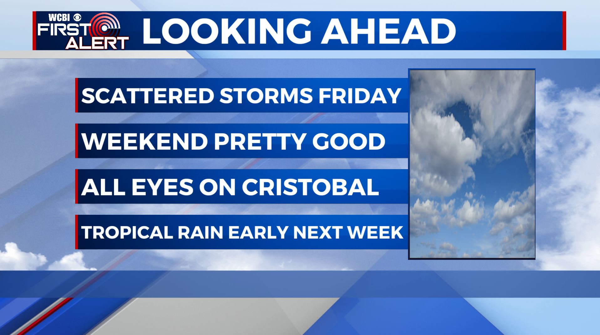
Some stormy weather for Friday, still watching Cristobal for next week
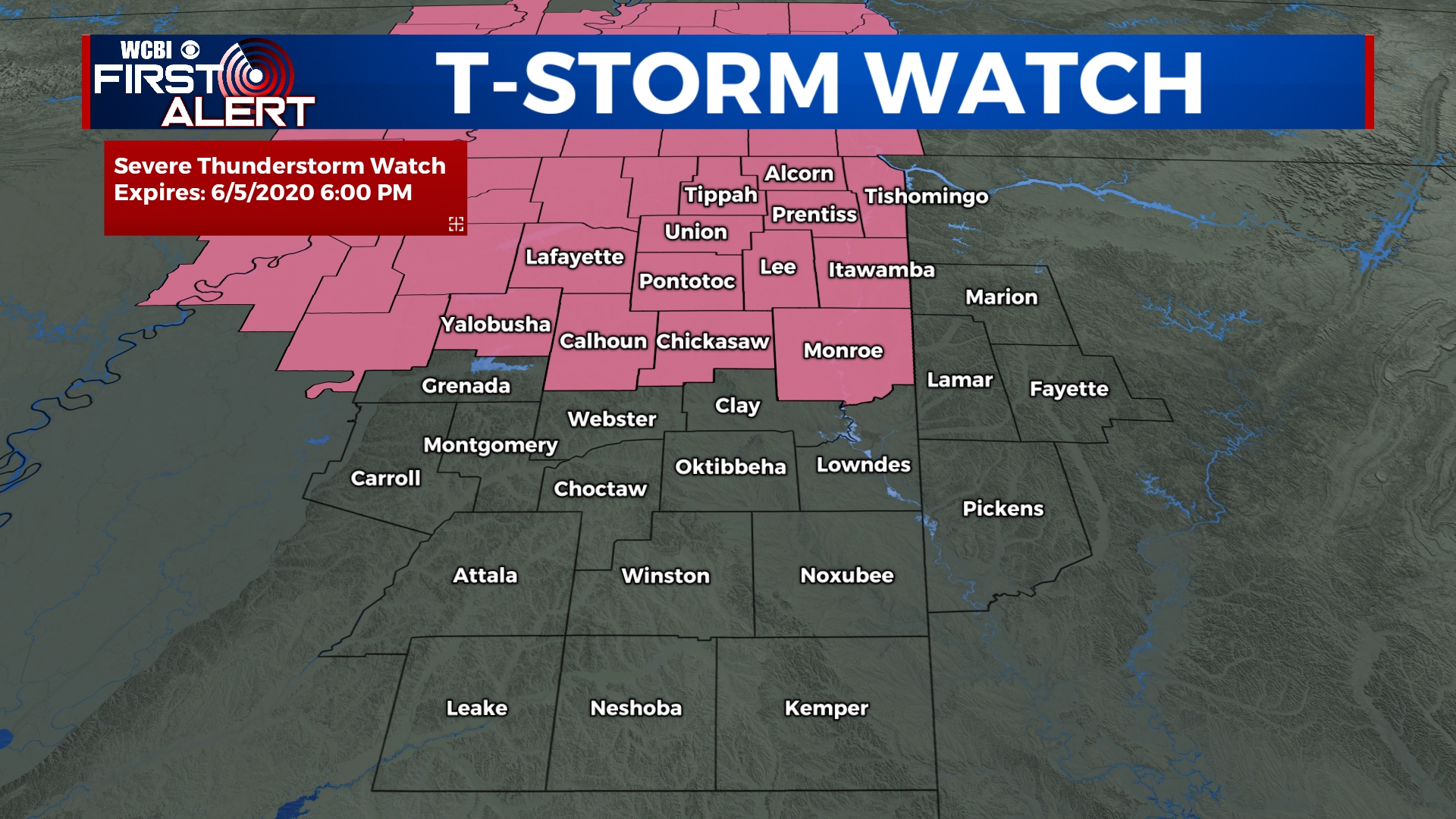
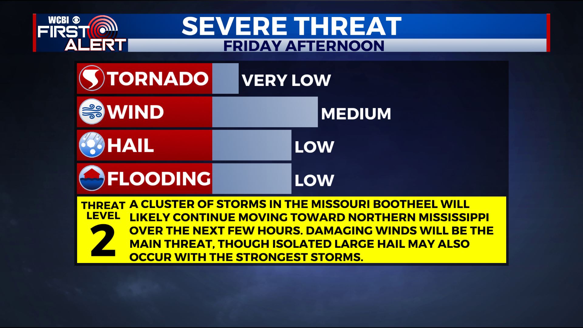
SUMMARY: A Severe Thunderstorm Watch is now in effect until 6pm for Alcorn, Calhoun, Chickasaw, Itawamba, Lafayette, Lee, Monroe, Pontotoc, Prentiss, Tippah, Tishomingo, Union and Yalobusha Counties in Mississippi. A cluster of storms in the Missouri Bootheel will likely continue moving toward western TN, northern MS and eastern AR over the next few hours. Damaging winds will be the main threat, though isolated large hail may also occur with the strongest storms. We’ll have drier weather for the weekend, but we’ll need to continue to watch Tropical Storm Cristobal closely as it could still affect our area early next week with locally heavy rain and an isolated tornado threat. Stay tuned to WCBI!
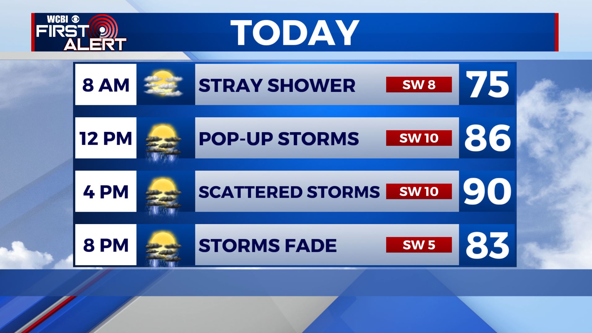
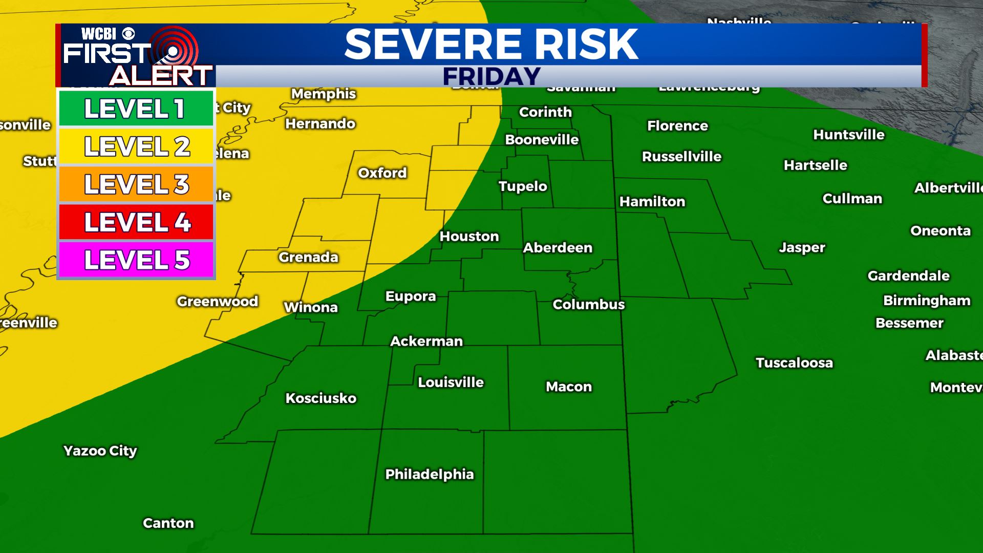
FRIDAY: We are waking up to mostly sunny skies this Friday morning. We’ll once again have chances of scattered showers & storms in the afternoon when we get the peak heating of the day. We’re right now under a Level 1 to Level 2 Risk for some strong to severe storms this afternoon. Some storms could be on the strong side with some gusty winds, large hail, heavy downpours and lightning. Highs in the upper 80s to lower 90s. Winds SW 5-10 mph.
FRIDAY NIGHT: Partly cloudy and muggy. Lows around 70.
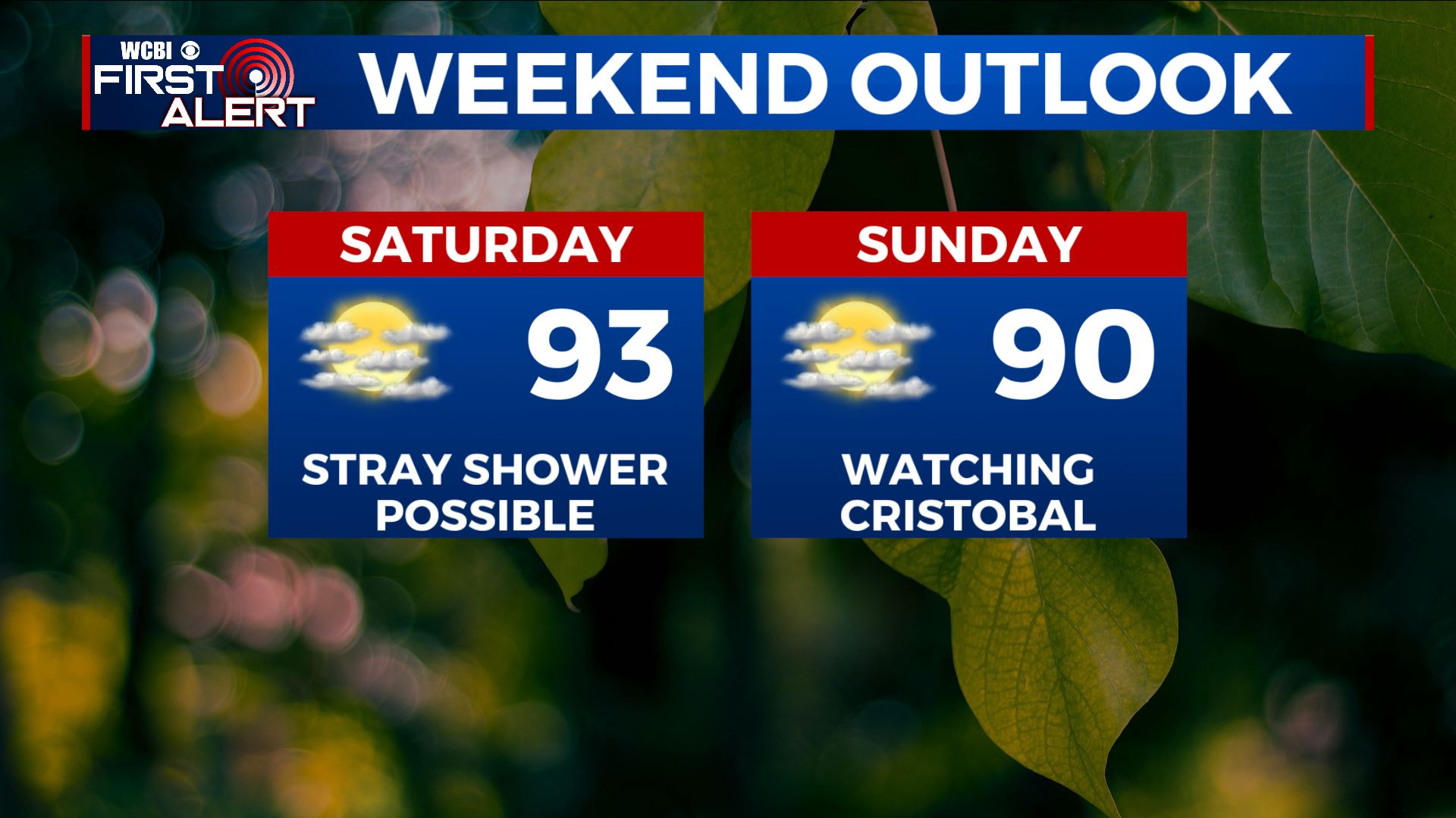
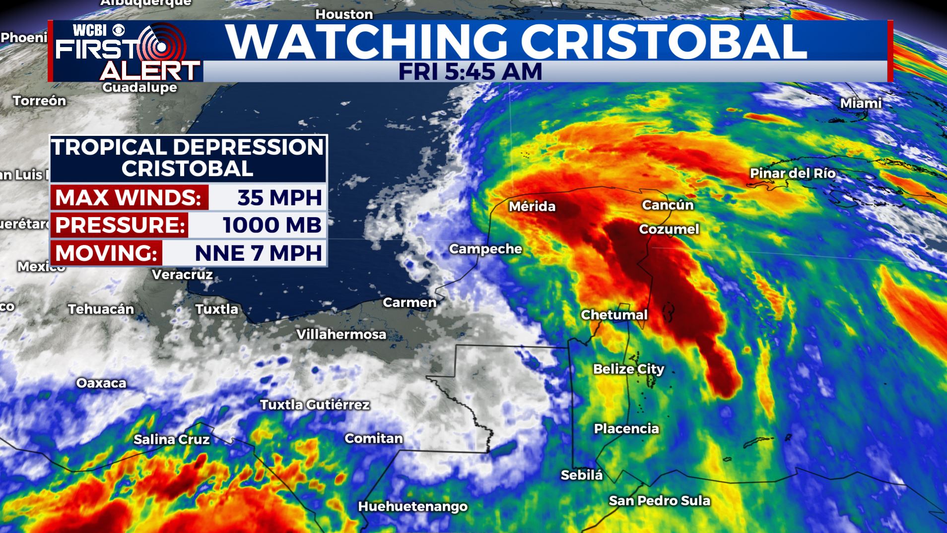
WEEKEND: Overall a mix of sun and clouds, but some stray shower or storm can’t be ruled out. Tropical Storm Cristobal will approach the Gulf coast by late Sunday. Highs temperatures continue to be very warm & humid in the upper 80s to lower 90s. Overnight lows in the 70s with partly to mostly cloudy skies.
MONDAY-TUESDAY: The remnant low of Cristobal will likely track to the west of the Mississippi River. That would put us on the eastern, wetter and more active side of the system. We may experience but heavy rain and even a small tornado risk but still anything can change with this forecast. Stay tuned for updates throughout the weekend.
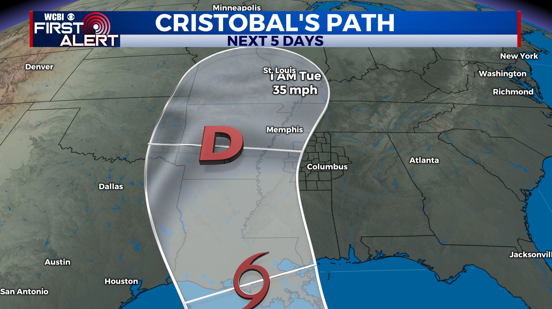
WEDNESDAY-THURSDAY: A cold front will push through on Wednesday, allowing for the remnants of Cristobal to finally move away from us. We’ll still have some scattered showers and storms on Wednesday before we finally dry out with a mix of sun and clouds on Thursday. Highs throughout the week will be in the mid 80s.
Stay connected with @WCBIWEATHER on Facebook, Twitter, Instagram, and the WCBI News App


Leave a Reply