Somewhat cooler weather by the weekend
SUMMARY: Very hot weather sticks around through Friday, with only stray to isolated afternoon and evening showers and storms. Highs will be in the mid 90s, lows in the mid 70s. By the weekend, rain chances increase and highs drop to around 90 degrees. Upper 80s are possible to begin next week as rain chances remain elevated, and could be enhanced by a tropical system which looks to track into the Gulf of Mexico. Lows will stay in the low to mid 70s. 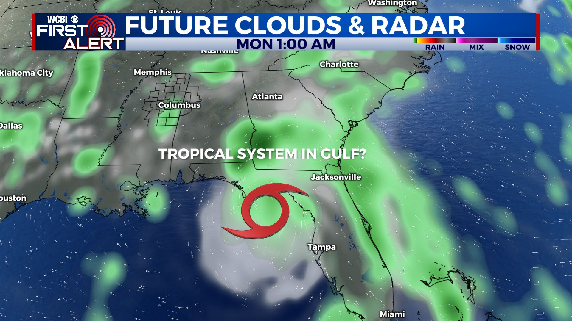 TONIGHT: Another warm and humid night in store, with partly cloudy skies and calm winds. Lows in the mid 70s. WEDNESDAY: Rain chances stay low for Wednesday, with only a stray storm possible in the afternoon. Hot and partly cloudy, highs in the mid 90s. Feels like temps 100-105+, so stay hydrated! WEDNESDAY NIGHT: Copy and paste from Tuesday night. Warm, muggy, mid 70s and partly cloudy. Winds remain calm. THURSDAY: Slightly better chances of an afternoon shower or storm, with isolated coverage in the afternoon. Still hot and partly cloudy, highs in the mid 90s. Feels like temps 100+ FRIDAY TO TUESDAY: Very similar story for Friday, with isolated afternoon storms and highs in the mid 90s. Slightly cooler in the low 90s with higher rain chances for Saturday, with scattered storms in the afternoon. Even cooler for Sunday and Monday, highs near 90 with upper 80s possible. Showers and storms will be scattered to widespread in the afternoons, and could be enhanced by likely tropical storm Fred in the Gulf of Mexico. Still a lot of uncertainty with the track and intensity of the storm, stay tuned for updates! Stay connected with @WCBIWEATHER on Facebook, Twitter, Instagram and the WCBI News App


Leave a Reply