Stay winter weather informed this weekend
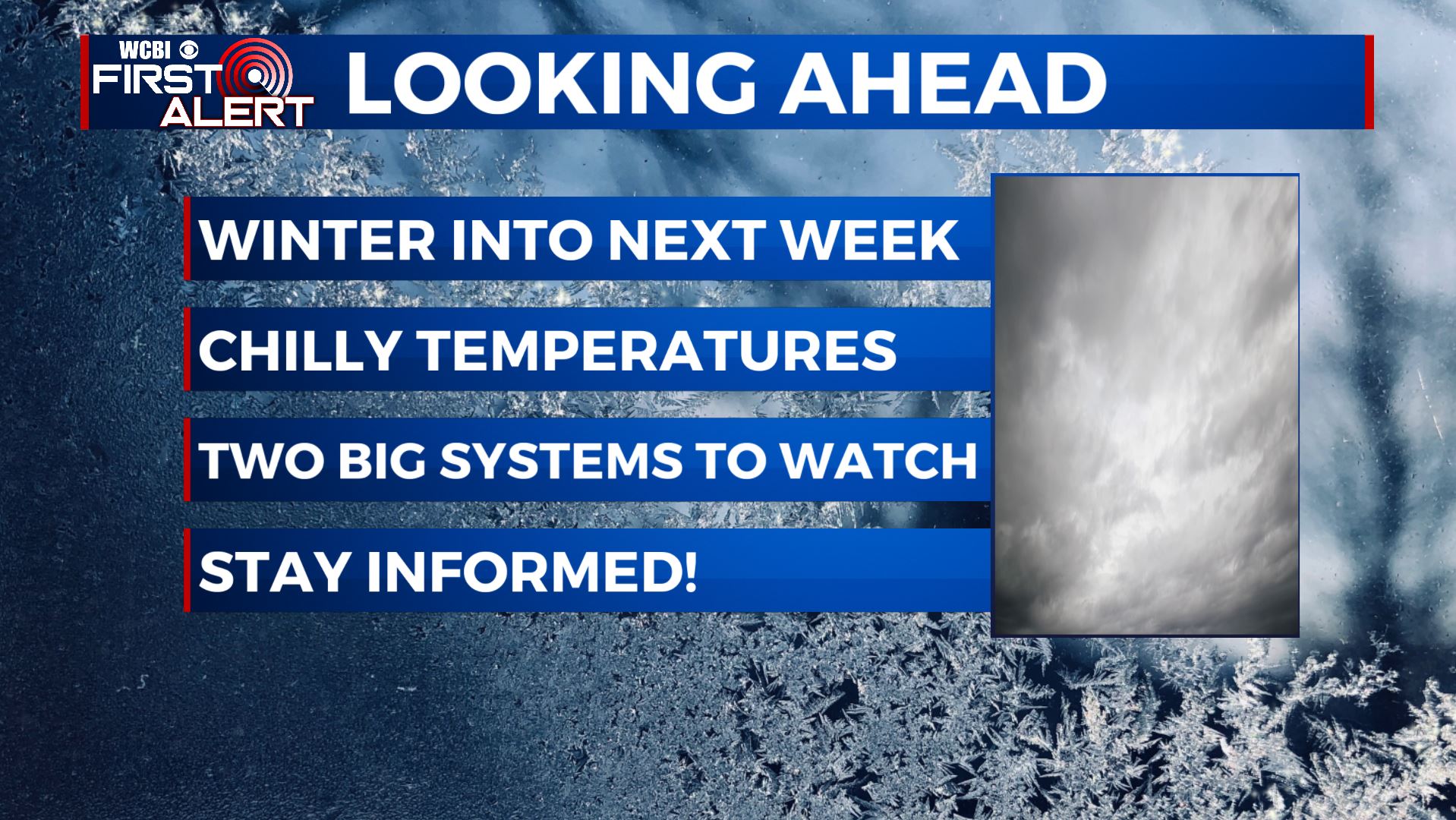
SUMMARY: Winter is here to stay! We’ll have a few more chances for some winter weather over the next week. Some rain and/or light freezing rain could develop both Saturday and Sunday morning, especially in our far NW counties. A big winter/ice storm will likely affect us on Monday. It will produce all types of winter weather from freezing rain, sleet, and even some snow. Another winter weather system could also affect the region mid to late next week. We are still continuing to fine tune this forecast so keep it tuned to WCBI throughout the weekend for the latest forecast and information.
FRIDAY: Another chilly & dreary day is ahead for our Friday. Expect cloudy overcast skies after this morning’s precipitation moves out. A chance of a few light showers or drizzle is possible during the day. Highs in the 30s to low 40s. Winds N 5-10 mph.
FRIDAY NIGHT: Cloudy with areas of rain developing. Some light freezing rain is possible in spots that hover around or just below freezing in our northwestern counties. Lows in the mid to low 30s. Winds N 5-15 mph.
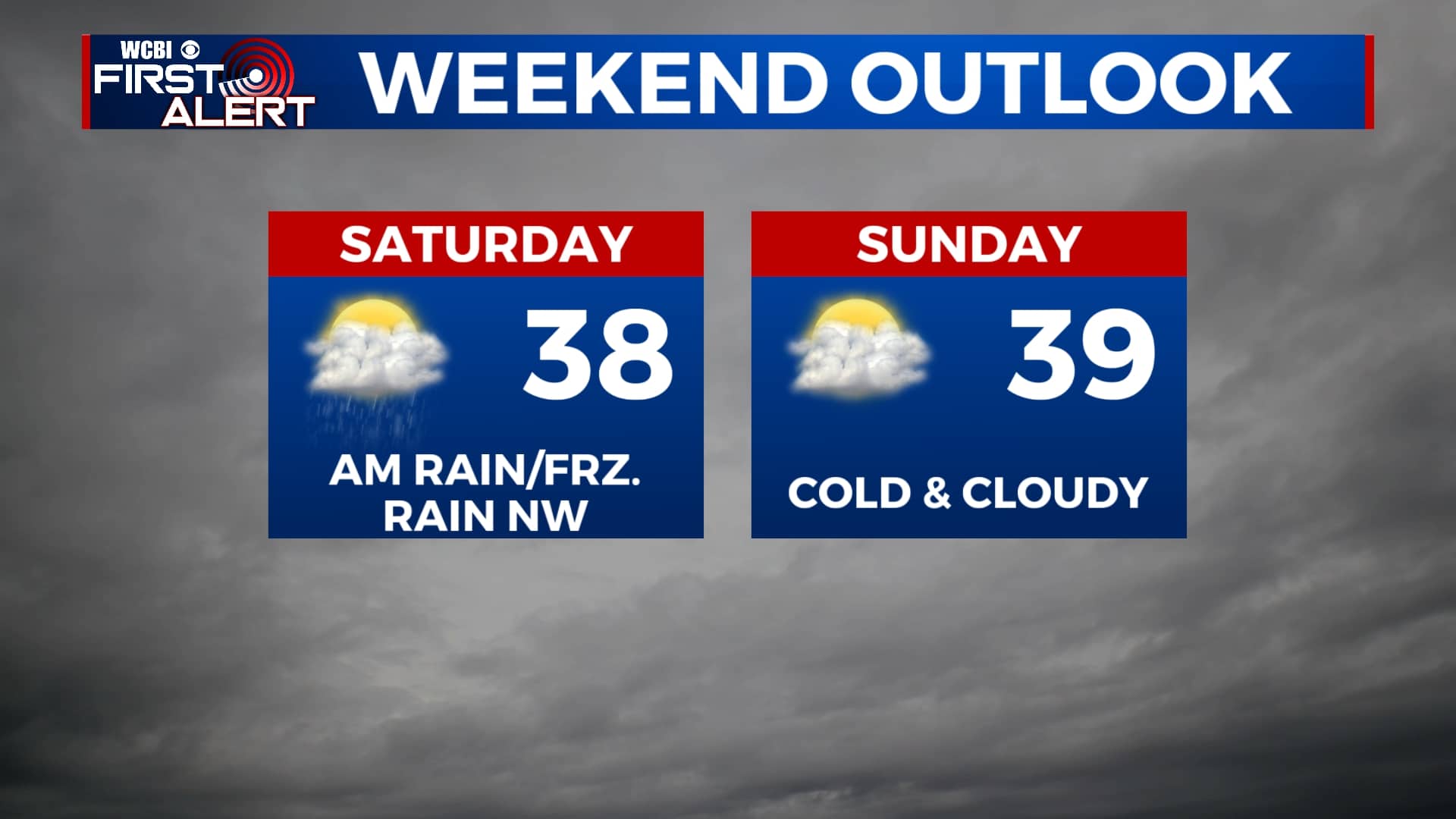
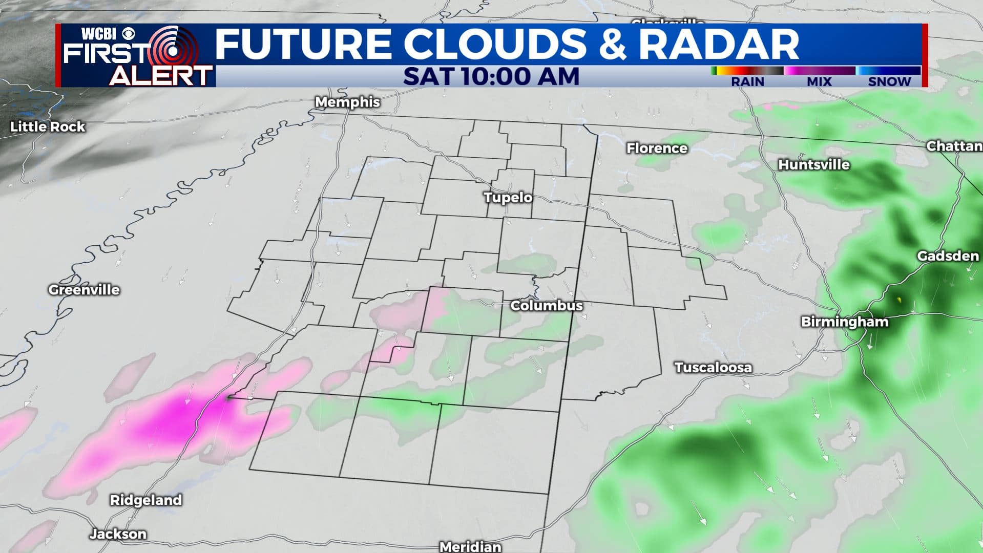
SATURDAY: Cloudy. Areas or rain or light freezing rain to our NW mainly during the morning hours. Afternoon highs in the upper 30s. Winds N 5-15 mph.
SATURDAY NIGHT: Mostly cloudy. A cold night as overnight lows fall to the upper 20s to lower 30s.
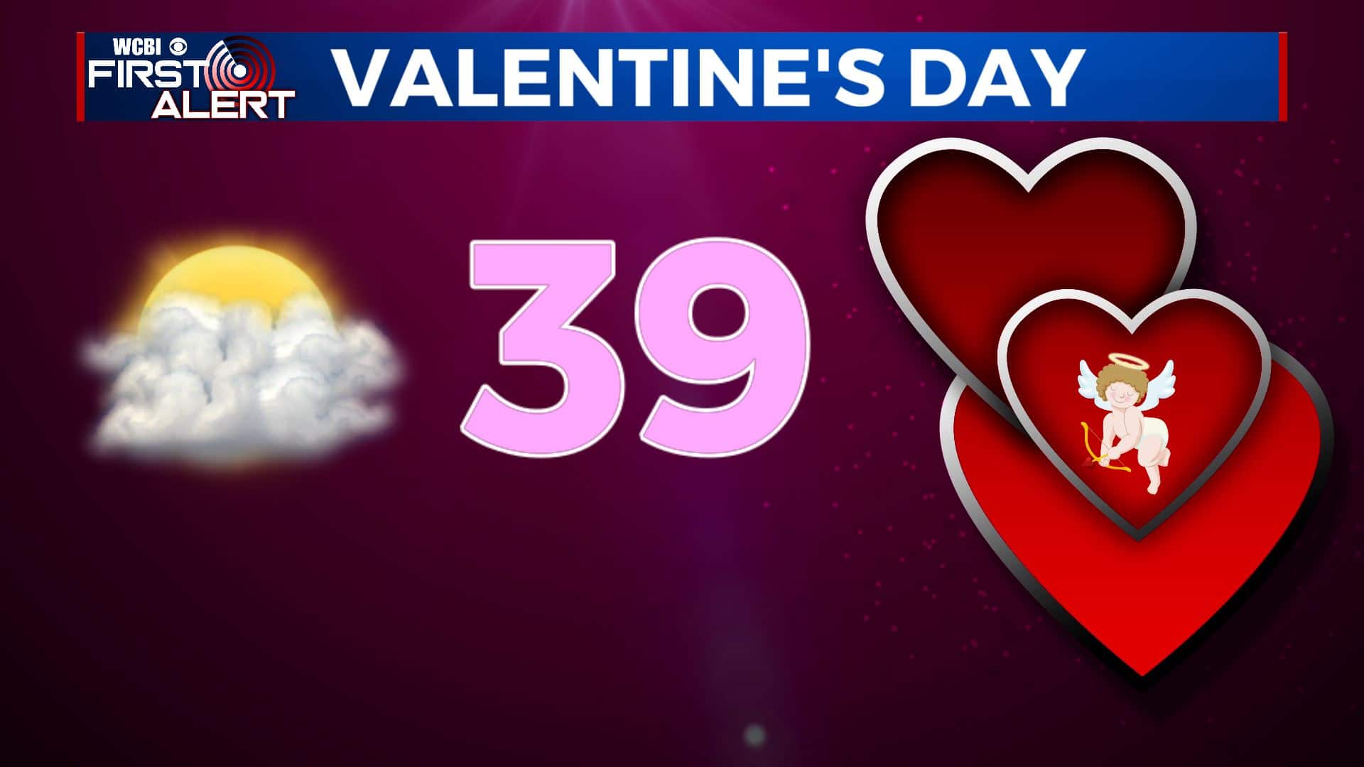
SUNDAY: There’s another chance for light freezing rain in our NW counties again. Overall, it will be cloudy and staying brisk for your Valentine’s Day. Highs may only top out in the upper 30s. Definitely good cuddling weather.
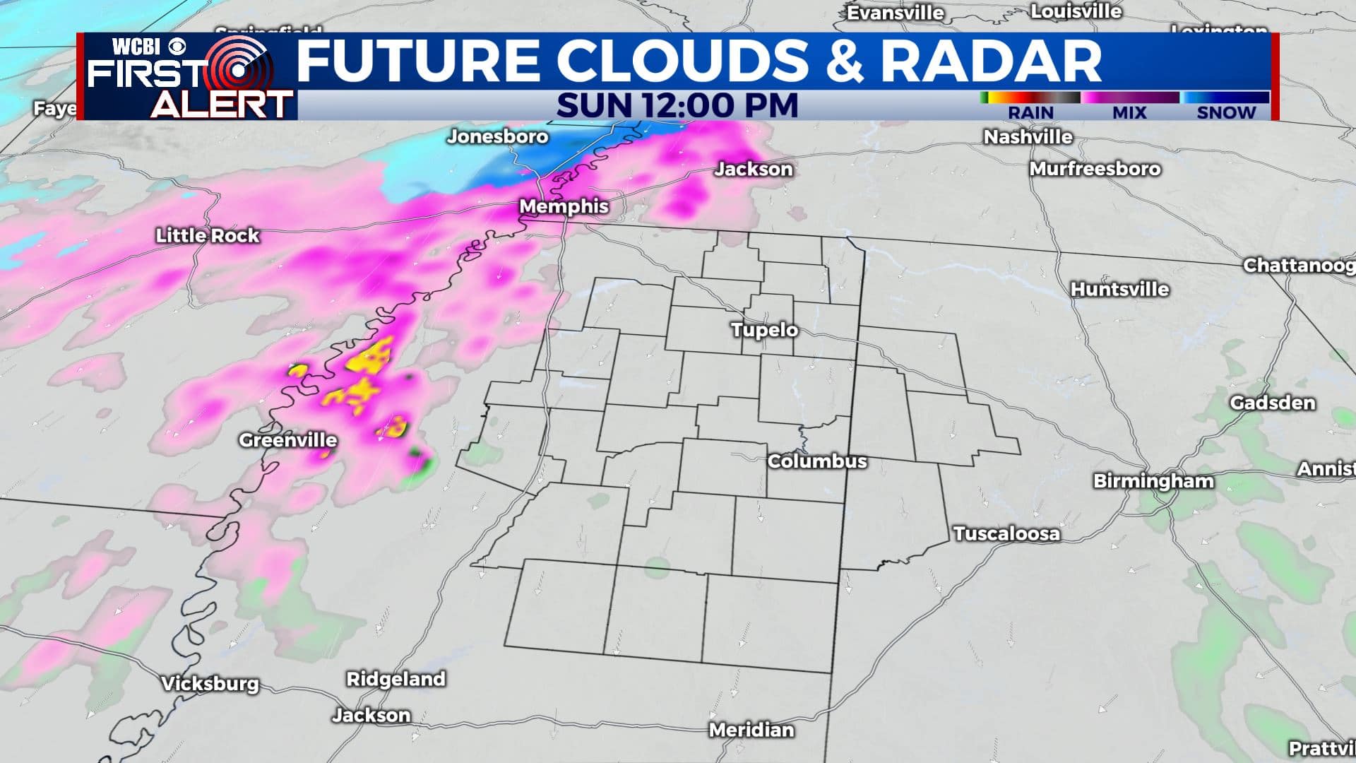
SUNDAY NIGHT: Mostly cloudy. Lows near 30 degrees.
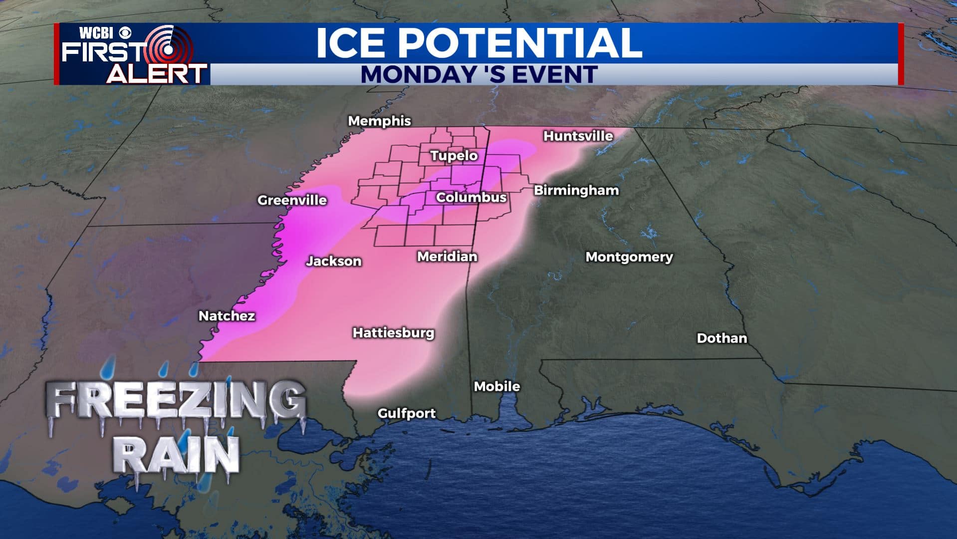
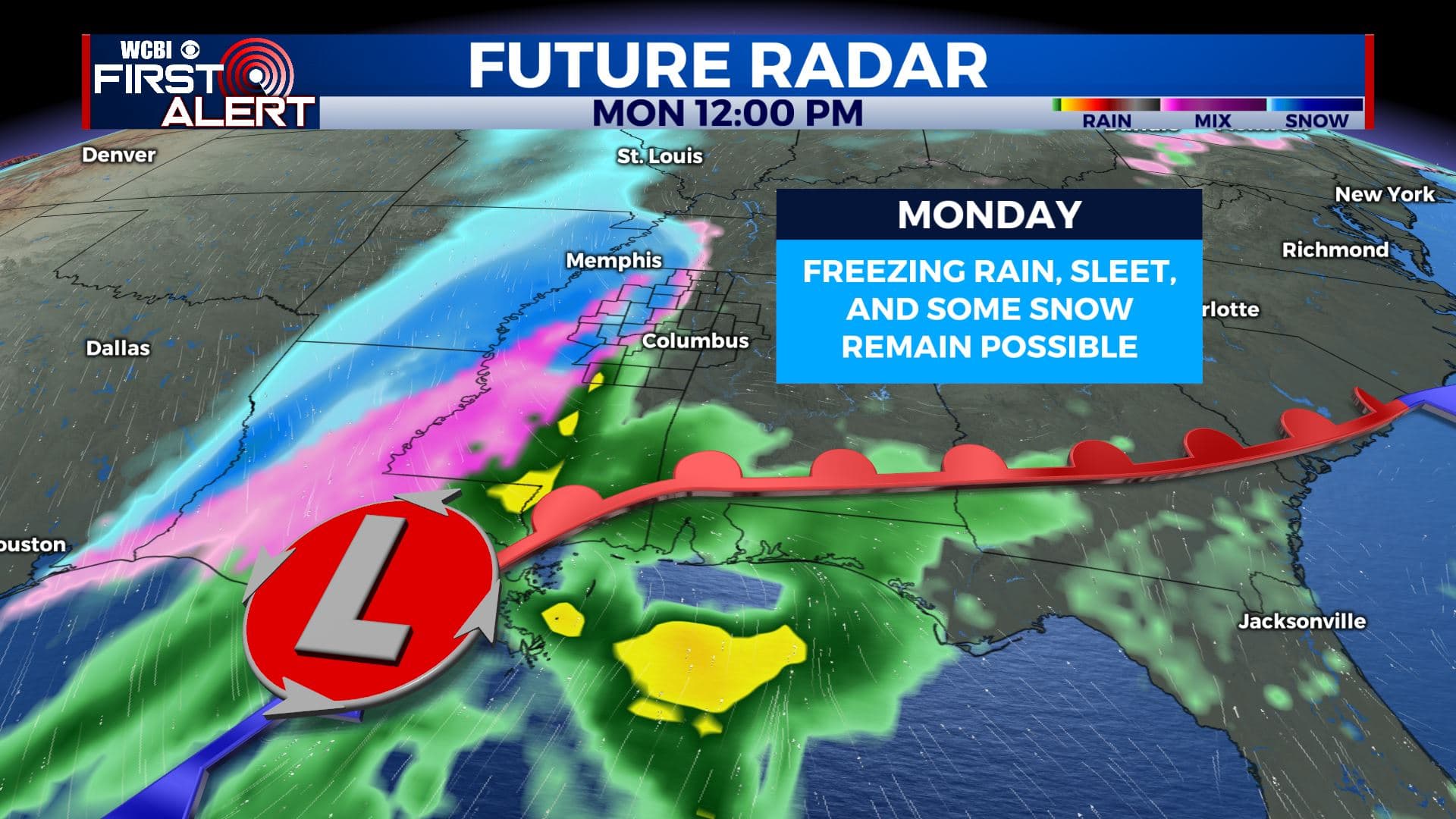
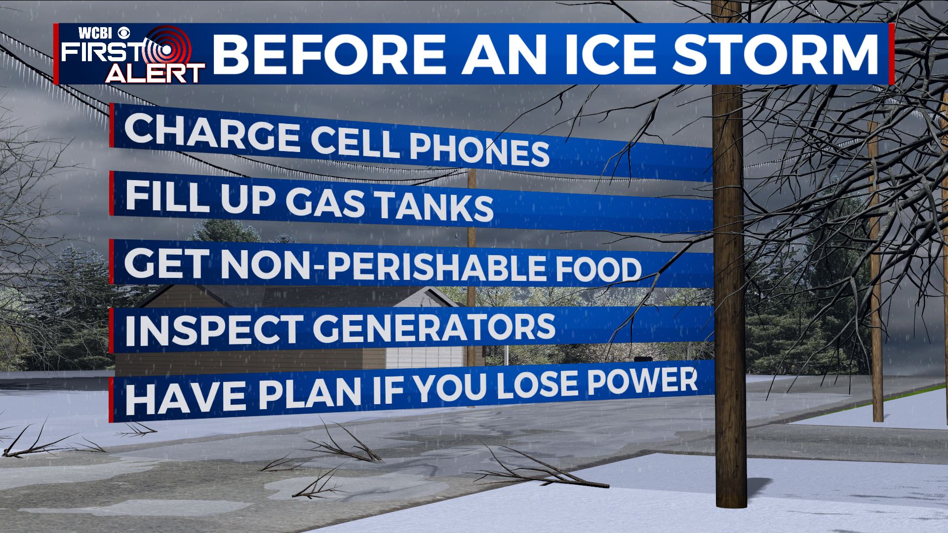
MONDAY: As of the latest forecasts, there’s a chance for freezing rain, sleet and snow late morning into the afternoon as a big winter/ice storm pushes through. Something we’ll continue to watch as we fine tune the forecast. As of right now, we are thinking anywhere between a quarter to half an inch of ice accumulation is possible. Be prepared for some major impacts, especially on the roads. Highs in the mid to upper 30s Monday. Lows in the mid 20s Monday night.
TUESDAY: Mostly cloudy. Highs in the lower 30s.
TUESDAY NIGHT: Mostly cloudy. Lows in the mid to low 20s.
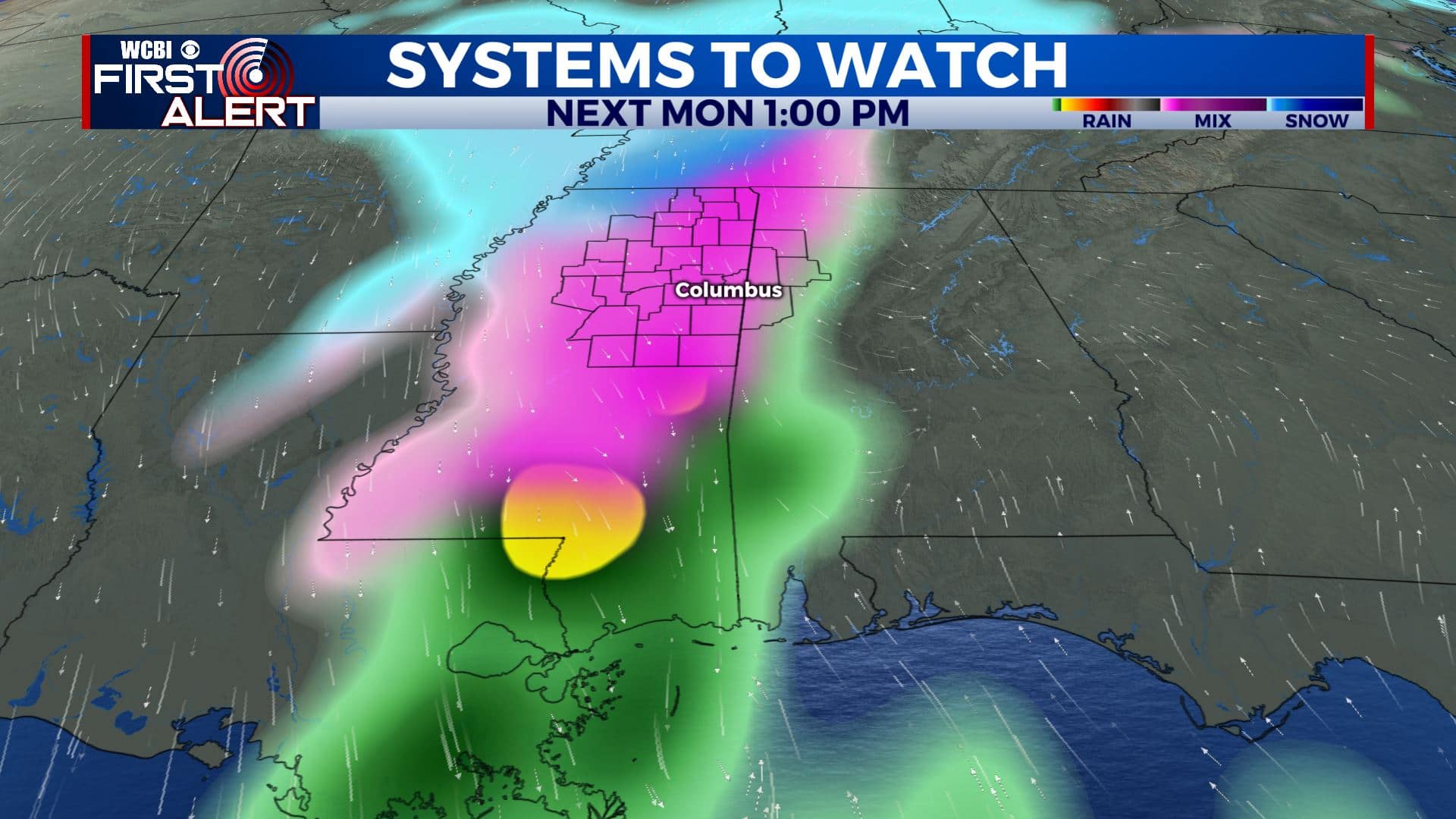
WEDNESDAY: Mostly cloudy. Highs in the lower 40s. A chance of some rain or wintry weather late in the day or Wednesday night as out next system pushes through.
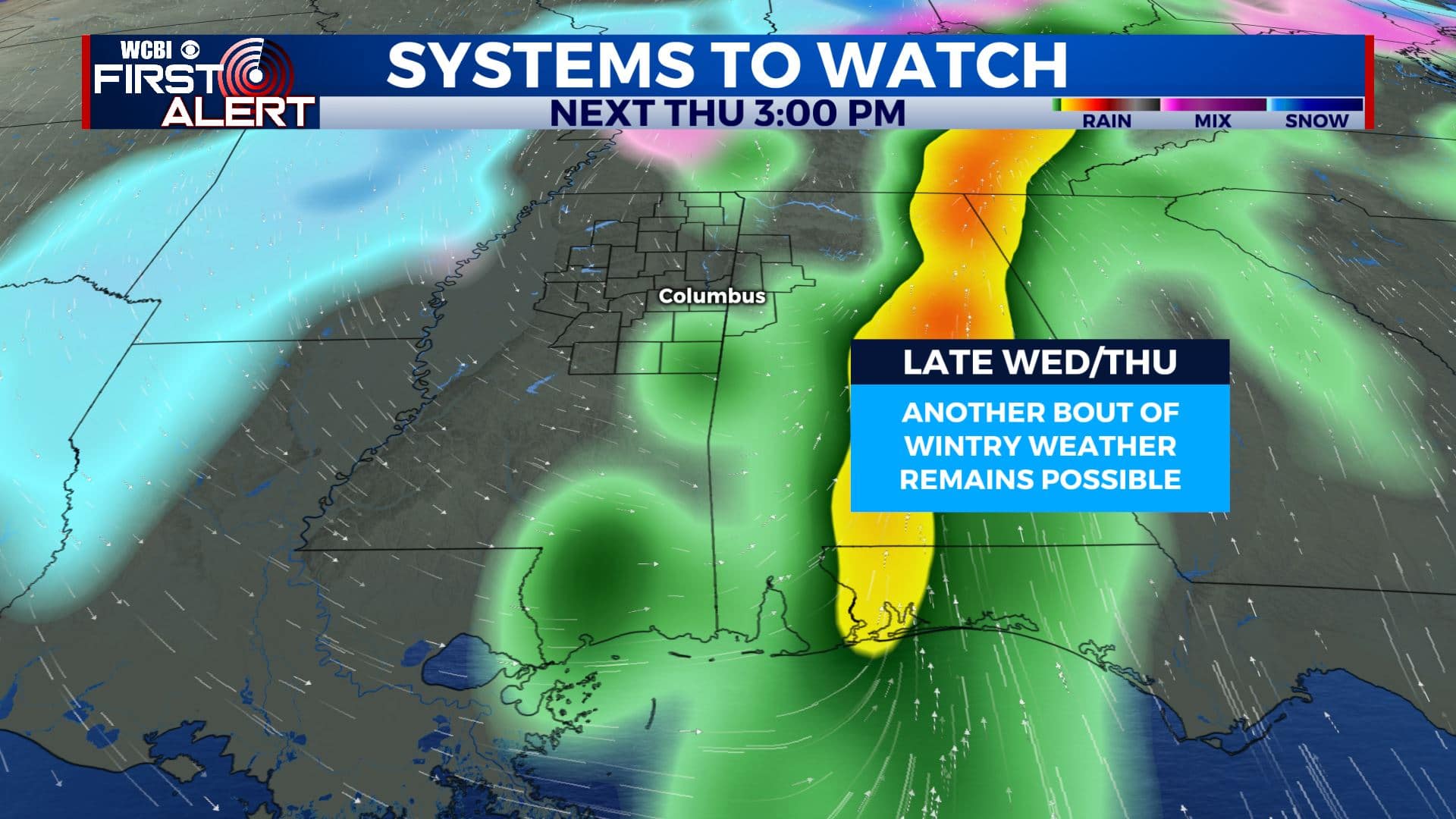
THURSDAY: Areas of rain and wintry weather are possible. Highs in the mid 30s.
Stay connected with @WCBIWEATHER on Facebook, Twitter, Instagram, and the WCBI News App


Leave a Reply