Staying dry & warming up the next few days
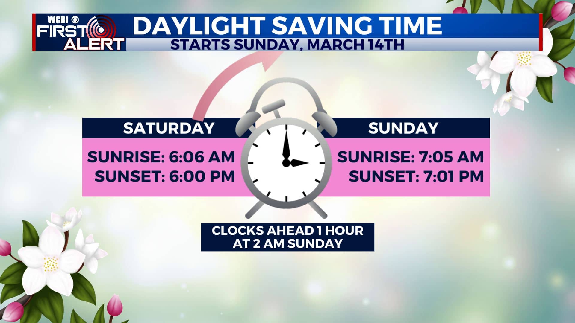
SUMMARY: Mild, above average, 70 degree temperatures will be with us for the rest of the week and into the weekend. Some rain chances will be possible by the weekend. The next chance of any strong to severe storms will not be until the Sunday-Monday time frame as a major storm system is set to push through. Something we’ll continue to watch. Stay tuned! Don’t forget to Spring Forward this Sunday at 2 am.
TUESDAY: We’ll continue to have sunshine with a few clouds. Highs in the lower 70s. A bit breezy with south winds at 5-15 mph. The dry conditions and low humidity/dew point levels will once again cause a fire danger outdoors, so refrain from outdoor burning.
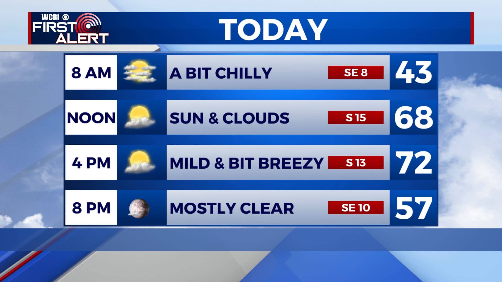
TUESDAY NIGHT: Mostly clear skies and staying quiet. Overnight lows in the mid 40s.
WEDNESDAY: A mix of sun and clouds. Highs in the lower to mid 70s.
WEDNESDAY NIGHT: Partly cloudy skies. Mild overnight lows in the 50s.
THURSDAY: A mix of sun & clouds. Highs in the upper 70s. Lows in the mid 50s Thursday night.
FRIDAY-SATURDAY: Cloudy skies for the end of the week on Friday with a few peeks of sunshine. It appears more that some showers are possible on Saturday. Highs will be in the upper 70s with overnight lows in the 50s.
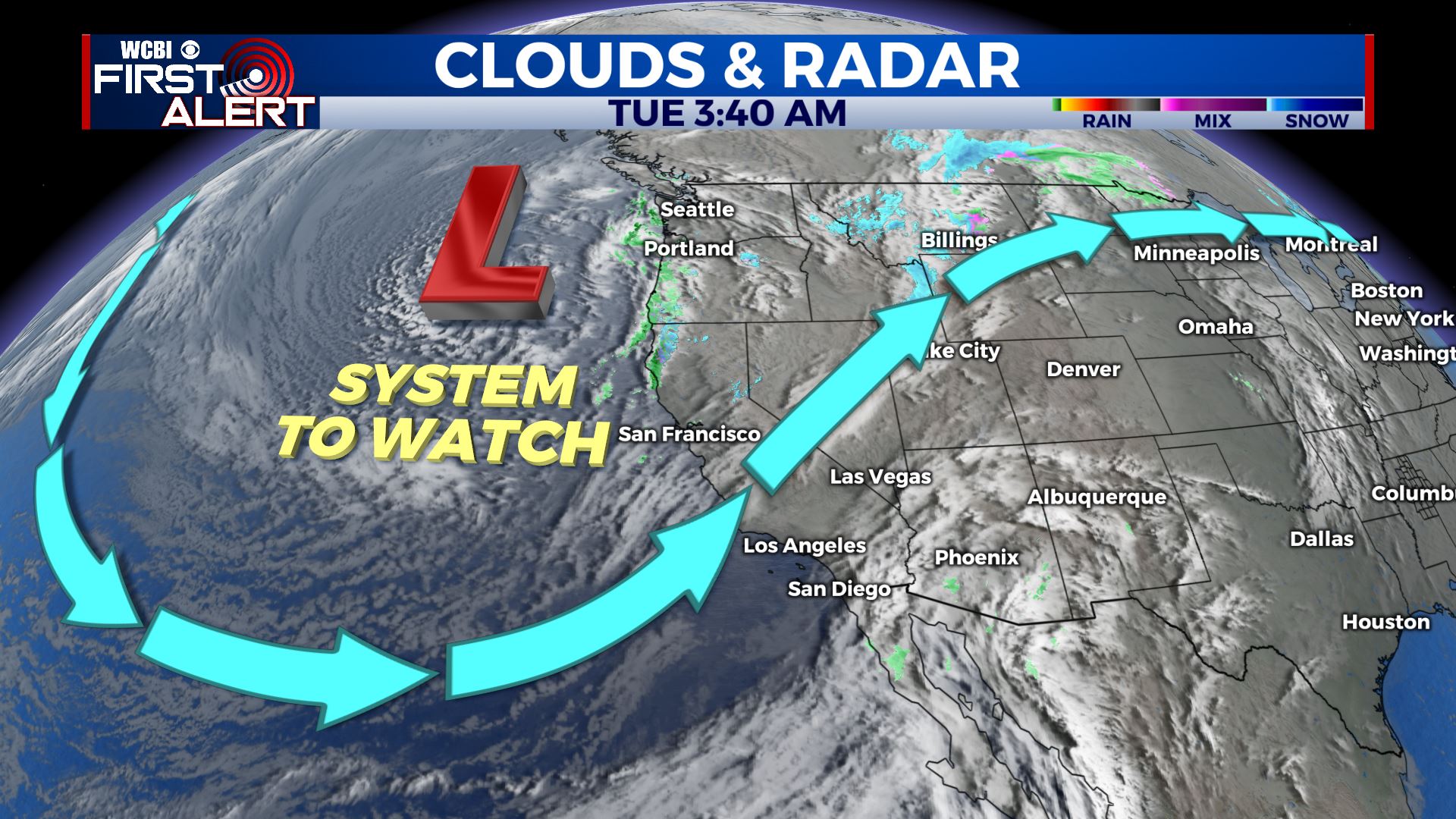
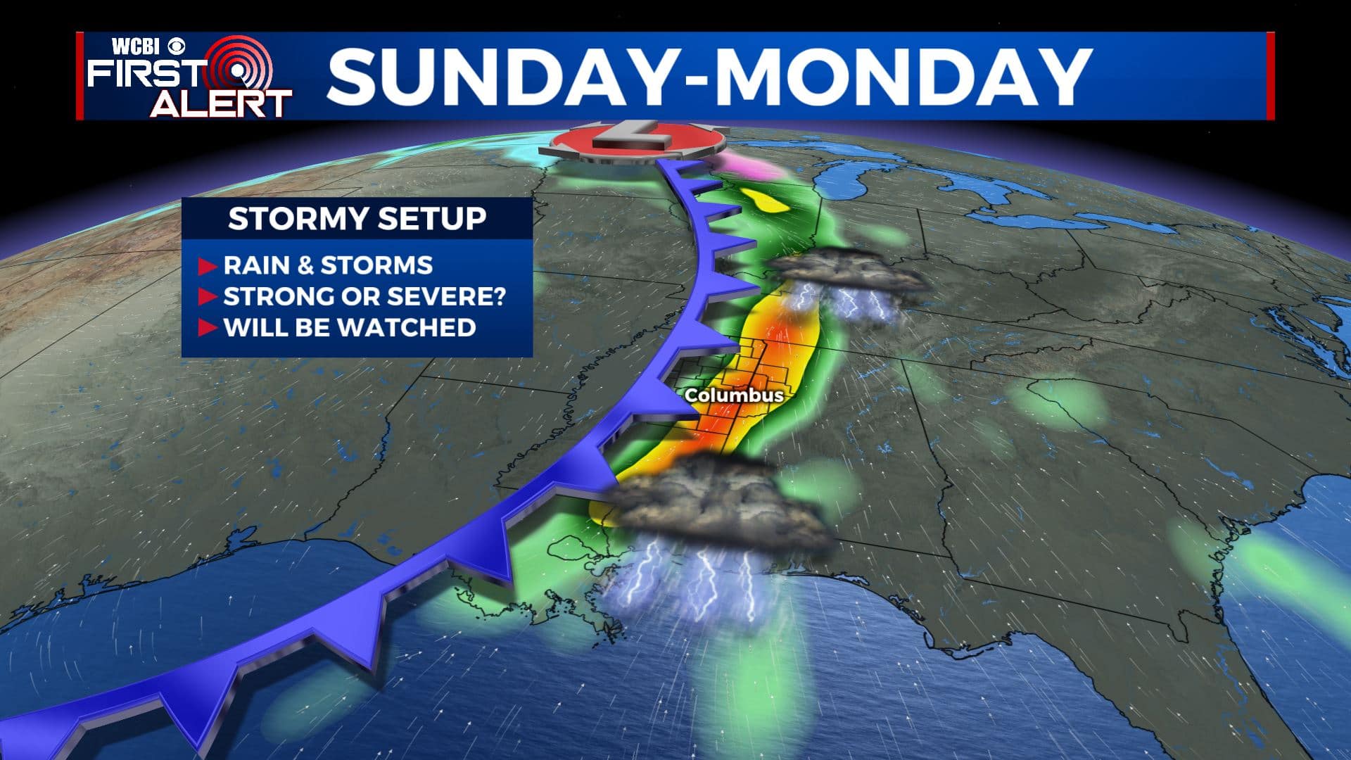
SUNDAY-MONDAY: Our next best chances of rain will be Sunday as our next storm system moves in. Showers and storms will be possible late Sunday into Monday. Some strong to severe weather could occur so we’ll keep an eye on how things develop over the coming days. Highs look to remain in the 70s with lows in the 50s.
Stay connected with @WCBIWEATHER on Facebook, Twitter, Instagram, and the WCBI News App


Leave a Reply