Staying Hot This Week
SUMMARY: A big ridge of high pressure in the upper levels of the atmosphere will keep our weather mainly hot and dry for the rest of the work week. Slightly better odds of moisture may return by the end of the weekend and early next week.
MONDAY NIGHT: Mainly clear and quiet. Lows in in the upper 60s to around 70 with light wind.
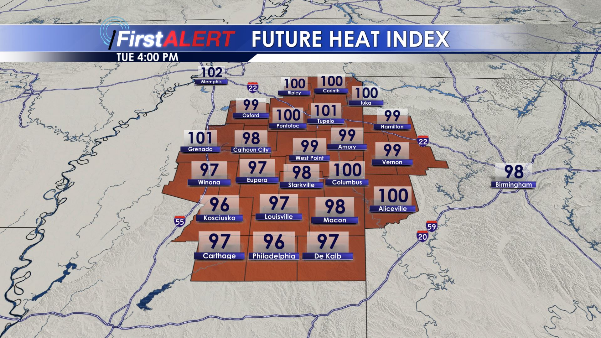
Tuesday’s Heat Index Forecast
TUESDAY-FRIDAY: Mostly sunny to partly cloudy and hot. Highs stay in the mid 90s, which is well above normal for this time of year. Heat indices may surpass 100 at times during peak heating. While a few stray showers or storms can’t be ruled out each day most spots in our area will NOT experience any rain or natural relief from the heat. Lows should remain near 70 each morning.
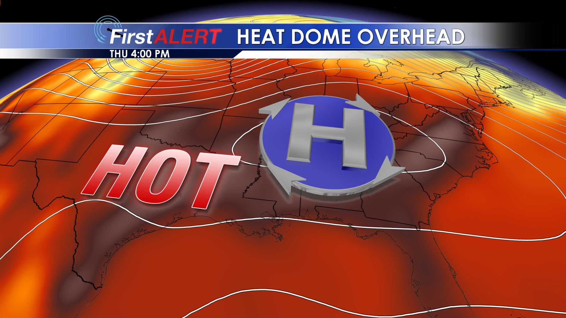
Heat Dome
WEEKEND: There could a be a few isolated storms and showers Saturday but the chance of moisture may be higher Sunday into Monday as a disturbance moves across the region. If we’re lucky this scenario will pan out since it would cool temperatures back down to more September-like levels.
Stay connected with @WCBIWEATHER on Facebook, Twitter, and Instagram


Leave a Reply