Staying mild & breezy
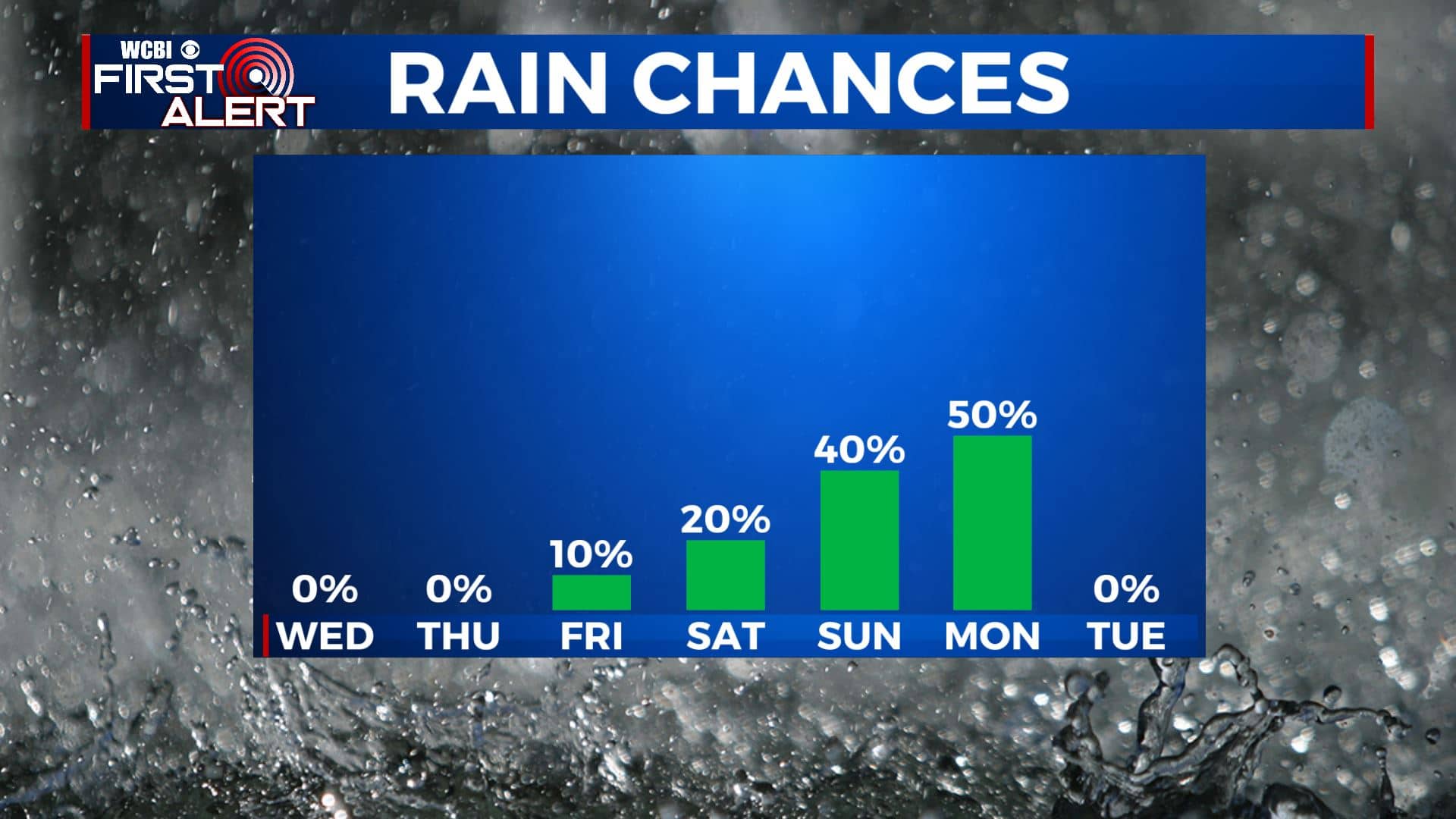
SUMMARY: Dry conditions will continue for the next few days with a few showers becoming possible again by the start of the weekend. Any strong/severe weather or heavy rain still looks like it is going to hold off until late Sunday or Monday. Daylight saving time begins at 2 a.m. Sunday and that’s when we set clocks ahead 1 hour.
TUESDAY NIGHT: Mostly clear with a few scattered high clouds. Lows from the mid 40s to around 50. Winds SSE 3-7 mph.
WEDNESDAY: A mix of sun & clouds. Breezy southerly winds 10-15 mph with gusts over 20 mph possible. Seasonably mild highs in the mid 70s.
WEDNESDAY NIGHT: Stars and clouds. Lows in the 50s.
THURSDAY: A mix of sun & clouds. Breezy southerly winds 10-15 mph with higher gusts will continue. Highs in the upper 70s.
THURSDAY NIGHT: Variably cloudy. Mild lows in the mid 50s.
FRIDAY & SATURDAY: Partly to mostly cloudy. Mild highs in the upper 70s. A few showers are possible but the rain chance is just 10-20%.
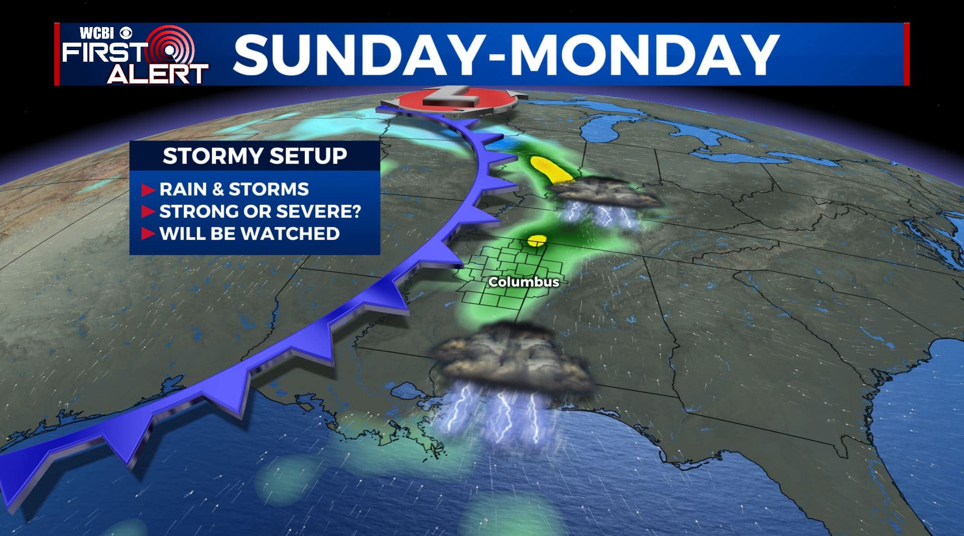
SUNDAY & MONDAY: We’re still watching out for the potential for some storms and heavy rain. It’s still early to pinpoint the exact timing or eventual threats but it’s definitely something we’ll keep watching since we are in the spring severe weather season. Highs remain in the 70s both days.
Follow @WCBIWEATHER on Facebook, Twitter, Instagram, and the WCBI News App


Leave a Reply