Staying warm & humid as we begin a new workweek
SUMMARY: Daily rain chances, the summer heat and humidity will continue to be the top weather stories as we end the month of June and begin the month of July this upcoming week. Temperatures will stay close to 90 and heat index values approaching 100 at times. Some pop-up afternoon rain & storm chances early in the week before they increase mid to late week.
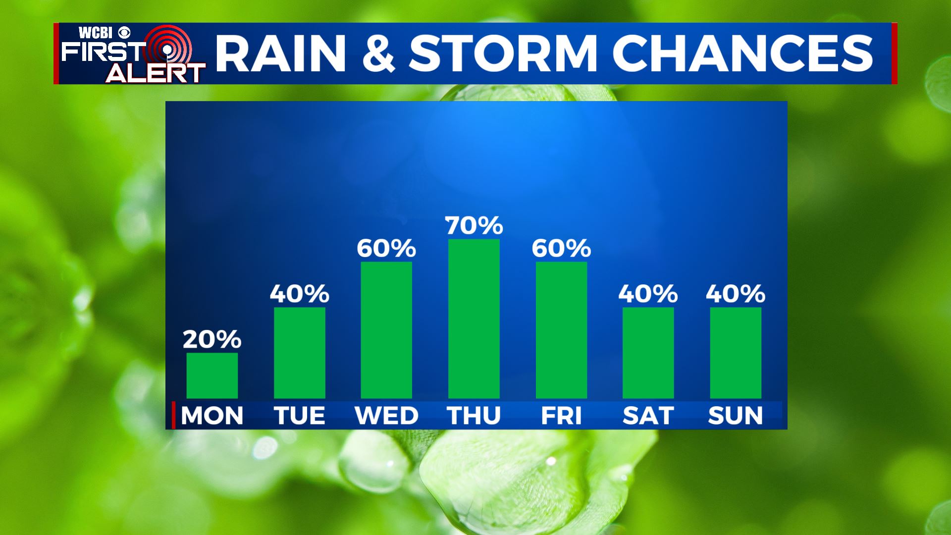
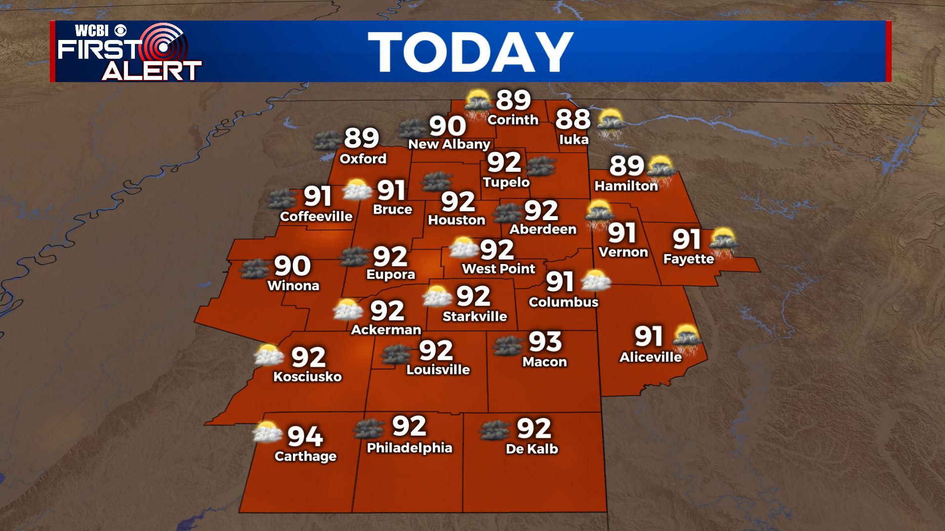
MONDAY: It’s definitely going to be cool drinks & ice cream weather for our Monday. It’s going to be warm & humid with highs in the lower 90s. Heat Index will make it feel around 100 so stay cool & hydrated with water. A mix of sun & clouds overall with maybe an isolated shower in the afternoon.
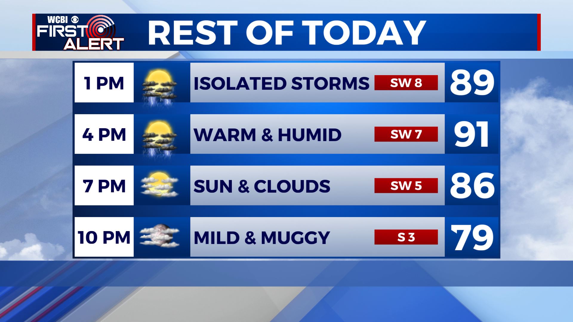
MONDAY NIGHT: A few clouds overnight. Mild & muggy with lows in the mid 70s.
TUESDAY: The summer heat and humidity continues with highs in the lower 90s. A mix of sun & clouds with afternoon pop-up scattered showers & storms, but not everyone will see it.
TUESDAY NIGHT: Showers & storms should come to an end once the sun sets early evening. Partly cloudy skies. Overnight lows will be in the mid 70s.
WEDNESDAY-FRIDAY: Better chances of showers and storms for the second half of the week, so keep the umbrella nearby. Some storms could produce small hail or gusty winds, but widespread severe weather is not expected. High temperatures will remain in the lower 90s with overnight lows in the lower 70s.
SATURDAY-SUNDAY: The long Fourth of July holiday weekend looks to feature typical summertime weather. We’ll see highs in the upper 80s to lower 90s with chances of a pop-up shower or storm in the afternoon hours, but not looking to be a complete washout so any outdoor weekend plans will be a go. But you may want to have a backup indoor plan just in case.
Stay connected with @WCBIWEATHER on Facebook, Twitter, Instagram, and the WCBI News App


Leave a Reply