Still closely watching Hurricane Delta
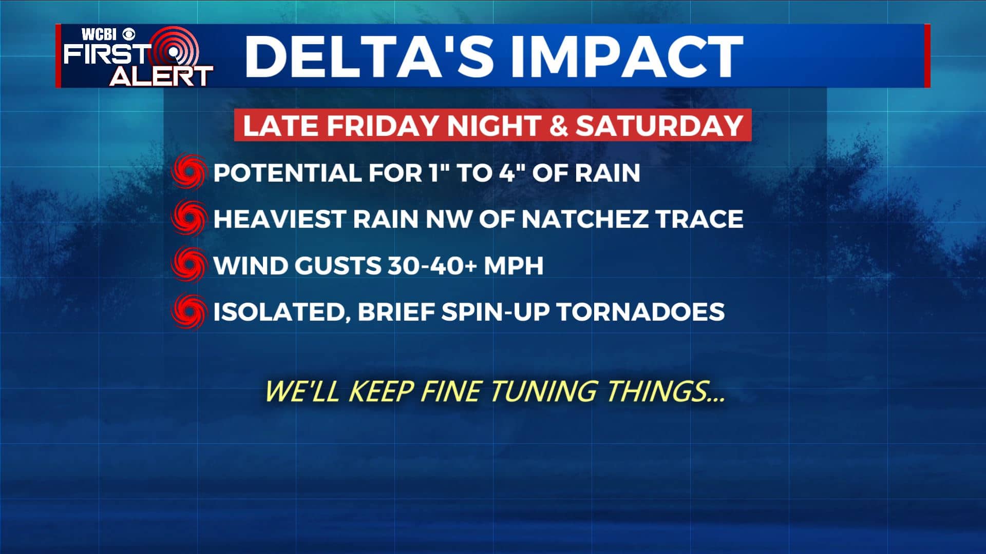
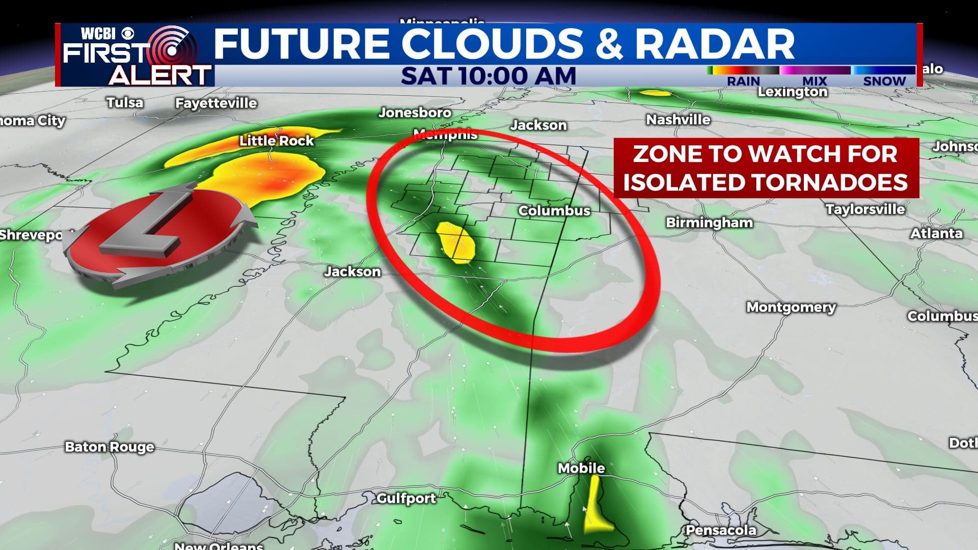
HURRICANE DELTA: This strong storm is expected to make landfall in Louisiana late Friday and then move into north Mississippi Friday night and into Saturday. Our area is still in line for isolated tornadoes, gusty winds, and heavy rainfall.
WEDNESDAY NIGHT: Mostly clear to partly cloudy and quiet. Lows in the 50s with calm wind.
THURSDAY: A mix of clouds and sunshine. Warm highs in the 80s. Light ENE winds 2-6 mph.
THURSDAY NIGHT: Clouds thicken with areas of rain possible. Lows in the mid 60s.
FRIDAY: Mostly cloudy with areas of rain or showers. The chance of rain is 50%. Highs in the upper 70s. Winds NE 5-15 mph.
FRIDAY NIGHT & SATURDAY: The remnants of Hurricane Delta will swirl through the region. Impacts include isolated tornadoes, wind gusts 30-40 mph (or higher), and 1-4” of rain (or more). The heaviest rain now looks to be along and northwest of the Natchez Trace. Humid highs the 70s are favored with the storm bringing in tropical air from the Gulf of Mexico.
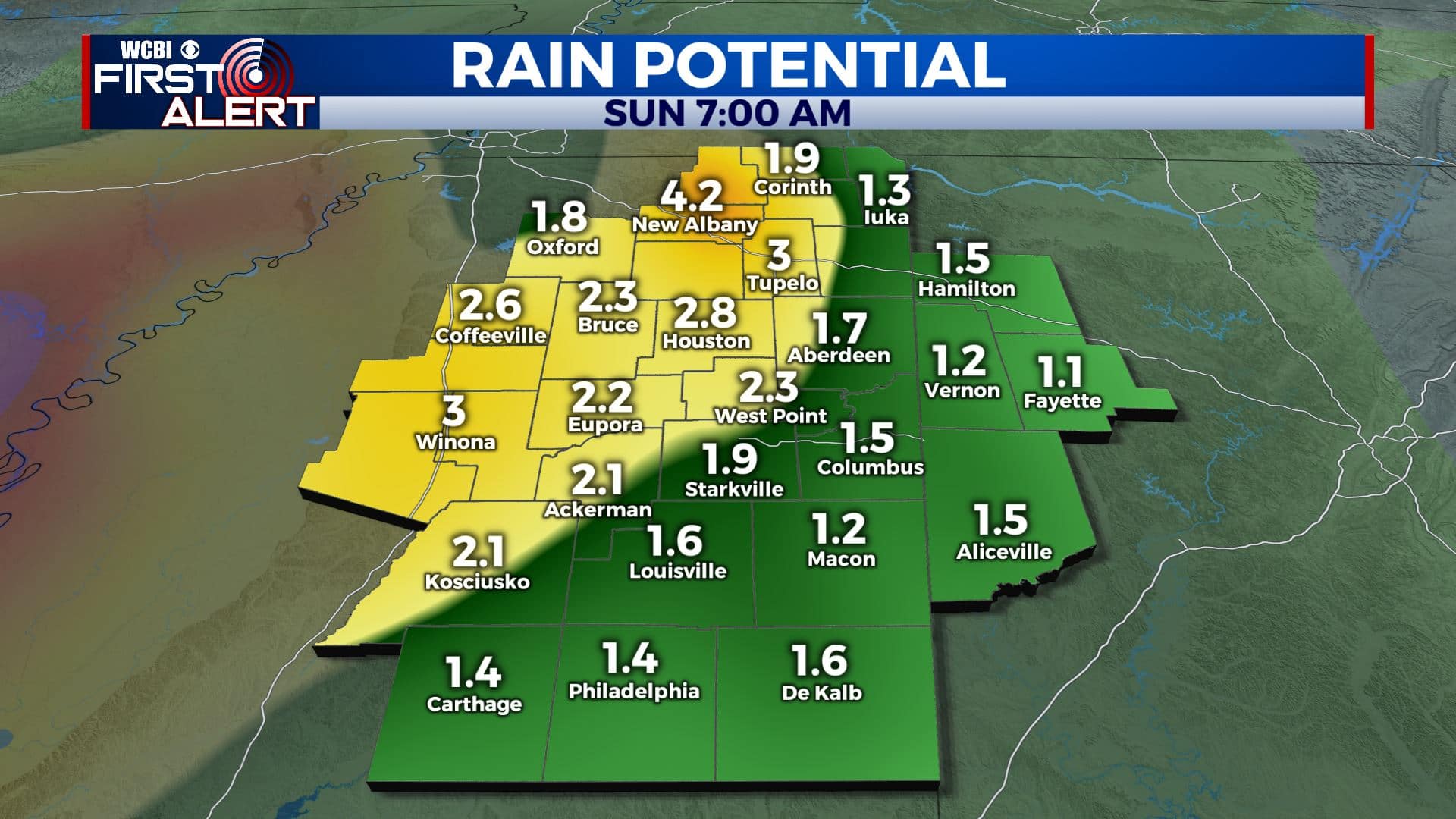
SUNDAY: Some rain and clouds could linger but it depends on how soon the remnants of Delta exit the region. Highs in the upper 70s to around 80 are possible.
Follow @WCBIWEATHER on Facebook, Twitter, Instagram, and the WCBI News App


Leave a Reply